Kamphaeng Phet Province
| Kamphaeng Phet กำแพงเพชร | ||
|---|---|---|
| Province | ||
| ||
 Map of Thailand highlighting Kamphaeng Phet Province | ||
| Country |
| |
| Capital | Nong Pling | |
| Government | ||
| • Governor | Thani Thanyaphot (since 2015) | |
| Area | ||
| • Total | 8,607.5 km2 (3,323.4 sq mi) | |
| Area rank | Ranked 22nd | |
| Population (2014) | ||
| • Total | 729,522[1] | |
| • Rank | Ranked 35th | |
| • Density rank | Ranked 53rd | |
| HDI | ||
| • HDI (2009) | 0.725 (medium) (49th) | |
| Time zone | ICT (UTC+7) | |
| Area code(s) | 055 | |
| ISO 3166 code | TH-62 | |
| Vehicle registration | กำแพงเพชร | |

Kamphaeng Phet (Thai: กำแพงเพชร, pronounced [kām.pʰɛ̄ːŋ pʰét]) is a province (changwat) of Thailand in the upper center of the country. Neighbouring provinces are (from north clockwise) Sukhothai, Phitsanulok, Phichit, Nakhon Sawan, and Tak.
Etymology
In Thai kamphaeng means a "wall" and phet (from Sanskrit vájra) means a "diamond" . Thus the name literally means the "diamond wall" and refers to the city's ancient defenses.
Geography

The main river is the Ping, a major tributary of the Chao Phraya River. River flats make up much of the east of the province, while the west is mountainous and covered with forests.
One of the provinces best-known products is bananas, especially the Kluai Khai, a small, round, sweet banana. Banana festivals are held every year to thank the spirits for the harvest.
History
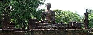
Kamphaeng Phet already was a royal city in the Sukhothai kingdom in the 14th century, then known under its old name Chakangrao. It formed an important part of the defence system of the kingdom, as well as later of the Ayutthaya Kingdom.
Symbols
The provincial seal shows the city walls surmounted by diamonds, since the city name means "diamond wall" (from the shape of the ramparts of the old city wall). The provincial tree is the areca nut palm (Acacia catechu), and the provincial flower the bullet wood (Mimusops elengi).
Administrative divisions

The province is subdivided in 11 districts (amphoe). These are further subdivided into 78 subdistricts (tambon) and 823 villages (muban).

References
- ↑ "Population of the Kingdom" (PDF). Department of Provincial Affairs (DOPA) Thailand (in Thai). 2014-12-31. Retrieved 19 Mar 2015.
External links
 Kamphaeng Phet travel guide from Wikivoyage
- Provincial page from the Tourist Authority of Thailand
- Website of Province (Thai)
 |
Sukhothai Province | Phitsanulok Province | | |
| Tak Province | |
Phichit Province | ||
| ||||
| | ||||
| Nakhon Sawan Province |
Coordinates: 16°33′29″N 99°30′40″E / 16.55806°N 99.51111°E