Kasare, Sangamner
| Kasare कासारे | |
|---|---|
| village | |
 Kasare  Kasare Location in Maharashtra, India | |
| Coordinates: 19°39′28″N 74°22′03″E / 19.65778°N 74.36750°ECoordinates: 19°39′28″N 74°22′03″E / 19.65778°N 74.36750°E | |
| Country |
|
| State | Maharashtra |
| District | Ahmadnagar |
| Taluka | Sangamner |
| Government | |
| • Body | Village Panchayat |
| Languages | |
| • Official | Marathi |
| Time zone | IST (UTC+5:30) |
| Lok Sabha constituency | Shirdi |
| Vidhan Sabha constituency | Sangamner |
Kasare (Marathi: कासारे), is a small village in Ahmednagar district of Maharashtra, India.[1] This village is located about equidistant between Talegaon to the northwest and Gogalgaon to the southeast on State Highway 45.
Demographics
In the 2001 census, the village of Kasare had 1,417 inhabitants, with 726 males (51.2%) and 691 females (48.8%), for a gender ratio of 952 females per thousand males.[2]
In the 2011 census, the village of Kasare had 1,776 inhabitants, for a net gain of 359 over the preceding decade.[3]
Religion
The majority of the population in Kasare is Hindu. There are several temples in the village, including the Kalika Mata Temple, the Hanumanji Temple, and the Gurdev Datta Temple.
References
- ↑ 2001 Census Village code for Kasare = 03218100, "2001 Census of India: List of Villages by Tehsil: Maharashtra" (PDF). Registrar General & Census Commissioner, India. p. 625. Archived (PDF) from the original on 13 November 2012.
- ↑ "Census 2001 Population Finder: Maharashtra: Ahmadnagar: Sangamner: Kasare". Office of The Registrar General & Census Commissioner, Ministry of Home Affairs, Government of India. Archived from the original on 15 May 2013.
- ↑ "NPR Report: Maharashtra: Ahmadnagar: Sangamner". National Population Register, Ministry of Home Affairs, Government of India. 2011.
Ahmednagar district topics | ||
|---|---|---|
| History | 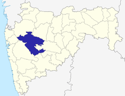 | |
| Geography | ||
| Talukas | ||
| Cities and towns | ||
| Monuments | ||
| Education | ||
| Lok Sabha constituencies | ||
| Vidhan Sabha constituencies | ||
| Dams in District | ||
This article is issued from Wikipedia - version of the 9/14/2016. The text is available under the Creative Commons Attribution/Share Alike but additional terms may apply for the media files.