Kolkata district
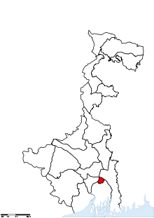
Kolkata district (Bengali: কলকাতা জেলা) is an administrative district of the Indian state of West Bengal. It contains the centre part of the city of Kolkata. The jurisdiction of the Kolkata Collector, that is, of the district, is within the areas covered by the Kolkata Police and by the Kolkata Municipal Corporation, but it does not cover the entire area covered by either of them. See Civic administration of Kolkata.
As regards civic infrastructure (water, sewage, etc.), the area of Kolkata District is under the administration of the Kolkata Municipal Corporation. But other parts of the city's (that is, the KMC's) area, and of the city's suburban areas, belong to the districts of North 24 Parganas, South 24 Parganas, Howrah, Hooghly and Nadia.
Kolkata District is bordered by Howrah District, North 24 Parganas District and South 24 Parganas District.
The office of the Kolkata Collector is in B.B.D. Bag, north of the General Post Office.
Divisions
Assembly constituencies
As of 2011, following the order of Delimitation Commission in respect of the boundary delimitation of constituencies in the West Bengal, Kolkata district has 11 assembly constituencies:[1]
- Kolkata Port (assembly constituency no. 158) covering the area under the wards numbered 75, 76, 78–80, 133–135 of the Kolkata municipal corporation,
- Bhabanipur (assembly constituency no. 159) covering the area under the wards numbered 63, 70–74, 77 and 82 of the Kolkata municipal corporation,
- Rashbehari (assembly constituency no. 160) covering the area under the wards numbered 81, 83, 84, 86–90 and 93 of the Kolkata municipal corporation,
- Ballygunge (assembly constituency no. 161) covering the area under the wards numbered 60, 61, 64, 65, 68, 69 and 85 of the Kolkata municipal corporation,
- Chowringhee (assembly constituency no. 162) covering the area under the wards numbered 44–53 and 62 of the Kolkata municipal corporation,
- Entally (assembly constituency no. 163) covering the area under the wards numbered 54–56, 58 and 59 of the Kolkata municipal corporation,
- Beleghata (assembly constituency no. 164) covering the area under the wards numbered 28–30, 33–36 and 57 of the Kolkata municipal corporation,
- Jorasanko (assembly constituency no. 165) covering the area under the wards numbered 22, 23, 25, 27 and 37–43 of the Kolkata municipal corporation,
- Shyampukur (assembly constituency no. 166) covering the area under the wards numbered 7–10, 17–21, 24 and 26 of the Kolkata municipal corporation,
- Maniktala (assembly constituency no. 167) covering the area under the wards numbered 11–16, 31 and 32 of the Kolkata municipal corporation and
- Kashipur-Belgachhia (assembly constituency no. 168) covering the area under the wards numbered 1–6 of the Kolkata municipal corporation.
None of the constituencies is reserved for Scheduled Castes (SC) candidates.
Parliamentary constituencies
- Kolkata Uttar (Lok Sabha constituency) consists Chowringhee, Entally, Beliaghata, Jorasanko, Shyampukur, Maniktala and Kashipur-Belgachhia Assembly constituencies.
- Kolkata Dakshin (Lok Sabha constituency) consists Kasba, Behala Purba, Behala Paschim, Kolkata Port, Bhabanipur, Rashbehari and Ballygunje Assembly constituencies.The first three assembly constituencies mentioned are NOT in Kolkata district.
Previous distribution of Assembly constituencies
Prior to the delimitation, the district was divided into 17 assembly constituencies:[2]
- Cossipur (assembly constituency no. 140),
- Shyampukur (assembly constituency no. 141),
- Jorabagan (assembly constituency no. 142),
- Jorasanko (assembly constituency no. 143),
- Barabazar (assembly constituency no. 144),
- Bowbazar (assembly constituency no. 145),
- Chowringhee (assembly constituency no. 146),
- Rashbehari Avenue (assembly constituency no. 149),
- Ballygunge (assembly constituency no. 152),
- Entally (assembly constituency no. 153),
- Taltola (SC) (assembly constituency no. 154),
- Beliaghata (assembly constituency no. 155),
- Sealdah (assembly constituency no. 156),
- Vidyasagar (assembly constituency no. 157),
- Burtola (assembly constituency no. 158),
- Manicktola (assembly constituency no. 159),
- Belgachia West (assembly constituency no. 160),
Taltola constituency was reserved for Scheduled Castes (SC) candidates. Cossipur, Shyampukur, Jorabagan, Barabazar, Bowbazar and Taltola constituencies formed the Calcutta North West (Lok Sabha constituency). Entally, Beliaghata, Sealdah, Vidyasagar, Burtola, Manicktola and Belgachia West constituencies formed the Calcutta North East (Lok Sabha constituency). Along with four assembly constituencies from South 24 Parganas district, Chowringhee, Rashbehari Avenue and Ballygunje constituencies formed the Calcutta South (Lok Sabha constituency).
Demographics
According to the 2011 census Kolkata district has a population of 4,486,679,[3] roughly equal to the nation of Croatia[4] or the US state of Louisiana.[5] This gives it a ranking of 35th in India (out of a total of 640).[3] The district has a population density of 24,252 inhabitants per square kilometre (62,810/sq mi) .[3] Its population growth rate over the decade 2001-2011 was -1.88%.[3] Kolkata has a sex ratio of 899 females for every 1000 males,[3] and a literacy rate of 87.14%.[3]
See also
References
- ↑ Delimitation Commission (15 February 2006). "Notification: order no. 18" (PDF). New Delhi: Election Commission of India. pp. 12–25. Retrieved 11 February 2012.
- ↑ "General election to the Legislative Assembly, 2001 – List of Parliamentary and Assembly Constituencies" (PDF). West Bengal. Election Commission of India. Archived from the original (PDF) on 4 May 2006. Retrieved 20 November 2008.
- 1 2 3 4 5 6 "District Census 2011". Census2011.co.in. 2011. Retrieved 30 September 2011.
- ↑ US Directorate of Intelligence. "Country Comparison:Population". Retrieved 1 October 2011.
Croatia 4,483,804 July 2011 est.
- ↑ "2010 Resident Population Data". U. S. Census Bureau. Archived from the original on 19 October 2013. Retrieved 30 September 2011.
Louisiana 4,533,372
External links
 |
Howrah district | North 24 Parganas district | | |
| |
||||
| ||||
| | ||||
| South 24 Parganas district |
Coordinates: 22°34′11″N 88°22′11″E / 22.56972°N 88.36972°E