Krotz Springs, Louisiana
| Town of Krotz Springs | |
| Town | |
| Country | United States |
|---|---|
| State | Louisiana |
| Parish | St. Landry |
| Elevation | 30 ft (9.1 m) |
| Coordinates | 30°32′15″N 91°45′18″W / 30.53750°N 91.75500°WCoordinates: 30°32′15″N 91°45′18″W / 30.53750°N 91.75500°W |
| Area | 1.7 sq mi (4.4 km2) |
| - land | 1.7 sq mi (4 km2) |
| - water | 0.0 sq mi (0 km2), 0% |
| Population | 1,219 (2000) |
| Density | 705.0/sq mi (272.2/km2) |
| Mayor | Carroll Snyder (D) |
| Timezone | CST (UTC-6) |
| - summer (DST) | CDT (UTC-5) |
| ZIP | 70750 |
| Area code | 337 |
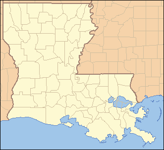 Location of Krotz Springs in Louisiana | |
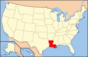 Location of Louisiana in the United States | |
Krotz Springs is a town in St. Landry Parish, Louisiana on the Atchafalaya River. The population was 1,219 at the 2000 census. It is part of the Opelousas–Eunice Micropolitan Statistical Area.
History
Around the turn of the 20th century, an Ohio native, C W Krotz, bought 20,000 acres (81 km2) of woodland around the Atchafalaya Basin and set up a sawmill to trim the trees hauled out of the basin. The tiny settlement that grew up around the mill was called Latania (fan palm), after the bayou of the same name and the types of palm plants found in the area.
Thinking he was sitting on an untapped pool of oil Krotz put down the first oil well in St. Landry Parish, but he struck water instead of oil, the result becoming known as Krotz’s spring. The spring was used to supply water for the developing sawmill town and Krotz even bottled the water, selling it throughout the country.
In 1909, a post office was established in the town, and the obvious choice was Krotz Springs.[1]
Mayors
Robert A. Moran served as Mayor from 1986-87. He died in office, May 1987. Saturday, November 21, 1987, Rasie Nall (D) defeated Ina Moran (D) in a runoff for Mayor.[2] Four years later, on Saturday, October 6, 1990, Gary Soileau (D) would defeat Larry Martinez Sr. (D) in a landslide victory, carrying 86% of the votes.[3] Gary Soileau would remain mayor until he retired in 2010. The citizens of Krotz Springs elected Carrol Snyder as their mayor on Saturday, October 2, 2010.[4]
Geography
Krotz Springs is located at 30°32′15″N 91°45′18″W / 30.53750°N 91.75500°W (30.537565, -91.754926).[5]
According to the United States Census Bureau, the town has a total area of 1.7 square miles (4.4 km2), all land.
Demographics
| Historical population | |||
|---|---|---|---|
| Census | Pop. | %± | |
| 1920 | 247 | — | |
| 1930 | 449 | 81.8% | |
| 1940 | 630 | 40.3% | |
| 1950 | 866 | 37.5% | |
| 1960 | 1,057 | 22.1% | |
| 1970 | 1,435 | 35.8% | |
| 1980 | 1,374 | −4.3% | |
| 1990 | 1,285 | −6.5% | |
| 2000 | 1,219 | −5.1% | |
| 2010 | 1,198 | −1.7% | |
| Est. 2015 | 1,203 | [6] | 0.4% |
As of the 2010 United States Census, there were 1,198 people residing in the town. The racial makeup of the town was 97.2% White, 0.2% Black, 0.3% Native American, 0.4% Asian and 0.3% from two or more races. 1.5% were Hispanic or Latino of any race.
As of the census[8] of 2000, there were 1,219 people, 490 households, and 339 families residing in the town. The population density was 705.0 people per square mile (272.1/km²). There were 562 housing units at an average density of 325.0 per square mile (125.4/km²). The racial makeup of the town was 99.10% White, 0.25% African American, 0.08% Native American, 0.08% from other races, and 0.49% from two or more races. Hispanic or Latino of any race were 0.74% of the population.
There were 490 households out of which 34.9% had children under the age of 18 living with them, 52.4% were married couples living together, 11.8% had a female householder with no husband present, and 30.8% were non-families. 26.9% of all households were made up of individuals and 12.9% had someone living alone who was 65 years of age or older. The average household size was 2.49 and the average family size was 2.99.
In the town the population was spread out with 26.9% under the age of 18, 11.4% from 18 to 24, 28.0% from 25 to 44, 20.2% from 45 to 64, and 13.5% who were 65 years of age or older. The median age was 33 years. For every 100 females there were 95.4 males. For every 100 females age 18 and over, there were 87.2 males.
The median income for a household in the town was $26,823, and the median income for a family was $31,842. Males had a median income of $29,167 versus $21,875 for females. The per capita income for the town was $13,914. About 17.5% of families and 22.5% of the population were below the poverty line, including 25.6% of those under age 18 and 18.3% of those age 65 or over.
As of 2010, 77.39% of the population identified themselves as belonging to a faith community; of these 86.5% were Catholic, 9.4% were Southern Baptist and 2.4% were Churches of Christ.[9]
Film history
- 1966: The prison camp scenes in Nevada Smith, starring Steve McQueen, were filmed just west of Krotz Springs in the 2 O'Clock Bayou area.
- 1969: The final scene of Easy Rider, starring Peter Fonda and Dennis Hopper, was filmed a few miles north of there,[10] in which the two main characters are shot by two local residents, David C. Billodeau and Johnny David, on Louisiana Highway 105.
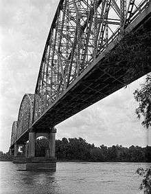
- 1998: In the film Out of Sight, starring George Clooney and Jennifer Lopez, two of the main characters lose control of their vehicle coming down the Atchafalaya River Bridge on U.S. Route 190 Westbound.
- In the show The Venture Bros. they animated the scene from Easy Rider.
References
| Wikivoyage has a travel guide for Krotz Springs. |
- ↑ www.cajuntravel.com "KROTZ SPRINGS"
- ↑ St Landry Parish. Louisiana Secretary of State, Elections Division. November 21, 1987.
- ↑ St Landry Parish. Louisiana Secretary of State, Elections Division. October 6, 1990.
- ↑ St Landry Parish. Louisiana Secretary of State, Elections Division. October 2, 2010.
- ↑ "US Gazetteer files: 2010, 2000, and 1990". United States Census Bureau. 2011-02-12. Retrieved 2011-04-23.
- ↑ "Annual Estimates of the Resident Population for Incorporated Places: April 1, 2010 to July 1, 2015". Retrieved July 2, 2016.
- ↑ "Census of Population and Housing". Census.gov. Archived from the original on May 11, 2015. Retrieved June 4, 2015.
- ↑ "American FactFinder". United States Census Bureau. Archived from the original on September 11, 2013. Retrieved 2008-01-31.
- ↑ City Data Krotz Springs
- ↑ [30°45′39″N 91°45′51″W / 30.76083°N 91.76417°W]
Municipalities and communities of St. Landry Parish, Louisiana, United States | ||
|---|---|---|
| Cities |  | |
| Towns | ||
| Villages | ||
| CDP | ||
| Other unincorporated communities |
| |
| Footnotes | ‡This populated place also has portions in an adjacent parish or parishes | |