Lake Mountains
| Lake Mountains | |
|---|---|
|
satellite view of Utah Lake 3 mountain ranges west: Oquirrh Mountains, Lake Mountains, and East Tintic Mountains | |
| Highest point | |
| Peak | Unnamed (Lake Mountains (approx. center)) |
| Dimensions | |
| Length | 15 mi (24 km) N-S (arc-shape, curved east) |
| Width | 8 mi (13 km) (at center, narrower north/south) |
| Geography | |
 Lake Mountains in Utah | |
| Country | United States |
| State | Utah |
| Regions |
(south of)-Salt Lake Valley (west & northwest)-Utah Valley |
| County | Utah |
| Communities (at foothills) |
List
|
| Range coordinates | 40°17′N 111°59′W / 40.28°N 111.98°WCoordinates: 40°17′N 111°59′W / 40.28°N 111.98°W |
| Borders on |
Oquirrh Mountains-NW Salt Lake City & Valley-N Utah Lake-NE, E, & SE Goshen Valley-S East Tintic Mountains-SSW Cedar Valley-W |

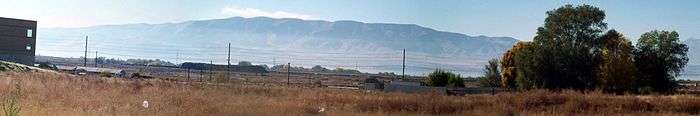
The Lake Mountains are a 15-mile (24 km) long[1] mountain range located in west Utah County, Utah in western Utah Valley; the range forms the northwest border of Utah Lake, and its proximity allows its use for communication towers, mostly in its north section, bordering Eagle Mountain.
Description
The range is arc-shaped, curved to the east, on the northwest shore of Utah Lake. The Lake Mountains have no prominent peaks, but a central ridgeline, about 5-mi (8 km) long,[2] trends slightly NNW by SSE. About nine named canyons are on the east, with Utah Lake; the west has fewer canyons, and Wiley Canyon on the west is slightly north of the range's center.
The arc-shaped east mountain range perimeter contains Utah Route 68 on the lakeshore. In Cedar Valley (Utah) on the west side, Utah Route 73 travels east, then northeast, around the northern perimeter of the mountain range.
Tourism
Cedar Valley, at Fairfield contains the Camp Floyd/Stagecoach Inn State Park; it is on the Pony Express National Historic Trail.
References
External links
 Media related to Lake Mountains at Wikimedia Commons
- Wiley Canyon (west of range center, coordinates), topoquest