Eagle Mountain, Utah
| Eagle Mountain, Utah | |
|---|---|
| City | |
|
Eagle Mountain monument | |
 Location in Utah County and the state of Utah | |
| Coordinates: 40°18′22″N 112°0′35″W / 40.30611°N 112.00972°WCoordinates: 40°18′22″N 112°0′35″W / 40.30611°N 112.00972°W | |
| Country | United States |
| State | Utah |
| County | Utah |
| Incorporated | December 3, 1996 |
| Became a city | May 31, 2001 |
| Government[1] | |
| • Type | Six Member Council [2] |
| • Mayor | Christopher Pengra |
| • Councilmembers | Adam Bradley, Colby Curtis, Stephanie Gricius, Ben Reaves, Tom Westmoreland |
| Area | |
| • Total | 41.7 sq mi (108.0 km2) |
| • Land | 41.7 sq mi (108.0 km2) |
| • Water | 0.0 sq mi (0.0 km2) |
| Elevation | 4,882 ft (1,488 m) |
| Population (2012) | |
| • Total | 23,212 |
| • Density | 560/sq mi (210/km2) |
| Time zone | Mountain (MST) (UTC-7) |
| • Summer (DST) | MDT (UTC-6) |
| ZIP code | 84005 |
| Area code(s) | 385, 801 |
| FIPS code | 49-20810[3] |
| GNIS feature ID | 1759211[4] |
| Website | www.emcity.org |


Eagle Mountain is a city in Utah County, Utah, United States. It is part of the Provo–Orem, Utah Metropolitan Statistical Area. The city is located to the west as well as north of the Lake Mountains, which are west of Utah Lake. It was incorporated December 3, 1996 and has been rapidly growing ever since. The population was 21,415 at the 2010 census.[5] Although Eagle Mountain was a town in 2000,[3] it has since been classified as a fourth-class city by state law.[6] In its short history, the city has quickly become known for its rapid growth.[7][8]
Geography
Eagle Mountain is located at the western and northern bases of the Lake Mountains in the flat Cedar Valley northeast of the city of Cedar Fort. According to the United States Census Bureau, the city has a total area of 41.7 square miles (108.0 km2).
SR-73 and Eagle Mountain Boulevard provide access to the city from Utah Valley and Salt Lake Valley, although the city center sits at least 15 miles (24 km) from the two valleys' main transportation corridor along Interstate 15. The Utah Department of Transportation is in the process of building a western freeway for the Salt Lake Valley (the Mountain View Corridor), which will connect to SR-73 only a few miles from the city.[9]
The area is home to a number of natural landmarks, including a site along the original Pony Express trail[10] and 1,800-year-old rock art petroglyphs carved by ancient Fremont Indians.[11]
History
In 2011 Eagle Mountain extended further west with the annexation of the White Hills neighborhood, which had about 400 residents, as well as area that is part of the Pole Canyon development plan. The land outside of white hills was Almost 2,900 acres.[12]
Demographics
| Historical population | |||
|---|---|---|---|
| Census | Pop. | %± | |
| 2000 | 2,157 | — | |
| 2010 | 21,415 | 892.8% | |
| Est. 2015 | 27,332 | [13] | 27.6% |
As of the census[3] of 2010, there were 21,415 people, 5,111 households, and 4,741 families residing in the town. The population density was 513.6 inhabitants per square mile (20.0/km²). There were 5,546 housing units at an average density of 133 per square mile. The racial makeup of the town was 91.9% White, 0.6% African American, 0.5% American Indian and Alaskan Native, 0.6% Asian, 0.6% Pacific Islander, 2.7% from other races, and 3.1% from two or more races. Hispanic or Latino of any race were 8.6% of the population.
There were 5,111 households of which 72.9% had children under the age of 18 living with them, 84.7% were married couples living together, 5.6% had a female householder with no husband present, and 7.2% were non-families. 5.0% of all households were made up of individuals and 0.3% had someone living alone who was 65 years of age or older. The average household size was 4.19 and the average family size was 4.34.
In the town the population was spread out with 49.5% under the age of 18, 4.6% from 20 to 24, 35.7% from 25 to 44, 8.0% from 45 to 64, and 1.8% who were 65 years of age or older. The median age was 20.3 years.
According to the U.S. Census Bureau's 2007-2011 statistics, the median income for a household in the city was $64,676. The per capita income for the town was $17,814 (U.S. Census Bureau 2007-2011). About 7.6% of the population was below the poverty line.
In 2015, Eagle Mountain was the 10th most conservative city in the United States as judged by political donations.[15]
Law and government

Eagle Mountain City has a six-member Traditional Council form of government. The Mayor is a non-voting member of the Council except in the situation of a tie vote. The mayor acts as an elected executive with the city council functioning with legislative powers. Eagle Mountain is unique for a Utah city of its size to have a full-time mayor with a salary of $70,000.[16] The mayor may select a chief administrative officer to oversee the different departments. The current mayor is Christopher Pengra who took office in January 2014.[17]
Education
Eagle Mountain is located in the Alpine School District and currently has five elementary schools (Eagle Valley, Hidden Hollow, Mountain Trails, Pony Express, and Blackridge). Frontier Middle School serves students in grades 7-9 except for those in the Silverlake area who attend Vista Heights Middle School in Saratoga Springs. High school students attend Westlake High School in nearby Saratoga Springs. A high school in Eagle Mountain is planned around 2017. Vern Henshaw is the Superintendent of Schools.[18]
The city also has two public charter schools (The Ranches Academy, grades K-6 and Rockwell Charter High School, grades 7-12).
Transportation
The two major roads running into Eagle Mountain are Utah State Route 73, which runs through the northern part of the city and along its western edge into Cedar Fort, and Pony Express Pkwy, which was extended east to Redwood road in Saratoga Springs in 2010. This was done to facilitate access with the rest of Utah County via connection with Pioneer Crossing, the east-west connector from Redwood Road to I-15.[19][20][21] In 2008, the Utah Transit Authority (UTA) began service on an express bus route (#806) into Eagle Mountain. It is the first UTA bus to service the city, and it connects to Downtown Salt Lake City.
Parks
The city lists 4 regional parks and about 35 local parks.[22] In 2009, Eagle Mountain opened the Mountain Ranch Bike Park. This park is the first of its kind on the Wasatch Front. It features a jump line, two slope style tracks, a single track network, and a skills area with a pump track and wood features.[23]
References
- ↑ List of mayors of Eagle Mountain, Utah
- ↑ "Utah forms of government" (PDF). Retrieved 2016-09-01.
- 1 2 3 "American FactFinder". United States Census Bureau. Retrieved 2008-01-31.
- ↑ "US Board on Geographic Names". United States Geological Survey. 2007-10-25. Retrieved 2008-01-31.
- ↑ 2010 Census Information. Accessed November 9, 2011.
- ↑ §10-2-301 of the Utah Code, last amended in 2003. Accessed 2008-06-14.
- ↑ "Eagle Mountain elementary schools bursting - help may be on the way". Salt Lake Tribune. Retrieved 2007-09-23.
- ↑ "City votes to double size of new sewer". Salt Lake Tribune. Retrieved 2007-09-23.
- ↑ "MountainView Corridor". Utah Department of Transportation. Retrieved 2006-08-13.
- ↑ "Dedication of Pony Express Trail Monument" (PDF). Eagle Mountain City. Retrieved 2007-09-23.
- ↑ "Eagle Mountain Hopes to Protect Rock Art". KSL. Retrieved 2010-07-06.
- ↑ Provo Daily Herald article on annexation of White Hills to Eagle Mountain
- ↑ "Annual Estimates of the Resident Population for Incorporated Places: April 1, 2010 to July 1, 2015". Retrieved July 2, 2016.
- ↑ "Census of Population and Housing". Census.gov. Retrieved June 4, 2015.
- ↑ Phillips, Amber (2015-12-14). "The 10 most liberal and conservative cities in the U.S. — as judged by campaign donors". The Washington Post. ISSN 0190-8286. Retrieved 2016-04-03.
- ↑ "Eagle Mountain City Code". www.codepublishing.com. Retrieved 2016-09-01.
- ↑ "Eagle Mountain City : Mayor". www.eaglemountaincity.org. Retrieved 2016-05-23.
- ↑ "Administration". Alpine School District. Retrieved 2012-06-16.
- ↑ Eagle Mountain City, Pony Express Parkway Road Extension Now Open. Accessed 2010-07-19.
- ↑ KSL, Eagle Mountain's Pony Express Pkwy to be extended to Redwood Rd Accessed 2010-07-19.
- ↑ Udot, Welcome to Pioneer Crossing. Accessed 2010-07-19
- ↑ "Eagle Mountain City : Parks". eaglemountaincity.org. Retrieved 2016-04-03.
- ↑ "Eagle Mountain City : Mountain Ranch Bike Park". eaglemountaincity.org. Retrieved 2016-04-03.
Historical books
2005. "A Ride from the Past on a Road to the Future: A History of Eagle Mountain". Copyright 2005; Published by Eagle Mountain City, Utah with 106 pages. First Edition 2005. Written by Marci Purnell; Edited by Leah Woodard; With Contributions by Mayors Hooge, Bond, Bateman, and Bailey.
External links
 |
Tooele | Herriman | |
|
| Cedar Fort | |
Saratoga Springs | ||
| ||||
| | ||||
| Fairfield | Goshen, Genola | Utah Lake / Spanish Fork Payson, Salem |
Municipalities and communities of Utah County, Utah, United States | ||
|---|---|---|
| Cities | 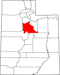 | |
| Towns | ||
| CDPs | ||
| Unincorporated communities | ||
| Indian reservation | ||
| Ghost towns | ||
| Footnotes | ‡This populated place also has portions in an adjacent county or counties | |