Cedar Fort, Utah
| Cedar Fort, Utah | |
|---|---|
| Town | |
|
Cedar Valley Post Office | |
 Location in Utah County and the state of Utah | |
| Coordinates: 40°19′35″N 112°6′20″W / 40.32639°N 112.10556°WCoordinates: 40°19′35″N 112°6′20″W / 40.32639°N 112.10556°W | |
| Country | United States |
| State | Utah |
| County | Utah |
| Settled | 1852 |
| Incorporated | May 17, 1965 |
| Named for | Juniper ("cedar") trees |
| Area | |
| • Total | 21.2 sq mi (55.0 km2) |
| • Land | 21.2 sq mi (55.0 km2) |
| • Water | 0.0 sq mi (0.0 km2) |
| Elevation | 5,085 ft (1,550 m) |
| Population (2012) | |
| • Total | 375 |
| • Density | 18/sq mi (6.8/km2) |
| Time zone | Mountain (MST) (UTC-7) |
| • Summer (DST) | MDT (UTC-6) |
| ZIP code | 84013 |
| Area code(s) | 385, 801 |
| FIPS code | 49-11430[1] |
| GNIS feature ID | 1455091[2] |
| Website | townofcedarfort.webs.com |

Cedar Fort is a town in Utah County, Utah, United States. It is part of the Provo–Orem Metropolitan Statistical Area. The population was 368 at the 2010 census.[3]
Geography
According to the United States Census Bureau, the town has a total area of 21.2 square miles (55.0 km2), all of it land.[4]
Demographics
| Historical population | |||
|---|---|---|---|
| Census | Pop. | %± | |
| 1870 | 272 | — | |
| 1880 | 250 | −8.1% | |
| 1890 | 176 | −29.6% | |
| 1900 | 218 | 23.9% | |
| 1910 | 236 | 8.3% | |
| 1920 | 178 | −24.6% | |
| 1930 | 177 | −0.6% | |
| 1940 | 208 | 17.5% | |
| 1950 | 213 | 2.4% | |
| 1970 | 188 | — | |
| 1980 | 269 | 43.1% | |
| 1990 | 284 | 5.6% | |
| 2000 | 341 | 20.1% | |
| 2010 | 368 | 7.9% | |
| Est. 2015 | 383 | [5] | 4.1% |
As of the census[1] of 2000, there were 341 people, 101 households, and 83 families residing in the town. The population density was 16.1 people per square mile (6.2/km²). There were 110 housing units at an average density of 5.2 per square mile (2/km²). The racial makeup of the town was 95.89% White, 0.59% Native American, 0.29% Asian, 0.29% Pacific Islander, 0.29% from other races, and 2.64% from two or more races. Hispanic or Latino of any race were 0.88% of the population.
There were 101 households out of which 43.6% had children under the age of 18 living with them, 76.2% were married couples living together, 4.0% had a female householder with no husband present, and 17.8% were non-families. 16.8% of all households were made up of individuals and 10.9% had someone living alone who was 65 years of age or older. The average household size was 3.38 and the average family size was 3.87.
In the town the population was spread out with 36.1% under the age of 18, 8.8% from 18 to 24, 24.0% from 25 to 44, 19.6% from 45 to 64, and 11.4% who were 65 years of age or older. The median age was 29 years. For every 100 females there were 101.8 males. For every 100 females age 18 and over, there were 101.9 males.
The median income for a household in the town was $44,773, and the median income for a family was $45,833. Males had a median income of $40,000 versus $25,500 for females. The per capita income for the town was $14,266. About 5.4% of families and 11.3% of the population were below the poverty line, including 18.5% of those under age 18 and 7.5% of those age 65 or over.

Education
Cedar Fort is part of the Alpine School District. The only school in town is Cedar Valley Elementary. Older students attend schools in Eagle Mountain and Saratoga Springs.
See also
References
- 1 2 "American FactFinder". United States Census Bureau. Archived from the original on 2013-09-11. Retrieved 2008-01-31.
- ↑ "US Board on Geographic Names". United States Geological Survey. 2007-10-25. Retrieved 2008-01-31.
- ↑ "Profile of General Population and Housing Characteristics: 2010 Demographic Profile Data (DP-1): Cedar Fort town, Utah". U.S. Census Bureau, American Factfinder. Archived from the original on September 11, 2013. Retrieved March 8, 2012.
- ↑ "Geographic Identifiers: 2010 Demographic Profile Data (G001): Cedar Fort town, Utah". U.S. Census Bureau, American Factfinder. Archived from the original on September 11, 2013. Retrieved March 8, 2012.
- ↑ "Annual Estimates of the Resident Population for Incorporated Places: April 1, 2010 to July 1, 2015". Retrieved July 2, 2016.
- ↑ "Census of Population and Housing". Census.gov. Archived from the original on May 11, 2015. Retrieved June 4, 2015.
 |
Tooele Stockton |
Copperton | Herriman |
|
| Ophir | |
Eagle Mountain | ||
| ||||
| | ||||
| Vernon | Fairfield |
Municipalities and communities of Utah County, Utah, United States | ||
|---|---|---|
| Cities | 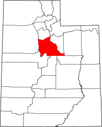 | |
| Towns | ||
| CDPs | ||
| Unincorporated communities | ||
| Indian reservation | ||
| Ghost towns | ||
| Footnotes | ‡This populated place also has portions in an adjacent county or counties | |