Lamotte Township, Crawford County, Illinois
| Lamotte Township | |
|---|---|
| Township | |
|
The Stoner Site, an important archaeological site in the township | |
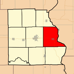 Location in Crawford County | |
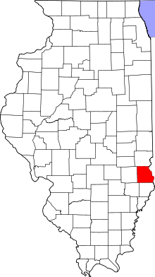 Crawford County's location in Illinois | |
| Coordinates: 39°00′53″N 87°37′12″W / 39.01472°N 87.62000°WCoordinates: 39°00′53″N 87°37′12″W / 39.01472°N 87.62000°W | |
| Country | United States |
| State | Illinois |
| County | Crawford |
| Established | November 5, 1867 |
| Area | |
| • Total | 51.41 sq mi (133.2 km2) |
| • Land | 50.81 sq mi (131.6 km2) |
| • Water | 0.59 sq mi (1.5 km2) 1.15% |
| Elevation | 440 ft (134 m) |
| Population (2010) | |
| • Total | 2,046 |
| • Density | 40.3/sq mi (15.6/km2) |
| Time zone | CST (UTC-6) |
| • Summer (DST) | CDT (UTC-5) |
| ZIP codes | 62451, 62454 |
| GNIS feature ID | 0429229 |

Lamotte Township is one of ten townships in Crawford County, Illinois, USA. As of the 2010 census, its population was 2,046 and it contained 995 housing units.[1] Its name changed from Palestine Township sometime before 1921.
Geography
According to the 2010 census, the township has a total area of 51.41 square miles (133.2 km2), of which 50.81 square miles (131.6 km2) (or 98.83%) is land and 0.59 square miles (1.5 km2) (or 1.15%) is water.[1] The Wabash River defines its eastern border.
Cities, towns, villages
Unincorporated towns
(This list is based on USGS data and may include former settlements.)
Cemeteries
The township contains these seven cemeteries: Barbee, East Union, Green, Higgins, Kitchell, Neathery and Oak Grove.
Major highways
Airports and landing strips
- Robinson Municipal Airport
Landmarks
- Leaverton Park
School districts
- Hutsonville Community Unit School District 1
- Palestine Community Unit School District 3
- Robinson Community Unit School District 2
- Oblong Community Unit School District 4
Political districts
- Illinois' 15th congressional district
- State House District 109
- State Senate District 55
References
- "Lamotte Township, Crawford County, Illinois". Geographic Names Information System. United States Geological Survey. Retrieved 2010-01-10.
- United States Census Bureau 2007 TIGER/Line Shapefiles
- United States National Atlas
- 1 2 "Population, Housing Units, Area, and Density: 2010 - County -- County Subdivision and Place -- 2010 Census Summary File 1". United States Census. Retrieved 2013-05-28.
External links
 |
Hutsonville Township | |
| |
| Robinson Township | |
Gill Township, Sullivan County, Indiana | ||
| ||||
| | ||||
| Honey Creek Township | Montgomery Township |
Municipalities and communities of Crawford County, Illinois, United States | ||
|---|---|---|
| City | ||
| Town | ||
| Villages | ||
| Townships | ||
| CDPs | ||
| Other unincorporated communities | ||
| Ghost town | ||
| Footnotes | ‡This populated place also has portions in an adjacent county or counties | |
This article is issued from Wikipedia - version of the 2/25/2014. The text is available under the Creative Commons Attribution/Share Alike but additional terms may apply for the media files.