Oblong Township, Crawford County, Illinois
| Oblong Township | |
|---|---|
| Township | |
 Location in Crawford County | |
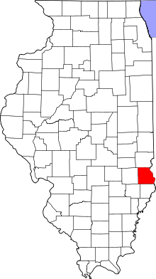 Crawford County's location in Illinois | |
| Coordinates: 39°00′28″N 87°52′52″W / 39.00778°N 87.88111°WCoordinates: 39°00′28″N 87°52′52″W / 39.00778°N 87.88111°W | |
| Country | United States |
| State | Illinois |
| County | Crawford |
| Established | November 5, 1867 |
| Area | |
| • Total | 57.43 sq mi (148.7 km2) |
| • Land | 57.39 sq mi (148.6 km2) |
| • Water | 0.04 sq mi (0.1 km2) 0.07% |
| Elevation | 486 ft (148 m) |
| Population (2010) | |
| • Total | 2,789 |
| • Density | 48.6/sq mi (18.8/km2) |
| Time zone | CST (UTC-6) |
| • Summer (DST) | CDT (UTC-5) |
| ZIP codes | 62449, 62454 |
| GNIS feature ID | 0429474 |
Oblong Township is one of ten townships in Crawford County, Illinois, USA. As of the 2010 census, its population was 2,789 and it contained 1,251 housing units.[1]
Geography
According to the 2010 census, the township has a total area of 57.43 square miles (148.7 km2), of which 57.39 square miles (148.6 km2) (or 99.93%) is land and 0.04 square miles (0.10 km2) (or 0.07%) is water.[1]
Cities, towns, villages
Unincorporated towns
(This list is based on USGS data and may include former settlements.)
Cemeteries
The township contains these three cemeteries: Oblong, Prier and White Oak.
Major highways
Lakes
- Oblong Lake
Landmarks
- Oblong Park
School districts
- Oblong Community Unit School District 4
- Robinson Community Unit School District 2
Political districts
- Illinois' 15th congressional district
- State House District 109
- State Senate District 55
References
- "Oblong Township, Crawford County, Illinois". Geographic Names Information System. United States Geological Survey. Retrieved 2010-01-10.
- United States Census Bureau 2007 TIGER/Line Shapefiles
- United States National Atlas
- 1 2 "Population, Housing Units, Area, and Density: 2010 - County -- County Subdivision and Place -- 2010 Census Summary File 1". United States Census. Retrieved 2013-05-28.
External links
 |
Licking Township | Prairie Township | | |
| Hunt City Township, Jasper County Willow Hill Township, Jasper County |
|
Robinson Township | ||
| ||||
| | ||||
| Sainte Marie Township, Jasper County | Martin Township |
Municipalities and communities of Crawford County, Illinois, United States | ||
|---|---|---|
| City | ||
| Town | ||
| Villages | ||
| Townships | ||
| CDPs | ||
| Other unincorporated communities | ||
| Ghost town | ||
| Footnotes | ‡This populated place also has portions in an adjacent county or counties | |
This article is issued from Wikipedia - version of the 9/10/2016. The text is available under the Creative Commons Attribution/Share Alike but additional terms may apply for the media files.