Landrum, South Carolina
| Landrum, South Carolina | |
|---|---|
| City | |
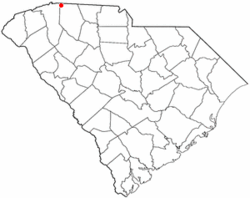 Location of Landrum, South Carolina | |
| Coordinates: 35°10′31″N 82°11′10″W / 35.17528°N 82.18611°WCoordinates: 35°10′31″N 82°11′10″W / 35.17528°N 82.18611°W | |
| Country | United States |
| State | South Carolina |
| County | Spartanburg |
| Area | |
| • Total | 2.4 sq mi (6.1 km2) |
| • Land | 2.3 sq mi (6.1 km2) |
| • Water | 0.0 sq mi (0.0 km2) |
| Elevation | 1,047 ft (319 m) |
| Population (2010) | |
| • Total | 2,376 |
| • Density | 990/sq mi (390/km2) |
| Time zone | Eastern (EST) (UTC-5) |
| • Summer (DST) | EDT (UTC-4) |
| ZIP code | 29356 |
| Area code(s) | 864 |
| FIPS code | 45-40075[1] |
| GNIS feature ID | 1246289[2] |
| Website | http://cityoflandrumsc.com |
Landrum is a city in Spartanburg County, South Carolina, United States. The population was 2,376 at the 2010 census.[3]
It was founded in 1880 and incorporated in 1912. It is located just west of Interstate 26 between Spartanburg, South Carolina and Asheville, North Carolina.[4]
History
The Landrum area was settled around 1760 by homesteaders from Pennsylvania, Maryland and Virginia. There, they built a fort approximately two miles from the current City of Landrum. The town of Landrum was founded in 1880 after the railroad was extended north from Spartanburg and named after John Landrum who gave the land for construction of the local depot. Landrum was incorporated as a town three years later. In 1973 it was made into a city.[5]
Geography
Landrum is located at 35°10′31″N 82°11′10″W / 35.17528°N 82.18611°W (35.175326, -82.186036).[6]
According to the United States Census Bureau, the city has a total area of 2.3 square miles (6.0 km2), of which 0.43% is water.
Demographics
| Historical population | |||
|---|---|---|---|
| Census | Pop. | %± | |
| 1890 | 155 | — | |
| 1900 | 263 | 69.7% | |
| 1910 | 449 | 70.7% | |
| 1920 | 980 | 118.3% | |
| 1930 | 1,212 | 23.7% | |
| 1940 | 1,289 | 6.4% | |
| 1950 | 1,333 | 3.4% | |
| 1960 | 1,930 | 44.8% | |
| 1970 | 1,859 | −3.7% | |
| 1980 | 2,141 | 15.2% | |
| 1990 | 2,347 | 9.6% | |
| 2000 | 2,472 | 5.3% | |
| 2010 | 2,376 | −3.9% | |
| Est. 2015 | 2,493 | [7] | 4.9% |
As of the census[1] of 2000, there were 2,472 people, 1,040 households, and 691 families residing in the city. The population density was 1,053.7 people per square mile (406.1/km²). There were 1,107 housing units at an average density of 471.9 per square mile (181.9/km²). The racial makeup of the city was 81.84% White, 15.86% African American, 0.08% Native American, 0.53% Asian, 0.81% from other races, and 0.89% from two or more races. Hispanic or Latino of any race were 1.78% of the population.
There were 1,040 households out of which 28.6% had children under the age of 18 living with them, 47.1% were married couples living together, 14.8% had a female householder with no husband present, and 33.5% were non-families. 30.2% of all households were made up of individuals and 14.5% had someone living alone who was 65 years of age or older. The average household size was 2.36 and the average family size was 2.93.
In the city the population was spread out with 23.7% under the age of 18, 7.2% from 18 to 24, 27.3% from 25 to 44, 23.4% from 45 to 64, and 18.5% who were 65 years of age or older. The median age was 39 years. For every 100 females there were 91.8 males. For every 100 females age 18 and over, there were 85.9 males.
The median income for a household in the city was $29,583, and the median income for a family was $40,347. Males had a median income of $28,375 versus $20,784 for females. The per capita income for the city was $14,259. About 10.4% of families and 15.0% of the population were below the poverty line, including 17.7% of those under age 18 and 18.9% of those age 65 or over.
Schools
Public Schools include O.P. Earle Elementary[9] serving grades PK-5, Landrum Middle[10] serving grades 5-8, and Landrum High[11] serving grades 9-12. Private School includes Grace Christian School serving grades PK-12.
References
- 1 2 "American FactFinder". United States Census Bureau. Retrieved 2008-01-31.
- ↑ "US Board on Geographic Names". United States Geological Survey. 2007-10-25. Retrieved 2008-01-31.
- ↑ "Race, Hispanic or Latino, Age, and Housing Occupancy: 2010 Census Redistricting Data (Public Law 94-171) Summary File (QT-PL), Landrum city, South Carolina". U.S. Census Bureau, American FactFinder 2. Retrieved August 15, 2011.
- ↑ http://www.cityoflandrum.com/about/index.php - Accessed July 11, 2013
- ↑ http://www.cityoflandrum.com/about/birth.php - Accessed July 11, 2013
- ↑ "US Gazetteer files: 2010, 2000, and 1990". United States Census Bureau. 2011-02-12. Retrieved 2011-04-23.
- ↑ "Annual Estimates of the Resident Population for Incorporated Places: April 1, 2010 to July 1, 2015". Retrieved July 2, 2016.
- ↑ "Census of Population and Housing". Census.gov. Retrieved June 4, 2015.
- ↑ "O.P. Earle Elementary". Spartanburg County School District One. Retrieved 1 September 2016.
- ↑ "Landrum Middle". Spartanburg County School District One. Retrieved 1 September 2016.
- ↑ "Landrum High School". Spartanburg County School District One. Retrieved 1 September 2016.
External links
Municipalities and communities of Spartanburg County, South Carolina, United States | ||
|---|---|---|
| Cities | 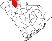 | |
| Towns | ||
| CDPs | ||
| Unincorporated communities | ||
| Ghost town | ||
| Footnotes | ‡This populated place also has portions in an adjacent county or counties | |