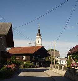
Lengau
| Lengau | ||
|---|---|---|
 | ||
| ||
 Lengau Location within Austria | ||
| Coordinates: 48°00′00″N 13°13′00″E / 48.00000°N 13.21667°ECoordinates: 48°00′00″N 13°13′00″E / 48.00000°N 13.21667°E | ||
| Country | Austria | |
| State | Upper Austria | |
| District | Braunau am Inn | |
| Government | ||
| • Mayor | Erich Rippl (SPÖ) | |
| Area | ||
| • Total | 58.18 km2 (22.46 sq mi) | |
| Elevation | 532 m (1,745 ft) | |
| Population (14 June 2016)[1] | ||
| • Total | 4,570 | |
| • Density | 79/km2 (200/sq mi) | |
| Time zone | CET (UTC+1) | |
| • Summer (DST) | CEST (UTC+2) | |
| Postal code | 5211 | |
| Area code | 07746 | |
| Vehicle registration | BR | |
| Website | www.gemeindelengau.at | |
Lengau is a municipality in the district of Braunau am Inn in the Austrian state of Upper Austria.
References

Parish church
| Wikimedia Commons has media related to Lengau. |
This article is issued from Wikipedia - version of the 8/20/2015. The text is available under the Creative Commons Attribution/Share Alike but additional terms may apply for the media files.