Munderfing
| Munderfing | ||
|---|---|---|
| ||
 Munderfing Location within Austria | ||
| Coordinates: 48°04′00″N 13°11′00″E / 48.06667°N 13.18333°ECoordinates: 48°04′00″N 13°11′00″E / 48.06667°N 13.18333°E | ||
| Country | Austria | |
| State | Upper Austria | |
| District | Braunau am Inn | |
| Government | ||
| • Mayor | Martin Voggenberger (ÖVP) | |
| Area | ||
| • Total | 31.02 km2 (11.98 sq mi) | |
| Elevation | 468 m (1,535 ft) | |
| Population (14 June 2016)[1] | ||
| • Total | 2,963 | |
| • Density | 96/km2 (250/sq mi) | |
| Time zone | CET (UTC+1) | |
| • Summer (DST) | CEST (UTC+2) | |
| Postal code | 5222 | |
| Area code | 07744 | |
| Vehicle registration | BR | |
| Website | www.munderfing.at | |

Munderfing is a municipality in the district of Braunau am Inn in the Austrian state of Upper Austria.
Geography
Munderfing lies on the western edge of the Kobernauß forest in the Innviertel. About 57 percent of the municipality is forest and 38 percent farmland.
References
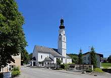
Parish church
| Wikimedia Commons has media related to Munderfing. |
This article is issued from Wikipedia - version of the 8/20/2015. The text is available under the Creative Commons Attribution/Share Alike but additional terms may apply for the media files.