Loreto, Dinagat Islands
| Loreto | |
|---|---|
| Municipality | |
| Nickname(s): Mindanao's Last Frontier | |
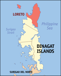 Map of Dinagat Islands with Loreto highlighted | |
.svg.png) Loreto Location within the Philippines | |
| Coordinates: 10°21′N 125°37′E / 10.350°N 125.617°ECoordinates: 10°21′N 125°37′E / 10.350°N 125.617°E | |
| Country | Philippines |
| Region | Caraga (Region XIII) |
| Province | Dinagat Islands |
| Congr. district | Lone district of Dinagat Islands |
| Established | January 1, 1919 |
| Barangays | 10 |
| Government[1] | |
| • Mayor | Nena I. Ladaga-Quijano |
| Area[2] | |
| • Total | 255.87 km2 (98.79 sq mi) |
| Population (2010)[3] | |
| • Total | 8,920 |
| • Density | 35/km2 (90/sq mi) |
| Time zone | PST (UTC+8) |
| ZIP code | 8415 |
| Dialing code | 86 |
Loreto is a municipality in the province of Dinagat Islands, Philippines. Its official population count as of the 2010 Census is 8,920.[3]
History
The town became a part of the province of Dinagat Islands in October 2, 2006 when the province was created from Surigao del Norte by Republic Act No. 9355. However, in February 2010, the Supreme Court ruled that the law was unconstitutional, as the necessary requirements for provincial land area and population were not met. The town reverted to Surigao del Norte.[4] On October 24, 2012, however, the Supreme Court reversed its ruling from the previous year, and upheld the constitutionality of RA 9355 and the creation of Dinagat Islands as a province.[5]
In 1956, the sitio of Roxas was converted into a barrio.[6]
Barangays
Loreto is politically subdivided into 10 barangays.[2]
- Carmen (Pob.)
- Esperanza
- Ferdinand
- Helen
- Liberty
- Magsaysay
- Panamaon
- San Juan (Pob.)
- Santa Cruz (Pob.)
- Santiago (Pob.)
Demographics
| Population census of Loreto | ||
|---|---|---|
| Year | Pop. | ±% p.a. |
| 1990 | 7,340 | — |
| 1995 | 8,048 | +1.74% |
| 2000 | 8,751 | +1.81% |
| 2007 | 9,030 | +0.43% |
| 2010 | 8,920 | −0.45% |
| Source: National Statistics Office[3] | ||
Economy
The town is endowed with rich mineral resources like aluminous laterite ore, chromite, gold, niceliferous laterite, sand and gravel, guano, rock phosphate, limestone, and siliceous sand. It is also considered as an excellent fishing ground.
References
- ↑ "Municipalities". Quezon City, Philippines: Department of the Interior and Local Government. Retrieved 15 March 2013.
- 1 2 "Province: Dinagat Islands". PSGC Interactive. Makati City, Philippines: National Statistical Coordination Board. Retrieved 15 March 2013.
- 1 2 3 "Total Population by Province, City, Municipality and Barangay: as of May 1, 2010" (PDF). 2010 Census of Population and Housing. National Statistics Office. Retrieved 15 March 2013.
- ↑ Tetch Torres (2010-02-11). "Dinagat Islands province back to being a town". Philippine Daily Inquirer. Retrieved 10 February 2010.
- ↑ "IRA Shares for LGUs Jump by 37.5% in 2013". Office of the President of the Philippines. January 9, 2013.
- ↑ "An Act Converting into Barrios Certain Sitios in the Province of Surigao, and Dividing the Barrio of Macalaya into two barangays, Municipality of Placer, in the Same Province". LawPH.com. Retrieved 2011-04-12.
External links
 |
Guiuan, Eastern Samar Leyte Gulf |
| ||
| Surigao Strait | |
Philippine Sea | ||
| ||||
| | ||||
| Tubajon |