Malo Tinje
| Malo Tinje | |
|---|---|
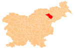
 Malo Tinje Location in Slovenia | |
| Coordinates: 46°24′50.66″N 15°29′30.65″E / 46.4140722°N 15.4918472°ECoordinates: 46°24′50.66″N 15°29′30.65″E / 46.4140722°N 15.4918472°E | |
| Country |
|
| Traditional region | Styria |
| Statistical region | Drava |
| Municipality | Slovenska Bistrica |
| Area | |
| • Total | 0.94 km2 (0.36 sq mi) |
| Elevation | 657.8 m (2,158.1 ft) |
| Population (2002) | |
| • Total | 72 |
| [1] | |
Malo Tinje (pronounced [ˈmaːlɔ ˈtiːnjɛ]) is a small village in the Pohorje Hills in the Municipality of Slovenska Bistrica in northeastern Slovenia. The area is part of the traditional region of Styria. It is now included with the rest of the municipality in the Drava Statistical Region.[2]
A small chapel in the settlement was built in 1931.[3]
References
External links
This article is issued from Wikipedia - version of the 3/25/2014. The text is available under the Creative Commons Attribution/Share Alike but additional terms may apply for the media files.