Križni Vrh, Slovenska Bistrica
| Križni Vrh | |
|---|---|
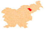
 Križni Vrh Location in Slovenia | |
| Coordinates: 46°21′3.47″N 15°34′35.45″E / 46.3509639°N 15.5765139°ECoordinates: 46°21′3.47″N 15°34′35.45″E / 46.3509639°N 15.5765139°E | |
| Country |
|
| Traditional region | Styria |
| Statistical region | Drava |
| Municipality | Slovenska Bistrica |
| Area | |
| • Total | 1.91 km2 (0.74 sq mi) |
| Elevation | 275.6 m (904.2 ft) |
| Population (2002) | |
| • Total | 297 |
| [1] | |
Križni Vrh (pronounced [ˈkɾiːʒni ˈʋəɾx]) is a settlement in the Municipality of Slovenska Bistrica in northeastern Slovenia. It lies on the main road south of Slovenska Bistrica towards Poljčane. The railway line from Ljubljana to Maribor runs along the western outskirts of the settlement. The area is part of the traditional region of Styria. It is now included with the rest of the municipality in the Drava Statistical Region.[2]
References
- ↑ Statistical Office of the Republic of Slovenia Archived November 18, 2008, at the Wayback Machine.
- ↑ Slovenska Bistrica municipal site
External links
This article is issued from Wikipedia - version of the 11/13/2016. The text is available under the Creative Commons Attribution/Share Alike but additional terms may apply for the media files.