Planina pod Šumikom
| Planina pod Šumikom | |
|---|---|
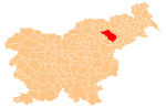
 Planina pod Šumikom Location in Slovenia | |
| Coordinates: 46°26′36.59″N 15°29′25.98″E / 46.4434972°N 15.4905500°ECoordinates: 46°26′36.59″N 15°29′25.98″E / 46.4434972°N 15.4905500°E | |
| Country |
|
| Traditional region | Styria |
| Statistical region | Drava |
| Municipality | Slovenska Bistrica |
| Area | |
| • Total | 23.31 km2 (9.00 sq mi) |
| Elevation | 843.5 m (2,767.4 ft) |
| Population (2002) | |
| • Total | 89 |
| [1] | |
Planina pod Šumikom (pronounced [plaˈniːna pɔt ʃuˈmiːkɔm]) is a dispersed settlement in the Pohorje Hills in the Municipality of Slovenska Bistrica in northeastern Slovenia. The area is part of the traditional region of Styria. It is now included with the rest of the municipality in the Drava Statistical Region.[2]
Name
The name of the settlement was changed from Planina to Planina pod Šumnikom in 1955.[3]
Church
The local church is dedicated to the Three Kings and belongs to the Parish of Tinje. It dates to the early 16th century.[4]
References
- ↑ Statistical Office of the Republic of Slovenia
- ↑ Slovenska Bistrica municipal site
- ↑ Spremembe naselij 1948–95. 1996. Database. Ljubljana: Geografski inštitut ZRC SAZU, DZS.
- ↑ Slovenian Ministry of Culture register of national heritage reference number ešd 3447
External links
This article is issued from Wikipedia - version of the 2/3/2014. The text is available under the Creative Commons Attribution/Share Alike but additional terms may apply for the media files.