Maple Valley, Washington
| City of Maple Valley, Washington | ||
|---|---|---|
| City | ||
|
The Maple Valley Library | ||
| ||
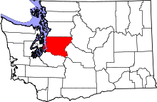
 Location of Maple Valley within King County, Washington, and King County within Washington. | ||
| Coordinates: 47°21′58″N 122°2′41″W / 47.36611°N 122.04472°WCoordinates: 47°21′58″N 122°2′41″W / 47.36611°N 122.04472°W | ||
| Country | United States | |
| State | Washington | |
| County | King | |
| Incorporated | 1997 | |
| Government | ||
| • Type |
Mayoral Mayor: Sean P. Kelly Deputy Mayor: Dana Parnello | |
| Area[1] | ||
| • Total | 5.90 sq mi (15.28 km2) | |
| • Land | 5.72 sq mi (14.81 km2) | |
| • Water | 0.18 sq mi (0.47 km2) | |
| Elevation | 343 ft (104.5 m) | |
| Population (2010)[2] | ||
| • Total | 22,684 | |
| • Estimate (2015)[3] | 25,686 | |
| • Density | 3,965.7/sq mi (1,531.2/km2) | |
| Time zone | Pacific (UTC-8) | |
| • Summer (DST) | Pacific (UTC-7) | |
| ZIP code | 98038 | |
| Area code(s) | 425 | |
| FIPS code | 53-43150 | |
| GNIS feature ID | 1506457[4] | |
| Website | www.maplevalleywa.gov | |

Maple Valley is a city in King County, Washington, United States. The population was 22,684 at the 2010 census. The population was 25,686 at the 2015 estimate.[3]
History
The area was settled in 1879 by three men who were improving a trail and brought their families in. When a name for a future community was proposed, the names Vine Maple Valley and Maple Ridge were suggested. A vote was taken by writing the names on slips of paper and placing them in a hat. Vine Maple Valley won by 2/3, but the word "Vine" was later cut by the post office because it made the name too long.
The town's early history mainly had to do with coal, lumber milling to build homes, and a railroad which ran through town. Coal was brought in from Black Diamond to the south, but the town itself also mined coal from Cedar Mountain. The mine was used as late as 1947. Rail workers for lines like the Northern Pacific Railroad and the Cedar River Watershed, closed off by the City of Seattle, meant more workers for those things. More residents meant more lumber milling. More lumber milling meant more workers. Suquamish tribe chairperson Martha George was born near Maple Valley in Sheridan in 1892, at a logging camp where her mother and grandmother worked as cooks."[5]
The town grew inward. Blacksmith shops, hotels, saloons and stores took up the town in the 1910s and 1920s. Schools went up as well. Early schools were shacks at best. A two-room school went up in 1910, but a larger school was quickly needed. Tahoma High School, a three-story brick building, went up in 1920. Students made up the name by combining the first two letters in the town names Taylor, Hobart and Maple Valley.[6] The school still serves the Tahoma School District as a middle school.
More residents meant farming and fishing became staples in the area, with milk, poultry and berry farming becoming the main grown food staples in the area. Fishing out of the Cedar River also became popular.
Maple Valley also saw resorts beginning in the 1920s. Lake Wilderness, once the site of a county lumber mill, quickly became a resort lake with the opening of Gaffney's Grove, which opened with a ballroom, restaurant and roller rink. Later, the resort grew to include an airstrip, lodge, rental cabins, a nine-hole golf course and a bowling alley. It remained in operation until 1964.
Increasing automobile use in the area gave rise to new roads being built. In the early 1960s, the construction of Washington State Route 18 between Auburn and North Bend ran through the city, requiring many landmarks to be either demolished or moved.
Recent
The city was officially incorporated on August 31, 1997. Today, the mostly residential city has shopping centers, gas stations, and housing. The Maple Valley Historical Society keeps records on the city's past, with two historical museums holding artifacts such as the city's first fire engine and photographs of old places in and around the city like Gaffney's Grove. The old Gaffney's Grove site is now a city park, and the Green to Cedar River trail runs through the city. The park includes a swimming beach, an arboretum and sprawling grass fields and sees the annual Maple Valley Days Parade each year in June. In 2011, Family Circle magazine reported that Maple Valley was one of the top ten family-oriented cities in the USA. Recently, the north side of Maple Valley has seen large growth, prompting major renovations to shopping centers in the area known as 'Four Corners'. This area houses restaurants, gas stations, and stores of all kinds, such as Fred Meyer, Safeway, Walgreens, Goodwill, among many others. Also in this area, construction on the new Tahoma High School has begun.
Geography
Maple Valley is located at 47°21′58″N 122°2′41″W / 47.36611°N 122.04472°W (47.366160, -122.044692).[7] According to the United States Census Bureau, the city has a total area of 5.90 square miles (15.28 km2), of which, 5.72 square miles (14.81 km2) is land and 0.18 square miles (0.47 km2) is water.[1]
The main bodies of water in the city limits are Lake Wilderness, Lake Lucerne, Rock Creek, and part of Pipe Lake. The Cedar River passes through unincorporated King County very near the northeastern border of the city.
Demographics
| Historical population | |||
|---|---|---|---|
| Census | Pop. | %± | |
| 1900 | 112 | — | |
| 1910 | 112 | 0.0% | |
| 1920 | 225 | 100.9% | |
| 1930 | 250 | 11.1% | |
| 1940 | 122 | −51.2% | |
| 1950 | 800 | 555.7% | |
| 1960 | 800 | 0.0% | |
| 1970 | 350 | −56.2% | |
| 1980 | 900 | 157.1% | |
| 1990 | 1,211 | 34.6% | |
| 2000 | 14,209 | 1,073.3% | |
| 2010 | 22,684 | 59.6% | |
| Est. 2015 | 25,686 | [8] | 13.2% |
| source:[9] 2015 Estimate[3] | |||
Based on per capita income, one of the more reliable measures of affluence, Maple Valley ranks 93rd of 522 areas in the state of Washington to be ranked.
2010 census
As of the census[2] of 2010, there were 22,684 people, 7,679 households, and 6,159 families residing in the city. The population density was 3,965.7 inhabitants per square mile (1,531.2/km2). There were 7,997 housing units at an average density of 1,398.1 per square mile (539.8/km2). The racial makeup of the city was 85.8% White, 2.1% African American, 0.5% Native American, 4.5% Asian, 0.4% Pacific Islander, 1.7% from other races, and 5.0% from two or more races. Hispanic or Latino of any race were 5.7% of the population.
There were 7,679 households of which 49.9% had children under the age of 18 living with them, 67.1% were married couples living together, 9.2% had a female householder with no husband present, 3.9% had a male householder with no wife present, and 19.8% were non-families. 15.0% of all households were made up of individuals and 5% had someone living alone who was 65 years of age or older. The average household size was 2.95 and the average family size was 3.30.
The median age in the city was 34.2 years. 32.3% of residents were under the age of 18; 5.9% were between the ages of 18 and 24; 31.8% were from 25 to 44; 23.3% were from 45 to 64; and 6.6% were 65 years of age or older. The gender makeup of the city was 49.4% male and 50.6% female.
2000 census
As of the census of 2000, there were 14,209 people, 4,809 households, and 3,952 families residing in the city. The population density was 2,617.9 inhabitants per square mile (1,010.3/km²). There were 4,922 housing units at an average density of 350.0 units/km² (906.8 units/mi²). The ethnic makeup of the city was 90.62% white, 1.11% African American, 0.66% Native American, 2.46% Asian, 0.15% Pacific Islander, 1.36% from other races, and 3.64% from two or more ethnic groups. Hispanic or Latino of any ethnic group were 3.56% of the population.
There were 4,809 households out of which 51.7% had children under the age of 18 living with them, 69.9% were married couples living together, 8.9% had a female householder with no husband present, and 17.8% were non-families. 13.6% of all households were made up of individuals and 3.2% had someone living alone who was 65 years of age or older. The average household size was 2.95 and the average family size was 3.26.
In the city the population was spread out with 33.8% under the age of 18, 5.4% between 19 and 24, 38.5% between 25 and 44, 17.8% between 45 and 64, and 4.5% who were 65 years of age or older. The median age was 32 years. For every 100 females there were 99.2 males. For every 100 females age 18 and over, there were 96.5 males.
The median income for a household in the city was $67,159, and the median income for a family was $70,008. Males had a median income of $50,623 versus $34,097 for females. The per capita income for the city was $24,859. About 2.1% of families and 2.6% of the population were below the poverty line, including 2.4% of those under age 18 and 3.7% of those age 65 and over.
Police department
Maple Valley is a contract city with the King County Sheriff's Office for police services. The King County deputies that are assigned to the city, wear city uniforms and patches but wear a King County Sheriff badge. The deputies mostly drive marked patrol cars with the city logo. There are currently ten patrol officers, three detectives, one traffic officer, one sergeant, three reserve officers, one civilian police assistant, and one chief assigned full-time to the city. The city has several active volunteers and approximately 15 youth police explorers.
Points of interest
- Wilderness Trail
- Cedar River
- Cedar River Trail
- Maple Valley Skate Park
- Lake Wilderness Park and golf course
- Lake Wilderness Arboretum
- Elk Run Golf Course, now closed
- Take a Break Park
Notable people
- Brandi Carlile, singer, hails from the area.
- Omare Lowe, who played football at the University of Washington and was drafted by the Miami Dolphins. He has had brief stints with Titans, Jets, Vikings, Redskins, and Patriots. In April 2008, he signed a 1-year contract with the Seahawks.
- Jens Pulver, the first Ultimate Fighting Championship lightweight champion and a coach on The Ultimate Fighter 5 reality show, attended and wrestled for Tahoma Senior High School in Maple Valley.
- Richard Sherman, Stanford graduate and cornerback for the Seattle Seahawks.
- Johnny Valentine, 2006 inductee in Professional Wrestling Hall of Fame, was born in Maple Valley.
References
- 1 2 "US Gazetteer files 2010". United States Census Bureau. Retrieved 2012-12-19.
- 1 2 "American FactFinder". United States Census Bureau. Retrieved 2012-12-19.
- 1 2 3 "Population Estimates". United States Census Bureau. Retrieved June 17, 2016.
- ↑ "Maple Valley". Geographic Names Information System. United States Geological Survey.
- ↑ "Notable Native American Women". Retrieved 2013-04-20.
- ↑ http://www.tahomasd.us/pages/Tahoma_School_District_409/About_Us/District_Overview
- ↑ "US Gazetteer files: 2010, 2000, and 1990". United States Census Bureau. 2011-02-12. Retrieved 2011-04-23.
- ↑ "Annual Estimates of the Resident Population for Incorporated Places: April 1, 2010 to July 1, 2015". Retrieved July 2, 2016.
- ↑ Moffatt, Riley. Population History of Western U.S. Cities & Towns, 1850-1990. Lanham: Scarecrow, 1996, 326.
- ↑ "U.S. Decennial Census". Census.gov. Retrieved June 7, 2013.
External links
| Wikimedia Commons has media related to Maple Valley, Washington. |
Municipalities and communities of King County, Washington, United States | ||
|---|---|---|
| Cities |
|  |
| Towns | ||
| CDPs |
| |
| Unincorporated communities | ||
| Indian reservation | ||
| Ghost towns | ||
| Footnotes | ‡This populated place also has portions in an adjacent county or counties | |