Tanner, Washington
| Tanner, Washington | |
|---|---|
| Census-designated place | |
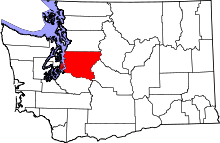
 Location of Tanner, Washington | |
| Coordinates: 47°28′43″N 121°44′45″W / 47.47861°N 121.74583°WCoordinates: 47°28′43″N 121°44′45″W / 47.47861°N 121.74583°W | |
| Country | United States |
| State | Washington |
| County | King |
| Area | |
| • Total | 4.1 sq mi (10.5 km2) |
| • Land | 3.9 sq mi (10.0 km2) |
| • Water | 0.2 sq mi (0.5 km2) |
| Elevation | 522 ft (159 m) |
| Population (2010) | |
| • Total | 1,018 |
| • Density | 264/sq mi (102.0/km2) |
| Time zone | Pacific (PST) (UTC-8) |
| • Summer (DST) | PDT (UTC-7) |
| FIPS code | 53-70315[1] |
| GNIS feature ID | 1526933[2] |
Tanner is a census-designated place (CDP) in east King County, Washington, United States. As of the 2010 census, it had a population of 1,018.[3]
Tanner ranks 46th out of 522 communities in the state of Washington for per capita income.
Geography
Tanner is located at 47°28′43″N 121°44′45″W / 47.47861°N 121.74583°W (47.478658, -121.745715).[4]
According to the United States Census Bureau, the CDP has a total area of 4.1 square miles (10.5 km2), of which 3.9 square miles (10.0 km2) is land and 0.19 square miles (0.5 km2), or 4.51%, is water.[3]
Going East on Interstate Highway I-90, Tanner is located just East of North Bend off of exit 32 on the North side of I-90, at the base of Mount Si. Tanner is surrounded by miles of hiking trails located in Washington State Forest Reserves. The most popular hiking trail located in the Tanner area is the Mount Si Trail.[5] The Mount Si Trail[5] is hiked by more than 100,000 people each year making Tanner a popular destination for day hikes up to the summit of Mount Si. There are other popular hiking trails located around the Tanner area including the Little Si Trail,[6] Kamikaze/Teneriffe Falls,[7] and the Mailbox Peak Trail.[8]
Demographics
As of the census[1] of 2000, there were 2,966 people, 1,055 households, and 835 families residing in the CDP. The population density was 489.0 people per square mile (188.7/km²). There were 1,087 housing units at an average density of 179.2/sq mi (69.1/km²). The racial makeup of the CDP was 94.10% White, 0.37% African American, 0.98% Native American, 1.21% Asian, 0.13% Pacific Islander, 0.84% from other races, and 2.36% from two or more races. Hispanic or Latino of any race were 2.29% of the population.
There were 1,055 households out of which 41.8% had children under the age of 18 living with them, 69.1% were married couples living together, 7.3% had a female householder with no husband present, and 20.8% were non-families. 14.8% of all households were made up of individuals and 2.2% had someone living alone who was 65 years of age or older. The average household size was 2.81 and the average family size was 3.12.
In the CDP the population was spread out with 29.3% under the age of 18, 5.9% from 18 to 24, 33.5% from 25 to 44, 25.7% from 45 to 64, and 5.6% who were 65 years of age or older. The median age was 36 years. For every 100 females there were 105.8 males. For every 100 females age 18 and over, there were 102.9 males.
The median income for a household in the CDP was $73,105, and the median income for a family was $78,021. Males had a median income of $52,140 versus $31,923 for females. The per capita income for the CDP was $28,604. About 1.5% of families and 4.5% of the population were below the poverty line, including 1.1% of those under age 18 and 24.3% of those age 65 or over.
References
- 1 2 "American FactFinder". United States Census Bureau. Retrieved 2008-01-31.
- ↑ "Tanner". Geographic Names Information System. United States Geological Survey.
- 1 2 "Geographic Identifiers: 2010 Demographic Profile Data (G001): Tanner CDP, Washington". U.S. Census Bureau, American Factfinder. Retrieved April 2, 2013.
- ↑ "US Gazetteer files: 2010, 2000, and 1990". United States Census Bureau. 2011-02-12. Retrieved 2011-04-23.
- 1 2 "Mount Si — Washington Trails Association". www.wta.org. Retrieved 2015-10-06.
- ↑ "Little Si Trail". AllTrails.com. Retrieved 2015-10-06.
- ↑ "Kamikaze/Teneriffe Falls". AllTrails.com. Retrieved 2015-10-06.
- ↑ "Mailbox Peak Trail". AllTrails.com. Retrieved 2015-10-06.
Municipalities and communities of King County, Washington, United States | ||
|---|---|---|
| Cities |
|  |
| Towns | ||
| CDPs |
| |
| Unincorporated communities | ||
| Indian reservation | ||
| Ghost towns | ||
| Footnotes | ‡This populated place also has portions in an adjacent county or counties | |