Mathiatis
| Mathiatis | |
|---|---|
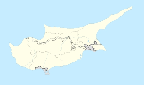 Mathiatis Location in Cyprus | |
| Coordinates: 34°57′46″N 33°20′10″E / 34.96278°N 33.33611°ECoordinates: 34°57′46″N 33°20′10″E / 34.96278°N 33.33611°E | |
| Country |
|
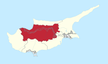
| District | Nicosia District |
| Population (2011)[1] | |
| • Total | 646 |
| Time zone | EET (UTC+2) |
| • Summer (DST) | EEST (UTC+3) |
Mathiatis (Greek: Μαθιάτης [locally [maˈθcatis]]; Turkish: Matiyat) is village located in the Nicosia District of Cyprus. Before 1960, it had a mixed Greek- and Turkish-Cypriot population.[2]
References
- ↑ "C1. POPULATION ENUMERATED BY SEX, AGE, DISTRICT, MUNICIPALITY/COMMUNITY AND QUARTER (1.10.2011)", Population - Place of Residence, 2011, Statistical Service of the Republic of Cyprus, 2014-04-17, retrieved 2014-04-20
- ↑ http://www.kypros-cyprus.com/maps/1960.jpg
This article is issued from Wikipedia - version of the 10/20/2014. The text is available under the Creative Commons Attribution/Share Alike but additional terms may apply for the media files.