Matthews, Missouri
| Matthews, Missouri | |
|---|---|
| City | |
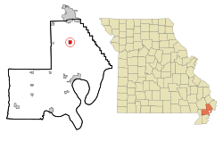 Location of Matthews, Missouri | |
| Coordinates: 36°45′28″N 89°35′12″W / 36.75778°N 89.58667°WCoordinates: 36°45′28″N 89°35′12″W / 36.75778°N 89.58667°W | |
| Country | United States |
| State | Missouri |
| County | New Madrid |
| Area[1] | |
| • Total | 1.96 sq mi (5.08 km2) |
| • Land | 1.96 sq mi (5.08 km2) |
| • Water | 0 sq mi (0 km2) |
| Elevation | 312 ft (95 m) |
| Population (2010)[2] | |
| • Total | 628 |
| • Estimate (2012[3]) | 639 |
| • Density | 320.4/sq mi (123.7/km2) |
| Time zone | Central (CST) (UTC-6) |
| • Summer (DST) | CDT (UTC-5) |
| ZIP code | 63867 |
| Area code(s) | 573 |
| FIPS code | 29-46730[4] |
| GNIS feature ID | 0721977[5] |
Matthews is a city in New Madrid County, Missouri, United States. The population was 628 at the 2010 census.
History
A post office called Matthews has been in operation since 1903.[6] The community has the name of C. D. Matthews, a pioneer citizen.[7]
Geography
Matthews is located at 36°45′28″N 89°35′12″W / 36.75778°N 89.58667°W (36.757706, -89.586662).[8]
According to the United States Census Bureau, the city has a total area of 1.96 square miles (5.08 km2), all of it land.[1]
Demographics
| Historical population | |||
|---|---|---|---|
| Census | Pop. | %± | |
| 1910 | 237 | — | |
| 1920 | 378 | 59.5% | |
| 1930 | 359 | −5.0% | |
| 1940 | 448 | 24.8% | |
| 1950 | 498 | 11.2% | |
| 1960 | 450 | −9.6% | |
| 1970 | 538 | 19.6% | |
| 1980 | 547 | 1.7% | |
| 1990 | 614 | 12.2% | |
| 2000 | 605 | −1.5% | |
| 2010 | 628 | 3.8% | |
| Est. 2015 | 628 | [9] | 0.0% |
2010 census
As of the census[2] of 2010, there were 628 people, 247 households, and 158 families residing in the city. The population density was 320.4 inhabitants per square mile (123.7/km2). There were 267 housing units at an average density of 136.2 per square mile (52.6/km2). The racial makeup of the city was 97.13% White, 1.91% Black or African American, 0.48% Native American, 0.16% from other races, and 0.32% from two or more races. Hispanic or Latino of any race were 0.32% of the population.
There were 247 households of which 26.7% had children under the age of 18 living with them, 47.4% were married couples living together, 13.0% had a female householder with no husband present, 3.6% had a male householder with no wife present, and 36.0% were non-families. 31.2% of all households were made up of individuals and 14.5% had someone living alone who was 65 years of age or older. The average household size was 2.26 and the average family size was 2.77.
The median age in the city was 48.8 years. 16.7% of residents were under the age of 18; 6.1% were between the ages of 18 and 24; 23.3% were from 25 to 44; 32.7% were from 45 to 64; and 21% were 65 years of age or older. The gender makeup of the city was 46.0% male and 54.0% female.
2000 census
As of the census[4] of 2000, there were 605 people, 252 households, and 179 families residing in the city. The population density was 548.6 people per square mile (212.4/km²). There were 278 housing units at an average density of 252.1 per square mile (97.6/km²). The racial makeup of the city was 97.85% White, 0.17% African American, 0.33% Native American, 0.99% from other races, and 0.66% from two or more races. Hispanic or Latino of any race were 1.49% of the population.
There were 252 households out of which 32.9% had children under the age of 18 living with them, 56.0% were married couples living together, 11.9% had a female householder with no husband present, and 28.6% were non-families. 27.0% of all households were made up of individuals and 14.3% had someone living alone who was 65 years of age or older. The average household size was 2.38 and the average family size was 2.85.
In the city the population was spread out with 26.4% under the age of 18, 7.4% from 18 to 24, 27.3% from 25 to 44, 22.8% from 45 to 64, and 16.0% who were 65 years of age or older. The median age was 40 years. For every 100 females there were 92.1 males. For every 100 females age 18 and over, there were 90.2 males.
The median income for a household in the city was $28,083, and the median income for a family was $30,655. Males had a median income of $27,500 versus $15,417 for females. The per capita income for the city was $13,426. About 7.8% of families and 9.1% of the population were below the poverty line, including 12.3% of those under age 18 and 8.2% of those age 65 or over.
Notable person
The former actor Conlan Carter, who appeared on the television series The Law and Mr. Jones with James Whitmore and Combat! with Rick Jason and Vic Morrow, both on ABC, was reared in Matthews. He was the 1952 Missouri champion pole vaulter.
References
- 1 2 "US Gazetteer files 2010". United States Census Bureau. Retrieved 2012-07-08.
- 1 2 "American FactFinder". United States Census Bureau. Retrieved 2012-07-08.
- ↑ "Population Estimates". United States Census Bureau. Retrieved 2013-05-30.
- 1 2 "American FactFinder". United States Census Bureau. Retrieved 2008-01-31.
- ↑ "US Board on Geographic Names". United States Geological Survey. 2007-10-25. Retrieved 2008-01-31.
- ↑ "Post Offices". Jim Forte Postal History. Retrieved 19 November 2016.
- ↑ "New Madrid County Place Names, 1928–1945". The State Historical Society of Missouri. Archived from the original on June 24, 2016. Retrieved November 19, 2016.
- ↑ "US Gazetteer files: 2010, 2000, and 1990". United States Census Bureau. 2011-02-12. Retrieved 2011-04-23.
- ↑ "Annual Estimates of the Resident Population for Incorporated Places: April 1, 2010 to July 1, 2015". Retrieved July 2, 2016.
- ↑ "Census of Population and Housing". Census.gov. Retrieved June 4, 2015.
Municipalities and communities of New Madrid County, Missouri, United States | ||
|---|---|---|
| Cities | 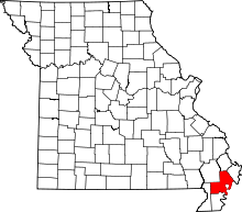 | |
| Village | ||
| Townships |
| |
| Unincorporated communities | ||
| Ghost towns | ||
| Footnotes | ‡This populated place also has portions in an adjacent county or counties | |