Tallapoosa, Missouri
| Tallapoosa, Missouri | |
|---|---|
| City | |
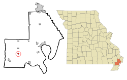 Location of Tallapoosa, Missouri | |
| Coordinates: 36°30′27″N 89°49′8″W / 36.50750°N 89.81889°WCoordinates: 36°30′27″N 89°49′8″W / 36.50750°N 89.81889°W | |
| Country | United States |
| State | Missouri |
| County | New Madrid |
| Area[1] | |
| • Total | 0.45 sq mi (1.17 km2) |
| • Land | 0.45 sq mi (1.17 km2) |
| • Water | 0 sq mi (0 km2) |
| Elevation | 272 ft (83 m) |
| Population (2010)[2] | |
| • Total | 168 |
| • Estimate (2012[3]) | 164 |
| • Density | 373.3/sq mi (144.1/km2) |
| Time zone | Central (CST) (UTC-6) |
| • Summer (DST) | CDT (UTC-5) |
| ZIP code | 63878 |
| Area code(s) | 573 |
| FIPS code | 29-72196[4] |
| GNIS feature ID | 0727441[5] |
Tallapoosa is a city in New Madrid County, Missouri, United States. The population was 168 at the 2010 census.
History
Tallapoosa was laid out in 1902.[6] The town was named after Tallapoosa County, Alabama.[7] A post office called Tallapoosa has been in operation since 1915.[8]
Geography
Tallapoosa is located at 36°30′27″N 89°49′8″W / 36.50750°N 89.81889°W (36.507559, -89.818775).[9]
According to the United States Census Bureau, the city has a total area of 0.45 square miles (1.17 km2), all of it land.[1]
Demographics
| Historical population | |||
|---|---|---|---|
| Census | Pop. | %± | |
| 1930 | 154 | — | |
| 1970 | 205 | — | |
| 1980 | 197 | −3.9% | |
| 1990 | 174 | −11.7% | |
| 2000 | 204 | 17.2% | |
| 2010 | 168 | −17.6% | |
| Est. 2015 | 161 | [10] | −4.2% |
2010 census
At the 2010 census,[2] there were 168 people, 68 households and 45 families residing in the city. The population density was 373.3 inhabitants per square mile (144.1/km2). There were 77 housing units at an average density of 171.1 per square mile (66.1/km2). The racial makeup of the city was 97.62% White, 1.79% Native American, and 0.60% from two or more races. Hispanic or Latino of any race were 2.38% of the population.
There were 68 households of which 30.9% had children under the age of 18 living with them, 36.8% were married couples living together, 20.6% had a female householder with no husband present, 8.8% had a male householder with no wife present, and 33.8% were non-families. 32.4% of all households were made up of individuals and 14.7% had someone living alone who was 65 years of age or older. The average household size was 2.47 and the average family size was 2.98.
The median age in the city was 39 years. 22% of residents were under the age of 18; 12.5% were between the ages of 18 and 24; 23.8% were from 25 to 44; 27.4% were from 45 to 64; and 14.3% were 65 years of age or older. The gender makeup of the city was 56.0% male and 44.0% female.
2000 census
A the 2000 census,[4] there were 204 people, 73 households and 54 families residing in the city. The population density was 477.7 per square mile (183.2/km²). There were 88 housing units at an average density of 206.1 per square mile (79.0/km²). The racial makeup of the city was 95.10% White, 1.47% Native American, and 3.43% from two or more races.
There were 73 households of which 37.0% had children under the age of 18 living with them, 49.3% were married couples living together, 17.8% had a female householder with no husband present, and 24.7% were non-families. 19.2% of all households were made up of individuals and 9.6% had someone living alone who was 65 years of age or older. The average household size was 2.79 and the average family size was 3.22.
32.4% of the population were under the age of 18, 9.3% from 18 to 24, 26.5% from 25 to 44, 18.1% from 45 to 64, and 13.7% who were 65 years of age or older. The median age was 31 years. For every 100 females there were 129.2 males. For every 100 females age 18 and over, there were 94.4 males.
The median household income was $14,375 and the median family income was $15,000. Males had a median income of $11,875 compared with $15,000 for females. The per capita income for the city was $6,377. About 42.6% of families and 48.4% of the population were below the poverty line, including 50.9% of those under the age of eighteen and 18.2% of those sixty five or over.
References
- 1 2 "US Gazetteer files 2010". United States Census Bureau. Retrieved 2012-07-08.
- 1 2 "American FactFinder". United States Census Bureau. Retrieved 2012-07-08.
- ↑ "Population Estimates". United States Census Bureau. Retrieved 2013-05-30.
- 1 2 "American FactFinder". United States Census Bureau. Retrieved 2008-01-31.
- ↑ "US Board on Geographic Names". United States Geological Survey. 2007-10-25. Retrieved 2008-01-31.
- ↑ "New Madrid County Place Names, 1928–1945". The State Historical Society of Missouri. Archived from the original on June 24, 2016. Retrieved November 19, 2016.
- ↑ Ramsay, Robert L. (1952). Our Storehouse of Missouri Place Names. University of Missouri Press. p. 24.
- ↑ "Post Offices". Jim Forte Postal History. Retrieved 19 November 2016.
- ↑ "US Gazetteer files: 2010, 2000, and 1990". United States Census Bureau. 2011-02-12. Retrieved 2011-04-23.
- ↑ "Annual Estimates of the Resident Population for Incorporated Places: April 1, 2010 to July 1, 2015". Retrieved July 2, 2016.
- ↑ "Census of Population and Housing". Census.gov. Retrieved June 4, 2015.
Municipalities and communities of New Madrid County, Missouri, United States | ||
|---|---|---|
| Cities | 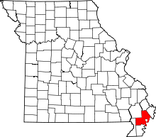 | |
| Village | ||
| Townships |
| |
| Unincorporated communities | ||
| Ghost towns | ||
| Footnotes | ‡This populated place also has portions in an adjacent county or counties | |