Mayfield Heights, Ohio
| Mayfield Heights, Ohio | |
|---|---|
| City | |
|
Hillcrest Hospital Front | |
| Motto: "A Vibrant Community" | |
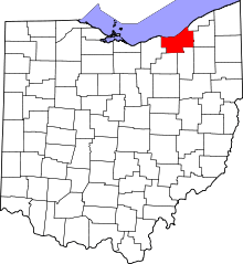
 Location in Cuyahoga County and the state of Ohio. | |
.svg.png) Location of Ohio in the United States | |
| Coordinates: 41°31′3″N 81°27′21″W / 41.51750°N 81.45583°WCoordinates: 41°31′3″N 81°27′21″W / 41.51750°N 81.45583°W | |
| Country | United States |
| State | Ohio |
| County | Cuyahoga |
| Founded | 1920 |
| Incorporated | 1950 |
| Government | |
| • Mayor | Anthony DiCicco (R)[1][2] |
| Area[3] | |
| • Total | 4.18 sq mi (10.83 km2) |
| • Land | 4.17 sq mi (10.80 km2) |
| • Water | 0.01 sq mi (0.03 km2) |
| Elevation | 1,089 ft (329 m) |
| Population (2010)[4] | |
| • Total | 19,155 |
| • Estimate (2012[5]) | 18,974 |
| • Density | 4,593.5/sq mi (1,773.6/km2) |
| Time zone | EST (UTC-5) |
| • Summer (DST) | EDT (UTC-4) |
| Zip code | 44124 and 44143 |
| Area code(s) | 440 |
| FIPS code | 39-48482[6] |
| GNIS feature ID | 1056413[7] |
| Website |
www |

Mayfield Heights is a city in Cuyahoga County, Ohio, United States, and is an east-side suburb of Cleveland. The population was 18,827 at the 2010 census.
History
Mayfield Heights was initially built up as a streetcar suburb.[8] It was incorporated as a village in 1925 and as a city in 1951.[9] The city derives its name from Mayfield Township, now defunct.[10] One location in the city, the W.A. Thorp House, was listed on the National Register of Historic Places in 1978.[11]
Geography
Mayfield Heights is located at 41°31′03″N 81°27′21″W / 41.517402°N 81.455889°W.[12]
According to the United States Census Bureau, the city has a total area of 4.18 square miles (10.83 km2), of which 4.17 square miles (10.80 km2) is land and 0.01 square miles (0.03 km2) is water.[3]
Demographics
| Historical population | |||
|---|---|---|---|
| Census | Pop. | %± | |
| 1930 | 2,612 | — | |
| 1940 | 2,696 | 3.2% | |
| 1950 | 5,807 | 115.4% | |
| 1960 | 13,478 | 132.1% | |
| 1970 | 22,139 | 64.3% | |
| 1980 | 21,550 | −2.7% | |
| 1990 | 19,847 | −7.9% | |
| 2000 | 19,386 | −2.3% | |
| 2010 | 19,155 | −1.2% | |
| Est. 2015 | 18,840 | [13] | −1.6% |
| Sources:[6][14][15][16] | |||
23.9% were of Italian, 14.5% German, 11.9% Irish, 7.4% Polish, 6.8% Russian, and 6.4% English ancestries.[17]
Languages
81.0% spoke English, 7.11% Russian, 4.10% Italian, and 1.03% Arabic as their first language.[18]
2010 census
As of the census[4] of 2010, there were 19,155 people, 9,662 households, and 4,884 families residing in the city. The population density was 4,593.5 inhabitants per square mile (1,773.6/km2). There were 10,538 housing units at an average density of 2,527.1 per square mile (975.7/km2). The racial makeup of the city was 80.4% White, 10.3% African American, 0.1% Native American, 7.0% Asian, 0.5% from other races, and 1.7% from two or more races. Hispanic or Latino of any race were 2.0% of the population.
There were 9,662 households of which 21.2% had children under the age of 18 living with them, 36.0% were married couples living together, 11.2% had a female householder with no husband present, 3.3% had a male householder with no wife present, and 49.5% were non-families. 44.2% of all households were made up of individuals and 20.5% had someone living alone who was 65 years of age or older. The average household size was 1.97 and the average family size was 2.75.
The median age in the city was 42.9 years. 17.6% of residents were under the age of 18; 7.2% were between the ages of 18 and 24; 27.6% were from 25 to 44; 23.9% were from 45 to 64; and 23.8% were 65 years of age or older. The gender makeup of the city was 45.3% male and 54.7% female.
Of the city's population over the age of 25, 38.3% hold a bachelor's degree or higher.[19]
2000 census
As of the census[6] of 2000, there were 19,386 people, 9,848 households, and 5,042 families residing in the city. The population density was 4,596.1 people per square mile (1,773.7/km2). There were 10,461 housing units at an average density of 2,480.1 per square mile (957.1/km2). The racial makeup of the city was 91.85% White, 2.98% African American, 0.03% Native American, 4.03% Asian, 0.01% Pacific Islander, 0.18% from other races, and 0.93% from two or more races. Hispanic or Latino of any race were 1.04% of the population.
There were 9,848 households out of which 17.9% had children under the age of 18 living with them, 40.1% were married couples living together, 8.2% had a female householder with no husband present, and 48.8% were non-families. 44.5% of all households were made up of individuals and 22.5% had someone living alone who was 65 years of age or older. The average household size was 1.95 and the average family size was 2.75.
In the city the population was spread out with 16.1% under the age of 18, 6.6% from 18 to 24, 28.9% from 25 to 44, 20.8% from 45 to 64, and 27.6% who were 65 years of age or older. The median age was 44 years. For every 100 females there were 82.2 males. For every 100 females age 18 and over, there were 78.9 males.
The median income for a household in the city was $37,236, and the median income for a family was $51,132. Males had a median income of $37,358 versus $29,118 for females. The per capita income for the city was $24,392. About 4.6% of families and 6.3% of the population were below the poverty line, including 6.3% of those under age 18 and 9.1% of those age 65 or over.
Schools
Mayfield Heights is a part of the Mayfield City School District, along with Highland Heights, Mayfield Village, and Gates Mills.
Notable person
- Birthplace of Matt Prater, American football placekicker for the Detroit Lions of the National Football League.
Surrounding communities
 |
Highland Heights | Mayfield | | |
| Lyndhurst | |
Gates Mills | ||
| ||||
| | ||||
| Pepper Pike | Hunting Valley |
References
- ↑ Exner, Rich (16 November 2013). "Democrats outnumber Republicans as mayors in Cuyahoga County, 39-14". Cleveland.com. Retrieved 31 January 2016.
- ↑ "Anthony DiCicco is new Mayfield Heights mayor". Retrieved 5 September 2016.
- 1 2 "US Gazetteer files 2010". United States Census Bureau. Archived from the original on July 14, 2012. Retrieved 2013-01-06.
- 1 2 "American FactFinder". United States Census Bureau. Retrieved 2013-01-06.
- ↑ "Population Estimates". United States Census Bureau. Archived from the original on June 17, 2013. Retrieved 2013-06-17.
- 1 2 3 "American FactFinder". United States Census Bureau. Archived from the original on September 11, 2013. Retrieved 2008-01-31.
- ↑ "US Board on Geographic Names". United States Geological Survey. 2007-10-25. Retrieved 2008-01-31.
- ↑ Morton, Marian J. (2005). Cleveland Heights. Arcadia Publishing. p. 7.
- ↑ "History". City of Mayfield Heights. Retrieved 4 April 2014.
- ↑ Overman, William Daniel (1958). Ohio Town Names. Akron, OH: Atlantic Press. p. 85.
- ↑ National Park Service (2010-07-09). "National Register Information System". National Register of Historic Places. National Park Service.
- ↑ "US Gazetteer files: 2010, 2000, and 1990". United States Census Bureau. 2011-02-12. Retrieved 2011-04-23.
- ↑ "Annual Estimates of the Resident Population for Incorporated Places: April 1, 2010 to July 1, 2015". Retrieved July 2, 2016.
- ↑ "Number of Inhabitants: Ohio" (PDF). 18th Census of the United States. U.S. Census Bureau. Retrieved 22 November 2013.
- ↑ "Ohio: Population and Housing Unit Counts" (PDF). U.S. Census Bureau. Retrieved 22 November 2013.
- ↑ "Incorporated Places and Minor Civil Divisions Datasets: Subcounty Population Estimates: April 1, 2010 to July 1, 2012". U.S. Census Bureau. Archived from the original on June 17, 2013. Retrieved 25 November 2013.
- ↑ http://factfinder2.census.gov/faces/tableservices/jsf/pages/productview.xhtml?pid=ACS_11_5YR_DP02&prodType=table
- ↑ "Archived copy". Retrieved August 10, 2013.
- ↑ "Population estimates, July 1, 2015, (V2015)". Retrieved 5 September 2016.
External links
| Wikimedia Commons has media related to Mayfield Heights, Ohio. |
Municipalities and communities of Cuyahoga County, Ohio, United States | ||
|---|---|---|
| Cities |
|  |
| Villages | ||
| Townships | ||
| Footnotes | ‡This populated place also has portions in an adjacent county or counties | |