Pepper Pike, Ohio
| Pepper Pike, Ohio | |
|---|---|
| City | |
|
Pepper Pike | |
| Motto: "A Great Place to Live and Work" | |
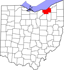
 Location in Cuyahoga County and the state of Ohio. | |
.svg.png) Location of Ohio in the United States | |
| Coordinates: 41°28′37″N 81°28′8″W / 41.47694°N 81.46889°WCoordinates: 41°28′37″N 81°28′8″W / 41.47694°N 81.46889°W | |
| Country | United States |
| State | Ohio |
| County | Cuyahoga |
| Government | |
| • Mayor | Richard Bain (D)[1] |
| Area[2] | |
| • Total | 7.09 sq mi (18.36 km2) |
| • Land | 7.06 sq mi (18.29 km2) |
| • Water | 0.03 sq mi (0.08 km2) |
| Elevation[3] | 1,060 ft (323 m) |
| Population (2010)[4] | |
| • Total | 5,979 |
| • Estimate (2012[5]) | 6,040 |
| • Density | 846.9/sq mi (327.0/km2) |
| Time zone | Eastern (EST) (UTC-5) |
| • Summer (DST) | EDT (UTC-4) |
| ZIP codes | 44122, 44124 |
| Area code(s) | 216 |
| FIPS code | 39-61686[6] |
| GNIS feature ID | 1044373[3] |
| Website | http://www.pepperpike.org/ |

Pepper Pike is a city in Cuyahoga County, Ohio, United States and is an affluent suburb of Cleveland. The population was 5,979 at the 2010 census.
History
In 1763, sixteen pioneers settled the area along the eastern border of present-day Cuyahoga County. In 1763, Orange Township was established, which included the present municipalities of Pepper Pike, Hunting Valley, Moreland Hills, Orange Village and Woodmere. Orange Township was the birthplace of President James A. Garfield in 1831. By the late 1880s, dairy farming and cheese production became the primary industry of the township.[7] In 1924, residents of the northwestern quadrant of Orange Township voted to separate, and the village of Pepper Pike was incorporated. The name "Pepper Pike" was selected after the Pepper family, who lived and worked along the primary transportation corridor (i.e., turnpike). Incorporated as a city in 1970, Pepper Pike operates under the mayor-council form of government. In the late 2000s, it was chosen as one of the top seven strangest city names by the World Book of Facts. [8]
Geography
Pepper Pike is located at 41°28′37″N 81°28′8″W / 41.47694°N 81.46889°W (41.476836, -81.468975) in the eastern section of Cuyahoga County.[9]
According to the United States Census Bureau, the city has a total area of 7.09 square miles (18.36 km2), of which 7.06 square miles (18.29 km2) is land and 0.03 square miles (0.08 km2) is water.[2]
Demographics
| Historical population | |||
|---|---|---|---|
| Census | Pop. | %± | |
| 1930 | 219 | — | |
| 1940 | 423 | 93.2% | |
| 1950 | 874 | 106.6% | |
| 1960 | 3,217 | 268.1% | |
| 1970 | 5,382 | 67.3% | |
| 1980 | 6,177 | 14.8% | |
| 1990 | 6,185 | 0.1% | |
| 2000 | 6,040 | −2.3% | |
| 2010 | 5,979 | −1.0% | |
| Est. 2015 | 6,204 | [10] | 3.8% |
| Sources:[6][11][12][13][14][15][16][17] | |||
The median income for a household in the city was $149,631, and the median income for a family was $166,765. The per capita income for the city was $68,984. About 3.1% of the total population were below the poverty line. Of the city's population over the age of 25, 69.7% held a bachelor's degree or higher.[18][19]
2010 census
As of the census[4] of 2010, there were 5,979 people, 2,176 households, and 1,753 families residing in the city. The population density was 846.9 inhabitants per square mile (327.0/km2). There were 2,349 housing units at an average density of 332.7 per square mile (128.5/km2). The racial makeup of the city was 86.3% White, 6.5% African American, 0.2% Native American, 5.5% Asian, 0.1% from other races, and 1.6% from two or more races. Hispanic or Latino of any race were 1.4% of the population.
There were 2,176 households of which 31.3% had children under the age of 18 living with them, 73.5% were married couples living together, 5.7% had a female householder with no husband present, 1.4% had a male householder with no wife present, and 19.4% were non-families. 16.8% of all households were made up of individuals and 9.4% had someone living alone who was 65 years of age or older. The average household size was 2.59 and the average family size was 2.91.
The median age in the city was 49.2 years. 23.6% of residents were under the age of 18; 6.4% were between the ages of 18 and 24; 14.1% were from 25 to 44; 32.5% were from 45 to 64; and 23.4% were 65 years of age or older. The gender makeup of the city was 46.5% male and 53.5% female.
2000 census
In 2000, there were 1,000 households out of which 32.0% had children under the age of 18 living with them, 78.3% were married couples living together, 5.0% had a female householder with no husband present, and 15.7% were non-families. 14.0% of all households were made up of individuals. The average household size was 2.62 and the average family size was 2.88.
In the city the population was spread out with 23.6% under the age of 18, 4.8% from 18 to 24, 16.7% from 25 to 44, 34.5% from 45 to 64, and 20.3% who were 65 years of age or older. The median age was 48 years. For every 100 females there were 91.6 males. For every 100 females age 18 and over, there were 84.5 males.
Pepper Pike's Israeli community had the twenty fifth highest percentage of residents, which was at 1.4% (tied with Plainview, NY.)[20]
Education
Pepper Pike is served by the Orange City School System which is well known as an exceptional public school system. For many decades, it has ranked among the best public school systems in the State of Ohio and throughout the U.S.
Ursuline College is located in Pepper Pike.
The Japanese Language School of Cleveland (JLSC; クリーブランド日本語補習校 Kurīburando Nihongo Hoshūkō), a part-time Japanese school, holds its classes at the Lillian and Betty Ratner School in Pepper Pike.[21][22]
Cemeteries
- Orange Cemetery, Lander Circle & Chagrin Blvd.
Notable people
- Matt Dery, radio personality
- Vincent Marotta, entrepreneur, co-creator of Mr. Coffee[23]
- Mark Rosewater, head designer of Magic the Gathering
- Tara Seibel, artist and graphic novelist, best known for being the last cartoonist to work with Harvey Pekar, creator of American Splendor
- George Stephanopoulos, ephanopoulos rose to early prominence as a communications director for the 1992 U.S. presidential campaign of Bill Clinton,[1] subsequently becoming White House Communications Director, then Senior Advisor for Policy and Strategy before departing in December 1996. Today he is chief anchor[2] and chief political correspondent for ABC News, co-anchor of ABC News' Good Morning America, and host of ABC's Sunday morning This Week.[3] He is also a member of the Council on Foreign Relations.[4] Stephanopoulos is also a common fill-in anchor for ABC World News Tonight with David Muir.
- Seth Taft, grandson of President William Howard Taft
- JD Samson, musician, producer, songwriter and DJ best known as a member of the bands Le Tigre and MEN.
Surrounding communities
 |
Lyndhurst | Mayfield Heights | Gates Mills | |
| Beachwood | |
Hunting Valley | ||
| ||||
| | ||||
| Orange | Woodmere | Moreland Hills |
References
- ↑ Exner, Rich (16 November 2013). "Democrats outnumber Republicans as mayors in Cuyahoga County, 39-14". Cleveland.com. Retrieved 31 January 2016.
- 1 2 "US Gazetteer files 2010". United States Census Bureau. Retrieved 2013-01-06.
- 1 2 "US Board on Geographic Names". United States Geological Survey. 2007-10-25. Retrieved 2008-01-31.
- 1 2 "American FactFinder". United States Census Bureau. Retrieved 2013-01-06.
- ↑ "Population Estimates". United States Census Bureau. Archived from the original on 2013-06-17. Retrieved 2013-06-17.
- 1 2 "American FactFinder". United States Census Bureau. Archived from the original on 2013-09-11. Retrieved 2008-01-31.
- ↑ "History". pepperpike.org.
- ↑ "Yahoo". Yahoo. Archived from the original on April 29, 2014.
- ↑ "US Gazetteer files: 2010, 2000, and 1990". United States Census Bureau. 2011-02-12. Retrieved 2011-04-23.
- ↑ "Annual Estimates of the Resident Population for Incorporated Places: April 1, 2010 to July 1, 2015". Retrieved July 2, 2016.
- ↑ "Population of Civil Divisions Less than Counties" (PDF). Statistics of the Population of the United States at the Tenth Census. U.S. Census Bureau. Retrieved 28 November 2013.
- ↑ "Population of Civil Divisions Less than Counties" (PDF). Statistics of the Population of the United States at the Tenth Census. U.S. Census Bureau. Retrieved 28 November 2013.
- ↑ "Population: Ohio" (PDF). 1910 U.S. Census. U.S. Census Bureau. Retrieved 28 November 2013.
- ↑ "Population: Ohio" (PDF). 1930 US Census. U.S. Census Bureau. Retrieved 28 November 2013.
- ↑ "Number of Inhabitants: Ohio" (PDF). 18th Census of the United States. U.S. Census Bureau. Retrieved 22 November 2013.
- ↑ "Ohio: Population and Housing Unit Counts" (PDF). U.S. Census Bureau. Retrieved 22 November 2013.
- ↑ "Incorporated Places and Minor Civil Divisions Datasets: Subcounty Population Estimates: April 1, 2010 to July 1, 2012". U.S. Census Bureau. Archived from the original on 17 June 2013. Retrieved 25 November 2013.
- ↑ "Pepper Pike (city) QuickFacts from the US Census Bureau". Quickfacts.census.gov. Retrieved 2012-12-22.
- ↑ Data Access and Dissemination Systems (DADS). "American FactFinder - Results". census.gov.
- ↑ "Israeli Ancestry Search - Israeli Genealogy by City - ePodunk.com". epodunk.com.
- ↑ "北米の補習授業校一覧(平成25年4月15日現在)." () MEXT. Retrieved on May 5, 2014. "The Lillian and Betty Ratner School 27575 Shaker Boulevard,Pepper Pike,OH 44124 U.S.A"
- ↑ "Home." Japanese Language School of Cleveland. Retrieved on April 1, 2015. URL of school
- ↑ Fox, Margalit (3 August 2015). "Vincent Marotta Sr., a Creator of Mr. Coffee, Dies at 91". New York Times. Retrieved 6 August 2015.
External links
Municipalities and communities of Cuyahoga County, Ohio, United States | ||
|---|---|---|
| Cities |
|  |
| Villages | ||
| Townships | ||
| Footnotes | ‡This populated place also has portions in an adjacent county or counties | |