Mazeppa, Minnesota
| Mazeppa, Minnesota | |
|---|---|
| City | |
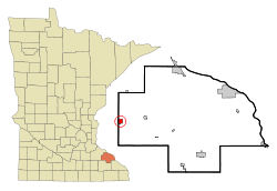 Location of Mazeppa, Minnesota | |
| Coordinates: 44°16′21″N 92°32′39″W / 44.27250°N 92.54417°W | |
| Country | United States |
| State | Minnesota |
| County | Wabasha |
| Area[1] | |
| • Total | 1.09 sq mi (2.82 km2) |
| • Land | 1.09 sq mi (2.82 km2) |
| • Water | 0 sq mi (0 km2) |
| Elevation | 955 ft (291 m) |
| Population (2010)[2] | |
| • Total | 842 |
| • Estimate (2012[3]) | 836 |
| • Density | 772.5/sq mi (298.3/km2) |
| Time zone | Central (CST) (UTC-6) |
| • Summer (DST) | CDT (UTC-5) |
| ZIP code | 55956 |
| Area code(s) | 507 |
| FIPS code | 27-41282[4] |
| GNIS feature ID | 0647648[5] |
Mazeppa is a city in Wabasha County, Minnesota, United States, along the North Fork of the Zumbro River. The population was 842 at the 2010 census.[6]
History
Mazeppa was platted in 1855, and named in honor of Hetman Ivan Mazepa via a poem by Lord Byron.[7][8] The city was incorporated in 1877.[7]
Geography
According to the United States Census Bureau, the city has a total area of 1.09 square miles (2.82 km2), all of it land.[1]
Minnesota State Highway 60 serves as a main route in the community.
Demographics
| Historical population | |||
|---|---|---|---|
| Census | Pop. | %± | |
| 1880 | 460 | — | |
| 1900 | 556 | — | |
| 1910 | 471 | −15.3% | |
| 1920 | 481 | 2.1% | |
| 1930 | 450 | −6.4% | |
| 1940 | 545 | 21.1% | |
| 1950 | 523 | −4.0% | |
| 1960 | 444 | −15.1% | |
| 1970 | 498 | 12.2% | |
| 1980 | 680 | 36.5% | |
| 1990 | 722 | 6.2% | |
| 2000 | 778 | 7.8% | |
| 2010 | 842 | 8.2% | |
| Est. 2015 | 822 | [9] | −2.4% |
2010 census
As of the census[2] of 2010, there were 842 people, 337 households, and 234 families residing in the city. The population density was 772.5 inhabitants per square mile (298.3/km2). There were 362 housing units at an average density of 332.1 per square mile (128.2/km2). The racial makeup of the city was 96.3% White, 1.2% African American, 0.6% Native American, 0.6% Asian, 0.6% from other races, and 0.7% from two or more races. Hispanic or Latino of any race were 1.2% of the population.
There were 337 households of which 32.6% had children under the age of 18 living with them, 59.6% were married couples living together, 6.2% had a female householder with no husband present, 3.6% had a male householder with no wife present, and 30.6% were non-families. 25.2% of all households were made up of individuals and 11% had someone living alone who was 65 years of age or older. The average household size was 2.50 and the average family size was 3.01.
The median age in the city was 38.4 years. 26% of residents were under the age of 18; 6.7% were between the ages of 18 and 24; 26.5% were from 25 to 44; 27.1% were from 45 to 64; and 13.8% were 65 years of age or older. The gender makeup of the city was 51.0% male and 49.0% female.
2000 census
As of the census[4] of 2000, there were 778 people, 312 households, and 214 families residing in the city. The population density was 795.7 people per square mile (306.5/km²). There were 335 housing units at an average density of 342.6 per square mile (132.0/km²). The racial makeup of the city was 97.69% White, 0.39% African American, 1.29% Native American, 0.13% from other races, and 0.51% from two or more races. Hispanic or Latino of any race were 0.77% of the population.
There were 312 households out of which 36.2% had children under the age of 18 living with them, 55.8% were married couples living together, 8.7% had a female householder with no husband present, and 31.4% were non-families. 28.5% of all households were made up of individuals and 12.8% had someone living alone who was 65 years of age or older. The average household size was 2.49 and the average family size was 3.06.
In the city the population was spread out with 29.2% under the age of 18, 7.6% from 18 to 24, 28.8% from 25 to 44, 20.2% from 45 to 64, and 14.3% who were 65 years of age or older. The median age was 36 years. For every 100 females there were 99.0 males. For every 100 females age 18 and over, there were 98.9 males.
The median income for a household in the city was $36,375, and the median income for a family was $46,250. Males had a median income of $30,208 versus $21,607 for females. The per capita income for the city was $17,509. About 5.7% of families and 7.4% of the population were below the poverty line, including 8.7% of those under age 18 and 20.5% of those age 65 or over.
Education
High school students attend the Zumbrota-Mazeppa High School jointly with students from the nearby town of Zumbrota.
Notable residents
- Stub Allison - sports coach
References
- 1 2 "US Gazetteer files 2010". United States Census Bureau. Archived from the original on January 24, 2012. Retrieved 2012-11-13.
- 1 2 "American FactFinder". United States Census Bureau. Retrieved 2012-11-13.
- ↑ "Population Estimates". United States Census Bureau. Archived from the original on June 17, 2013. Retrieved 2013-05-28.
- 1 2 "American FactFinder". United States Census Bureau. Archived from the original on September 11, 2013. Retrieved 2008-01-31.
- ↑ "US Board on Geographic Names". United States Geological Survey. 2007-10-25. Retrieved 2008-01-31.
- ↑ "2010 Census Redistricting Data (Public Law 94-171) Summary File". American FactFinder. United States Census Bureau. Archived from the original on July 21, 2011. Retrieved 27 April 2011.
- 1 2 Upham, Warren (1920). Minnesota Geographic Names: Their Origin and Historic Significance. Minnesota Historical Society. p. 557.
- ↑ "Where Did Minnesota Towns Get Names? Most Colorful in U.S.". The Winona Republican-Herald. July 12, 1949. p. 15. Retrieved January 24, 2015 – via Newspapers.com.

- ↑ "Annual Estimates of the Resident Population for Incorporated Places: April 1, 2010 to July 1, 2015". Retrieved July 2, 2016.
- ↑ "Census of Population and Housing". Census.gov. Archived from the original on May 11, 2015. Retrieved June 4, 2015.
External links
Municipalities and communities of Wabasha County, Minnesota, United States | ||
|---|---|---|
| Cities |  | |
| Townships | ||
| Unincorporated communities | ||
| Footnotes | ‡This populated place also has portions in an adjacent county or counties | |
Coordinates: 44°16′23″N 92°32′42″W / 44.27306°N 92.54500°W