Melville, Montana
| Melville | |
|---|---|
| Unincorporated community | |
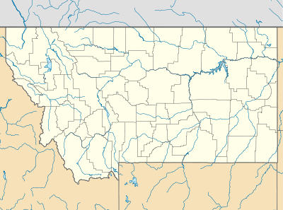 Melville Location within the state of Montana | |
| Coordinates: 46°6′11″N 109°57′14″W / 46.10306°N 109.95389°WCoordinates: 46°6′11″N 109°57′14″W / 46.10306°N 109.95389°W | |
| Country | United States |
| State | Montana |
| County | Sweet Grass |
| Elevation | 5,020 ft (1,530 m) |
| Time zone | Mountain (MST) (UTC-7) |
| • Summer (DST) | MDT (UTC-6) |
| ZIP codes | 59055 |
| GNIS feature ID | 774098[1] |
Melville is an unincorporated community in northern Sweet Grass County, Montana, United States. It lies along local roads just west of U.S. Route 191, north of the city of Big Timber, the county seat of Sweet Grass County.[2] Its elevation is 5,020 feet (1,530 m).[1] Although Melville is unincorporated, it has a post office, with the ZIP code of 59055,[3] which opened on 4 January 1883.[4]
History
Located 20 miles north of Big Timber, Melville was established in 1877 as a village named after Colonel Melville, the arctic explorer. A post office first went into operation in Melville in 1883, and the first Lutheran congregation in Montana was established there in 1885. Until a church was built in 1914, all services were held in the schoolhouse. Melville is a ranching community, originally settled by Norwegians. It became regional a meeting place for Saturday night dances, horse races, and gambling. This resulted in the town quickly gaining a reputation for being particularly rough and tumble.
At its height, Melville had a flourmill, a cheese factory, a hotel, at least four saloons, two stores and a drug store. The railroad in Big Timber made such luxuries as dried fruits and green coffee available.
Melville is situated along the Sweetgrass River. The town provides supplies for the sheep camps in the Crazy Mountains and is the headquarters of the Cremer Stock Ranch, which is renowned for providing stock for western rodeos.
Climate
The Köppen Climate System classifies the weather as humid continental, abbreviated as Dfb.[5]
| Climate data for Melville, Montana | |||||||||||||
|---|---|---|---|---|---|---|---|---|---|---|---|---|---|
| Month | Jan | Feb | Mar | Apr | May | Jun | Jul | Aug | Sep | Oct | Nov | Dec | Year |
| Average high °C (°F) | 1 (34) |
3 (38) |
6 (42) |
11 (51) |
16 (60) |
20 (68) |
25 (77) |
24 (76) |
19 (66) |
13 (56) |
6 (42) |
2 (35) |
12 (54) |
| Average low °C (°F) | −12 (11) |
−10 (14) |
−7 (19) |
−3 (27) |
2 (35) |
6 (42) |
9 (48) |
8 (46) |
4 (39) |
−1 (30) |
−7 (19) |
−11 (12) |
−2 (29) |
| Average precipitation mm (inches) | 15 (0.6) |
13 (0.5) |
28 (1.1) |
48 (1.9) |
80 (3) |
81 (3.2) |
46 (1.8) |
38 (1.5) |
36 (1.4) |
28 (1.1) |
20 (0.8) |
13 (0.5) |
442 (17.4) |
| Source: Weatherbase [6] | |||||||||||||
References
- 1 2 "Melville, Montana". Geographic Names Information System. United States Geological Survey.
- ↑ Rand McNally. The Road Atlas '08. Chicago: Rand McNally, 2008, p. 60-61.
- ↑ Zip Code Lookup
- ↑ U.S. Geological Survey Geographic Names Information System: Melville Post Office
- ↑ Climate Summary for Melville, Montana
- ↑ "Weatherbase.com". Weatherbase. 2013. Retrieved on September 5, 2013.
Municipalities and communities of Sweet Grass County, Montana, United States | ||
|---|---|---|
| City | 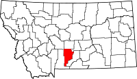 | |
| CDP | ||
| Unincorporated communities | ||