Sourdough, Montana
| Sourdough, Montana | |
|---|---|
| Unincorporated community | |
 Sourdough, Montana  Sourdough, Montana | |
| Coordinates: 45°54′07″N 109°48′52″W / 45.90194°N 109.81444°WCoordinates: 45°54′07″N 109°48′52″W / 45.90194°N 109.81444°W | |
| Country | United States |
| State | Montana |
| County | Sweet Grass |
| Elevation | 4,662 ft (1,421 m) |
| Time zone | Mountain (MST) (UTC-7) |
| • Summer (DST) | MDT (UTC-6) |
| Area code(s) | 406 |
| GNIS feature ID | 776749[1] |
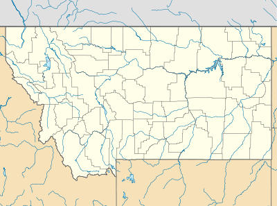
Sourdough is an unincorporated community in Sweet Grass County, Montana, United States. Sourdough is northeast of Big Timber.
Sourdough appears on the Ryan Creek U.S. Geological Survey Map.
History
Established in 1912, Sourdough was an isolated village situated in the Crazy Mountains. It had homes and a schoolhouse. The schoolhouse has been restored and relocated to Big Timber and part of the Crazy Mountain Museum.
There is nothing left in the location of Sourdough today.
References
- ↑ "US Board on Geographic Names". United States Geological Survey. 2007-10-25. Retrieved 2008-01-31.
Municipalities and communities of Sweet Grass County, Montana, United States | ||
|---|---|---|
| City | 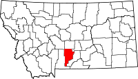 | |
| CDP | ||
| Unincorporated communities | ||
This article is issued from Wikipedia - version of the 8/8/2016. The text is available under the Creative Commons Attribution/Share Alike but additional terms may apply for the media files.