Menucourt
| Menucourt | ||
|---|---|---|
|
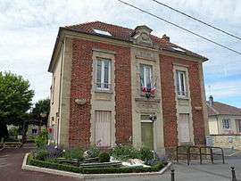
The town hall of Menucourt | ||
| ||
 Menucourt | ||
|
Location within Île-de-France region  Menucourt | ||
| Coordinates: 49°01′40″N 1°58′55″E / 49.0278°N 1.9819°ECoordinates: 49°01′40″N 1°58′55″E / 49.0278°N 1.9819°E | ||
| Country | France | |
| Region | Île-de-France | |
| Department | Val-d'Oise | |
| Arrondissement | Pontoise | |
| Canton | L'Hautil | |
| Intercommunality | Cergy-Pontoise | |
| Government | ||
| • Mayor (2001–2008) | Eric Proffit-Brulfert | |
| Area1 | 3.68 km2 (1.42 sq mi) | |
| Population (2006)2 | 5,197 | |
| • Density | 1,400/km2 (3,700/sq mi) | |
| Time zone | CET (UTC+1) | |
| • Summer (DST) | CEST (UTC+2) | |
| INSEE/Postal code | 95388 / 95180 | |
| Elevation | 85–188 m (279–617 ft) | |
|
1 French Land Register data, which excludes lakes, ponds, glaciers > 1 km² (0.386 sq mi or 247 acres) and river estuaries. 2 Population without double counting: residents of multiple communes (e.g., students and military personnel) only counted once. | ||
.svg.png)
Menucourt is a commune in the Val-d'Oise department in Île-de-France in northern France.
Education
Schools include:[1]
- Preschools: École maternelle des Cornouillers and École maternelle de la Vallée Basset
- Elementary schools: École des Cornouillers, École de la Vallée Basset, and École Louis Bourgeois
- One junior high school, Collège la taillette
High school students may attend Lycée Camille Claudel in Vauréal.[1]
See also
References
- 1 2 "Les établissements scolaires." Menucourt. Retrieved on September 6, 2016.
External links
| Wikimedia Commons has media related to Menucourt. |
- Official website (French)
- Land use (IAURIF) (English)
This article is issued from Wikipedia - version of the 9/6/2016. The text is available under the Creative Commons Attribution/Share Alike but additional terms may apply for the media files.