Saint-Witz
| Saint-Witz | ||
|---|---|---|
|
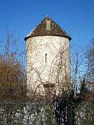
The old mill of Saint-Witz | ||
| ||
 Saint-Witz | ||
|
Location within Île-de-France region  Saint-Witz | ||
| Coordinates: 49°05′33″N 2°34′09″E / 49.0925°N 2.5692°ECoordinates: 49°05′33″N 2°34′09″E / 49.0925°N 2.5692°E | ||
| Country | France | |
| Region | Île-de-France | |
| Department | Val-d'Oise | |
| Arrondissement | Sarcelles | |
| Canton | Goussainville | |
| Intercommunality | Roissy Pays de France | |
| Government | ||
| • Mayor (2001–2020) | Germain Buchet | |
| Area1 | 7.66 km2 (2.96 sq mi) | |
| Population (2013)2 | 2,497 | |
| • Density | 330/km2 (840/sq mi) | |
| Time zone | CET (UTC+1) | |
| • Summer (DST) | CEST (UTC+2) | |
| INSEE/Postal code | 95580 / 95470 | |
| Elevation |
109–195 m (358–640 ft) (avg. 110 m or 360 ft) | |
|
1 French Land Register data, which excludes lakes, ponds, glaciers > 1 km² (0.386 sq mi or 247 acres) and river estuaries. 2 Population without double counting: residents of multiple communes (e.g., students and military personnel) only counted once. | ||

Saint-Witz is a commune in the Val-d'Oise department in Île-de-France in northern France.
Education
Public secondary schools:
- Collège Françoise Dolto, a public junior high school serving Saint-Witz, is in Marly-la-ville.[1]
- Saint-Witz has one public senior high school: Lycée Léonard de Vinci.[2]
Collège Institut Paul Ricoeur/Lycée Institut Paul RICOEUR is in nearby Louvres.[3][4]
Institut Saint-Dominique, a private Catholic preschool through senior high, is in nearby Mortefontaine, Oise.[5]
See also
References
- ↑ "Collège Françoise Dolto." Saint-Witz. Retrieved on September 3, 2016.
- ↑ "Lycée public Léonard de Vinci." Saint-Witz. Retrieved on September 3, 2016.
- ↑ "Lycée Institut Paul RICOEUR." Saint-Witz. Retrieved on September 3, 2016.
- ↑ "Collège Institut Paul Ricoeur." Saint-Witz. Retrieved on September 3, 2016.
- ↑ "Institut Saint-Dominique de Mortefontaine." Saint-Witz. Retrieved on September 3, 2016.
External links
| Wikimedia Commons has media related to Saint-Witz. |
- Home page (French)
- Land use (IAURIF) (English)
This article is issued from Wikipedia - version of the 9/4/2016. The text is available under the Creative Commons Attribution/Share Alike but additional terms may apply for the media files.