Meslay-du-Maine
| Meslay-du-Maine | ||
|---|---|---|
|
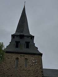
The clock tower of the church, in Meslay-du-Maine | ||
| ||
 Meslay-du-Maine | ||
|
Location within Pays de la Loire region  Meslay-du-Maine | ||
| Coordinates: 47°57′07″N 0°33′16″W / 47.9519°N 0.5544°WCoordinates: 47°57′07″N 0°33′16″W / 47.9519°N 0.5544°W | ||
| Country | France | |
| Region | Pays de la Loire | |
| Department | Mayenne | |
| Arrondissement | Laval | |
| Canton | Meslay-du-Maine | |
| Government | ||
| • Mayor (2001–2008) | André Bourdais | |
| Area1 | 24.18 km2 (9.34 sq mi) | |
| Population (2006)2 | 2,645 | |
| • Density | 110/km2 (280/sq mi) | |
| Time zone | CET (UTC+1) | |
| • Summer (DST) | CEST (UTC+2) | |
| INSEE/Postal code | 53152 / 53170 | |
| Elevation |
63–112 m (207–367 ft) (avg. 90 m or 300 ft) | |
|
1 French Land Register data, which excludes lakes, ponds, glaciers > 1 km² (0.386 sq mi or 247 acres) and river estuaries. 2 Population without double counting: residents of multiple communes (e.g., students and military personnel) only counted once. | ||

Meslay-du-Maine is a commune in the Mayenne department in north-western France.
See also
| Wikimedia Commons has media related to Meslay-du-Maine. |
This article is issued from Wikipedia - version of the 2/11/2016. The text is available under the Creative Commons Attribution/Share Alike but additional terms may apply for the media files.