Denazé
| Denazé | |
|---|---|
 | |
 Denazé | |
|
Location within Pays de la Loire region  Denazé | |
| Coordinates: 47°53′09″N 0°53′09″W / 47.8858°N 0.8858°WCoordinates: 47°53′09″N 0°53′09″W / 47.8858°N 0.8858°W | |
| Country | France |
| Region | Pays de la Loire |
| Department | Mayenne |
| Arrondissement | Château-Gontier |
| Canton | Château-Gontier |
| Intercommunality | Communauté de communes du Pays de Craon |
| Government | |
| • Mayor (2014-2020) | Odile Gohier |
| Area1 | 9.3 km2 (3.6 sq mi) |
| Population (2012)2 | 152 |
| • Density | 16/km2 (42/sq mi) |
| Time zone | CET (UTC+1) |
| • Summer (DST) | CEST (UTC+2) |
| INSEE/Postal code | 53090 / 53400 |
| Elevation |
52–104 m (171–341 ft) (avg. 150 m or 490 ft) |
|
1 French Land Register data, which excludes lakes, ponds, glaciers > 1 km² (0.386 sq mi or 247 acres) and river estuaries. 2 Population without double counting: residents of multiple communes (e.g., students and military personnel) only counted once. | |
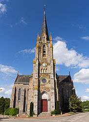
Denazé is a commune in the Mayenne department in north-western France.
See also
| Wikimedia Commons has media related to Denazé. |
This article is issued from Wikipedia - version of the 5/17/2015. The text is available under the Creative Commons Attribution/Share Alike but additional terms may apply for the media files.