Miguelete, Uruguay
| Miguelete Colonia Miguelete | |
|---|---|
| Village | |
 Miguelete Location in Uruguay | |
| Coordinates: 34°0′0″S 57°39′0″W / 34.00000°S 57.65000°WCoordinates: 34°0′0″S 57°39′0″W / 34.00000°S 57.65000°W | |
| Country |
|
| Department | Colonia Department |
| Founded | 1909 |
| Population (2011) | |
| • Total | 999 |
| Time zone | UTC -3 |
| Postal code | 70005 |
| Dial plan | +598 4575 (+4 digits) |
Miguelete or Colonia Miguelete is a village in the Colonia Department of southwestern Uruguay.
Location
It is located on Route 106, a small distance south of its intersection with Route 54, about 63 kilometres (39 mi) north-northeast of the department capital Colonia del Sacramento.
History
Miguelete was founded on 27 March 1909. Its status was elevated to "Pueblo" (village) category on 8 November 1942 por Ley No. 10.113.[1]
There is a nearby creek of the same name.
Population
In 2011 Miguelete had a population of 999.[2]
| Year | Population |
|---|---|
| 1908 | 2,795 |
| 1963 | 438 |
| 1975 | 536 |
| 1985 | 649 |
| 1996 | 893 |
| 2004 | 979 |
| 2011 | 999 |
Source: Instituto Nacional de Estadística de Uruguay[3]
Famous people
- Santiago Urrutia, race driver
References
- ↑ "LEY N° 10.113". República Oriental del Uruguay, Poder Legislativo. 1942. Retrieved 4 July 2011.
- ↑ "Censos 2011 Colonia (needs flash plugin)". ΙΝΕ. 2012. Retrieved 30 August 2012.
- ↑ "Statistics of urban localities (1908–2004)" (PDF). INE. 2012. Retrieved 3 September 2012.
External links
Capital: Colonia del Sacramento | ||
| Towns and villages | 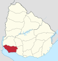 | |
| Sights | ||
This article is issued from Wikipedia - version of the 11/9/2014. The text is available under the Creative Commons Attribution/Share Alike but additional terms may apply for the media files.