Minato-ku, Nagoya
| Minato 港区 | |
|---|---|
| Ward | |
| Minato Ward | |
|
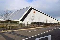
SCMaglev and Railway Park | |
 Location of Minato-ku in Nagoya | |
 Minato
| |
| Coordinates: 35°06′28″N 136°53′08″E / 35.10778°N 136.88556°ECoordinates: 35°06′28″N 136°53′08″E / 35.10778°N 136.88556°E | |
| Country | Japan |
| Region |
Tōkai region Chūbu region |
| Prefecture | Aichi |
| Area | |
| • Total | 45.69 km2 (17.64 sq mi) |
| Population (November 2011) | |
| • Total | 147,973 |
| • Density | 3,240/km2 (8,400/sq mi) |
| Time zone | Japan Standard Time (UTC+9) |
| - Tree | Cinnamomum camphora; Camellia sasanqua [1] |
| - Flower | Hibiscus [1] |
| Phone number | 052-651-3251 |
| Address | 1-12-20, Komei, Minato-ku, Nagoya-shi, Aichi-ken 455-8520 |
| Website |
www |
Minato-ku (港区 Minato-ku) is one of the 16 wards of the city of Nagoya in Aichi Prefecture, Japan. As of 2011, the ward had an estimated population of 147,937 and a population density of 2,240 persons per km². The total area was 45.69 km². It is geographically the largest of the wards of Nagoya in terms of land area.

Geography
Minato Ward is the southern portion of the city of Nagoya, in the coastal flatlands and river estuaries along the shore of Ise Bay. Due to land reclamation much of the coastline is no longer natural.
Surrounding municipalities
History
All of what is now Minato Ward was part of the holdings of Owari Domain during the Edo period. After the Meiji Restoration, the area was transferred to the new Nagoya Prefecture, which later became part of Aichi Prefecture. Nagoya was divided into wards on April 1, 1908. In 1922, Ousu village in Aichi District was annexed by the city of Nagoya becoming part of Minami Ward. The Nagoya Port Drawbridge was completed in 1926. On October 1, 1937 the city of Nagoya was re-divided into ten wards, with the original Minami Ward divided into the new Minami Ward, plus Atsuta Ward, Nakagawa Ward, Minato Ward, and part of Showa Ward. In 1955, the town of Nanyo from Ama District was annexed by Minato Ward. In 1959, the Isewan Typhoon caused severe damage to the area.
Economy
The economy of Minato Ward is dominated by Nagoya Port, one of the busiest in Japan.
Education
International schools:
- Colégio Brasil Japão Prof. Shinoda - Brazilian school[2]
The ward previously hosted Colégio Áureo, another Brazilian school.[3]
Transportation
Ports
Railroads
- Nagoya Seaside Rapid Railway - Aonami Line
- Nagoya Keibajō-mae • Arakogawakōen • Inaei •
Noseki • Kinjō-Futō
Highways
Local attractions
- Port of Nagoya Public Aquarium
- SCMaglev and Railway Park
- Nagoya Port Building
- Nagoya Port Sea Train Land
- Nagoya Racecourse
- Nagoya City Wilde Bird Observation Center
Local events
- Marine Day Nagoya Port Festival, held annually at Nagoya Port from 1946, as part of the postwar development plan. The festival is held on Marine Day.[4]
| Wikimedia Commons has media related to Minato-ku, Nagoya. |
References
- 1 2 "港区のあらまし". Nagoya City. 10 March 2010. Retrieved 7 January 2011.
- ↑ "Escolas Brasileiras Homologadas no Japão" (Archive). Embassy of Brazil in Tokyo. Retrieved on October 13, 2015.
- ↑ "Escolas Brasileiras Homologadas no Japão" (Archive). Embassy of Brazil in Tokyo. February 7, 2008. Retrieved on October 13, 2015.
| Wards of Nagoya | ||
|---|---|---|
| Core cities | ||
| Special cities | ||
| Cities | ||
| Aichi District | ||
| Ama District | ||
| Chita District | ||
| Kitashitara District | ||
| Nishikasugai District | ||
| Niwa District | ||
| Nukata District | ||