Mizuho-ku, Nagoya
| Mizuho 瑞穂区 | |
|---|---|
| Ward | |
| Mizuho Ward | |
|
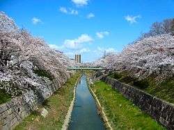
Yamazaki River | |
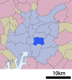 Location of Mizuho-ku in Nagoya | |
 Mizuho
| |
| Coordinates: 35°07′54″N 136°56′06″E / 35.13167°N 136.93500°ECoordinates: 35°07′54″N 136°56′06″E / 35.13167°N 136.93500°E | |
| Country | Japan |
| Region |
Tōkai region Chūbu region |
| Prefecture | Aichi |
| Area | |
| • Total | 11.23 km2 (4.34 sq mi) |
| Population (November 2011) | |
| • Total | 105,224 |
| • Density | 9,370/km2 (24,300/sq mi) |
| Time zone | Japan Standard Time (UTC+9) |
| - Tree | Cherry blossom |
| - Flower | Cherry blossom [1] |
| Phone number | 052-841-1521 |
| Address | 3-23 Mizuho-dori, Mizuho-ku, Nagoya-shi, Aichi-ken 467-8531 |
| Website |
www |
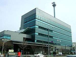
Mizuho-ku Ward Office
Mizuho (瑞穂区 Mizuho-ku) is one of the 16 wards of the city of Nagoya in Aichi Prefecture, Japan. As of 2011, the ward had an estimated population of 105,224 and a population density of 9,370 persons per km². The total area was 11.23 km².
Geography
Mizuho Ward is located near the geographic center of Nagoya city.
Surrounding municipalities
History
Mizuho District was established on February 11, 1944 from the eastern portion of Atsuka-ku.
Education
Transportation
Railroads
Highways
Local attractions
- Nagoya City Museum
- Mizuho Kofun Group
- Mizuho rugby stadium.
References
| Wikimedia Commons has media related to Mizuho-ku, Nagoya. |
| Wards of Nagoya | ||
|---|---|---|
| Core cities | ||
| Special cities | ||
| Cities | ||
| Aichi District | ||
| Ama District | ||
| Chita District | ||
| Kitashitara District | ||
| Nishikasugai District | ||
| Niwa District | ||
| Nukata District | ||
This article is issued from Wikipedia - version of the 1/28/2016. The text is available under the Creative Commons Attribution/Share Alike but additional terms may apply for the media files.