Moran Township, Todd County, Minnesota
| Moran Township, Minnesota | |
|---|---|
| Township | |
 Moran Township, Minnesota Location within the state of Minnesota | |
| Coordinates: 46°14′27″N 94°49′23″W / 46.24083°N 94.82306°WCoordinates: 46°14′27″N 94°49′23″W / 46.24083°N 94.82306°W | |
| Country | United States |
| State | Minnesota |
| County | Todd |
| Area | |
| • Total | 36.0 sq mi (93.3 km2) |
| • Land | 35.6 sq mi (92.1 km2) |
| • Water | 0.5 sq mi (1.2 km2) |
| Elevation | 1,266 ft (386 m) |
| Population (2000) | |
| • Total | 515 |
| • Density | 14.5/sq mi (5.6/km2) |
| Time zone | Central (CST) (UTC-6) |
| • Summer (DST) | CDT (UTC-5) |
| ZIP code | 56479 |
| Area code(s) | 218 |
| FIPS code | 27-44062[1] |
| GNIS feature ID | 0665030[2] |
Moran Township is a township in Todd County, Minnesota, United States. The population was 515 at the 2000 census.
Moran Township was organized in 1877, and named after Moran Creek.[3]
Geography
According to the United States Census Bureau, the township has a total area of 36.0 square miles (93.3 km²); 35.6 square miles (92.1 km²) of it is land and 0.5 square miles (1.2 km²) of it (1.28%) is water. The Long Prairie River flows northwardly through the eastern part of the township.[4]
Demographics
As of the census[1] of 2000, there were 515 people, 186 households, and 143 families residing in the township. The population density was 14.5 people per square mile (5.6/km²). There were 235 housing units at an average density of 6.6/sq mi (2.6/km²). The racial makeup of the township was 96.70% White, 0.58% African American, 0.78% Native American, 1.55% from other races, and 0.39% from two or more races. Hispanic or Latino of any race were 1.55% of the population.
There were 186 households out of which 33.9% had children under the age of 18 living with them, 67.7% were married couples living together, 4.3% had a female householder with no husband present, and 23.1% were non-families. 19.4% of all households were made up of individuals and 7.5% had someone living alone who was 65 years of age or older. The average household size was 2.77 and the average family size was 3.20.
In the township the population was spread out with 28.9% under the age of 18, 7.0% from 18 to 24, 27.6% from 25 to 44, 25.4% from 45 to 64, and 11.1% who were 65 years of age or older. The median age was 38 years. For every 100 females there were 111.1 males. For every 100 females age 18 and over, there were 119.2 males.
The median income for a household in the township was $27,083, and the median income for a family was $29,125. Males had a median income of $24,464 versus $16,528 for females. The per capita income for the township was $15,144. About 13.1% of families and 18.0% of the population were below the poverty line, including 19.3% of those under age 18 and 23.6% of those age 65 or over.
St. Isidore's Roman Catholic Church, founded by Polish immigrants in 1899, is located in the township.
References
- 1 2 "American FactFinder". United States Census Bureau. Retrieved 2008-01-31.
- ↑ "US Board on Geographic Names". United States Geological Survey. 2007-10-25. Retrieved 2008-01-31.
- ↑ Upham, Warren (1920). Minnesota Geographic Names: Their Origin and Historic Significance. Minnesota Historical Society. p. 545.
- ↑ Minnesota Atlas & Gazetteer. Yarmouth, Me.: DeLorme. 1994. p. 53. ISBN 0-89933-222-6.
Municipalities and communities of Todd County, Minnesota, United States | ||
|---|---|---|
| Cities | 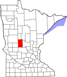 | |
| Townships | ||
| Unincorporated communities | ||
| Footnotes | ‡This populated place also has portions in an adjacent county or counties | |