Mount Sylvania
| Mount Sylvania | |
|---|---|
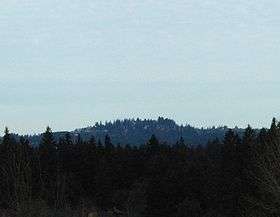 Top as seen from Tualatin | |
| Highest point | |
| Elevation | 978 ft (298 m) NAVD 88[1] |
| Prominence | 510 ft (155 m) [2] |
| Coordinates | 45°26′17″N 122°43′18″W / 45.438174217°N 122.72164825°WCoordinates: 45°26′17″N 122°43′18″W / 45.438174217°N 122.72164825°W [1] |
| Geography | |
| Location | Multnomah County, Oregon, U.S. |
| Parent range | Tualatin Mountains |
| Topo map | USGS Lake Oswego |
| Geology | |
| Mountain type | Shield volcano[3] |
| Volcanic field | Boring Lava Field |
Mount Sylvania is an extinct volcano, part of the Boring Lava Field, on the outskirts of Portland, Oregon. Parts of the mountain are within the cities of Portland, Lake Oswego, and Tigard. Mountain Park, a Lake Oswego suburban development, was built on the mountain in the 1970s.
The Sylvania campus of Portland Community College is located on the mountain's western slopes.
References
- 1 2 "Sylvania Reset". NGS data sheet. U.S. National Geodetic Survey. Retrieved 2008-11-17.
- ↑ "Mount Sylvania, Oregon". Peakbagger.com. Retrieved 2016-04-27.
- ↑ "The Boring Lava Field, Portland, Oregon". USGS: Cascades Volcano Observatory. Archived from the original on 2011-07-01. Retrieved 2008-04-01.
External links
This article is issued from Wikipedia - version of the 7/6/2016. The text is available under the Creative Commons Attribution/Share Alike but additional terms may apply for the media files.