Mulgrave-et-Derry, Quebec
| Mulgrave-et-Derry | |
|---|---|
| Municipality | |
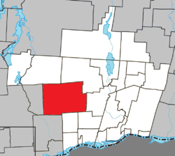 Location within Papineau RCM. | |
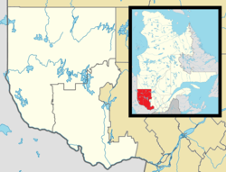 Mulgrave-et-Derry Location in western Quebec. | |
| Coordinates: 45°47′N 75°22′W / 45.783°N 75.367°WCoordinates: 45°47′N 75°22′W / 45.783°N 75.367°W[1] | |
| Country |
|
| Province |
|
| Region | Outaouais |
| RCM | Papineau |
| Constituted | January 1, 1870 |
| Government[2] | |
| • Mayor | Michael Kane |
| • Federal riding | Argenteuil—Papineau—Mirabel |
| • Prov. riding | Papineau |
| Area[2][3] | |
| • Total | 319.00 km2 (123.17 sq mi) |
| • Land | 295.99 km2 (114.28 sq mi) |
| Population (2011)[3] | |
| • Total | 246 |
| • Density | 0.8/km2 (2/sq mi) |
| • Pop 2006-2011 |
|
| • Dwellings | 190 |
| Time zone | EST (UTC−5) |
| • Summer (DST) | EDT (UTC−4) |
| Postal code(s) | J8L 2H2 |
| Area code(s) | 819 |
| Highways |
|
Mulgrave-et-Derry, is a village north of Mayo, in the Papineau Regional County Municipality, Quebec, Canada. The region includes a number of beautiful lakes, including Gull Lake, Hawk Lake, Lady Lake, Smallian Lake, Lac St. Sixte, Lac La Blanche and Little Lake. Community buildings include the Hill and Gully Riders Snowmobile Club, St. Matthew's Evangelical Lutheran Church, and Our Lady of the Light Roman Catholic Church.
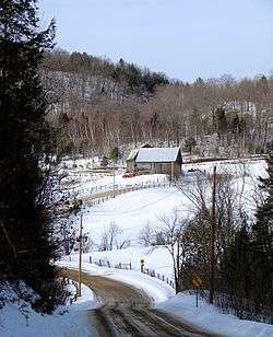
Quebec Route 315 through Blanche, Mulgrave-et-Derry
References
External links
- http://ca.epodunk.com/profiles/quebec/mulgrave-et-derry/2001563.html
- http://www.bytown.net/mayoquebec.htm
 |
Val-des-Bois | Montpellier | | |
| Notre-Dame-de-la-Salette | |
Ripon | ||
| ||||
| | ||||
| L'Ange-Gardien | Mayo | Saint-Sixte |
| Cities | |
|---|---|
| Municipalities | |
| Townships | |
| |
This article is issued from Wikipedia - version of the 2/28/2014. The text is available under the Creative Commons Attribution/Share Alike but additional terms may apply for the media files.