Nassau County, Florida
| Nassau County, Florida | ||
|---|---|---|
| County | ||
| County of Nassau | ||
.JPG) Nassau County Courthouse | ||
| ||
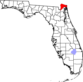 Location in the U.S. state of Florida | ||
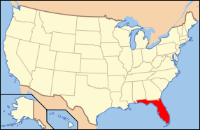 Florida's location in the U.S. | ||
| Founded | December 29, 1824 | |
| Named for | Duchy of Nassau | |
| Seat | Fernandina Beach | |
| Largest community | Yulee | |
| Area | ||
| • Total | 726 sq mi (1,880 km2) | |
| • Land | 649 sq mi (1,681 km2) | |
| • Water | 77 sq mi (199 km2), 10.6% | |
| Population (est.) | ||
| • (2015) | 78,444 | |
| • Density | 118/sq mi (46/km²) | |
| Congressional district | 4th | |
| Time zone | Eastern: UTC-5/-4 | |
| Website |
www | |
Nassau County is a county located in the state of Florida. As of the 2010 census, the population was 73,314.[1] The county seat and largest incorporated city is Fernandina Beach.[2]
Nassau County is included in the Jacksonville Metropolitan Statistical Area. Tourism, primarily associated with Amelia Island and the many golf courses in the area, is the chief economic industry.
History
Nassau County was created in 1824 from Duval County. It was named for the Duchy of Nassau in Germany.
Law and government
Nassau County is governed by the five-member Nassau County Board of County Commissioners, who are elected to four-year terms by the voters. The terms are staggered so that either three or two commissioners (alternately) are up for election every two years.
The main environmental and agricultural body is the Nassau County Soil and Water Conservation District, which works closely with other area agencies.
Local law enforcement is conducted by the Nassau County Sheriff's Office, under Sheriff Bill Leeper.
Geography
According to the U.S. Census Bureau, the county has a total area of 726 square miles (1,880 km2), of which 649 square miles (1,680 km2) is land and 77 square miles (200 km2) (10.6%) is water.[3] The city of Fernandina Beach is located on Amelia Island, the county’s one inhabited island. Fernandina Beach municipality extends across the Inter Coastal Waterway along A1A to Yulee.
Topography
There are 12 distinct topographical zones in Nassau County. Most of these zones run in narrow bands stretching from north to south, although this is less true as one approaches the Atlantic coast.
- Directly against the western border with Baker County, the topography ranges from fairly flat to slightly elevated. Drainage is poor and the soil is sandy.
- Moving east, there are some areas (mostly in the northern and central county) of higher ground with much better drainage.
- East of these areas are some lower places, especially in the south, that are level and have extremely poor drainage.
- Eastward again, there is a stretch that ranges from a few miles in the extreme northern areas to about 6-8 miles (13 km) wide in the southern area, including Hilliard and much of County Road 108 and State Road 301. This area again has very poor drainage, low-lying land, and fairly sandy soil.
- East of this are scattered areas of high, sandy land with spotty or poor drainage.
- East of this, there is an area including Callahan with very sandy soil on top, and clay underneath. This section of the county is heavily permeated by small creeks and rivers, which bring with them low, poorly drained soils. This zone extends across the entire county from north to south at a fairly consistent width of about 3-4 miles (6.4 km), except in the north, where it widens to nearly 6 miles (9.7 km) across.
- East of this area is a large band of land with a consistent width of about 8 miles (13 km). The land is low and level with extremely poor drainage, and it is permeated by small creeks and rivers. In the northern section, this is where some tributaries join the St. Marys River, while in the south a number of tributaries drain together into the Nassau River, which flows into the Nassau Sound and the Atlantic Ocean.
- East of this area is a section of land about 3 miles (4.8 km) in width that has extremely sandy soils with bad drainage all around.
- Further eastward is a large area, including Yulee and O'Neil, about 4 miles (6.4 km) in width, with poor drainage and sandy soil at higher elevations, pockmarked by large reas of low lands with even worse drainage.
- To the south is an area of low-lying, organic soils which are essentially marshes and wetlands along the northern bank of the Nassau River, continuing into the Nassau Sound.
- Still eastward and somewhat to the north is a large area of marshes and organic soils which characterize area wetlands. There are many small islands in this area, and it is permeated by the Bells River and Jolly River, which empty into the Cumberland Sound to the north, just below Cumberland Island.
- Amelia Island, the easternmost section of the county, is characterized by poor drainage in the west and better drained, higher, sandier land as one travels eastward towards the beach. The northern area of the island features salty marshlands surrounding Egan’s Creek, which runs directly beneath Atlantic Boulevard in Fernandina Beach.
Adjacent counties
- Camden County, Georgia - north
- Duval County - south
- Baker County - southwest
- Charlton County, Georgia - west
Transportation
Airports
Major highways
Demographics
| Historical population | |||
|---|---|---|---|
| Census | Pop. | %± | |
| 1840 | 1,892 | — | |
| 1850 | 2,164 | 14.4% | |
| 1860 | 3,644 | 68.4% | |
| 1870 | 4,247 | 16.5% | |
| 1880 | 6,635 | 56.2% | |
| 1890 | 8,294 | 25.0% | |
| 1900 | 9,654 | 16.4% | |
| 1910 | 10,525 | 9.0% | |
| 1920 | 11,340 | 7.7% | |
| 1930 | 9,375 | −17.3% | |
| 1940 | 10,826 | 15.5% | |
| 1950 | 12,811 | 18.3% | |
| 1960 | 17,189 | 34.2% | |
| 1970 | 20,626 | 20.0% | |
| 1980 | 32,894 | 59.5% | |
| 1990 | 43,941 | 33.6% | |
| 2000 | 57,663 | 31.2% | |
| 2010 | 73,314 | 27.1% | |
| Est. 2015 | 78,444 | [4] | 7.0% |
| U.S. Decennial Census[5] 1790-1960[6] 1900-1990[7] 1990-2000[8] 2010-2015[1] | |||
As of the census[9] of 2000, there were 57,663 people, 21,980 households, and 16,528 families residing in the county. The population density was 34/km² (88/sq mi). There were 25,917 housing units at an average density of 15/km² (40/sq mi). The racial makeup of the county was 90.02% White, 7.74% Black or African American, 0.43% Native American, 0.46% Asian, 0.03% Pacific Islander, 0.32% from other races, and 1.00% from two or more races. 1.51% of the population were Hispanic or Latino of any race.
According to the 2000 Census, the largest European ancestry groups in Nassau County were: English (36.2%), Irish (13.6%) and German (11.7%).
There were 21,980 households out of which 32.80% had children under the age of 18 living with them, 61.20% were married couples living together, 9.90% had a female householder with no husband present, and 24.80% were non-families. 20.10% of all households were made up of individuals and 7.70% had someone living alone who was 65 years of age or older. The average household size was 2.59 and the average family size was 2.97.
In the county the population was spread out with 25.00% under the age of 18, 7.20% from 18 to 24, 28.80% from 25 to 44, 26.30% from 45 to 64, and 12.60% who were 65 years of age or older. The median age was 38 years. For every 100 females there were 97.30 males. For every 100 females age 18 and over, there were 94.80 males.
The median income for a household in the county was $46,022, and the median income for a family was $52,477. Males had a median income of $37,027 versus $25,443 for females. The per capita income for the county was $22,836. About 6.40% of families and 9.10% of the population were below the poverty line, including 10.90% of those under age 18 and 8.90% of those age 65 or over.
Economy
Nassau County’s economy is very diverse, ranging from agricultural activity (mostly in the form of tree farms) in the west and central areas, to a variety of activities closer to Amelia Island. Much of the land used for tree farming is owned by Rayonier, a major employer in the area, and the owner of a large pulp mill in Fernandina Beach. Historically, tree farming, trucking, and pulp production have characterized a large portion of the local economy. However, extensive growth is occurring in the outlying small towns in the rural western area, and the home construction market is still quite strong. Fernandina Beach has long been known for professional industries such as real estate, legal services, and medical care, and is also the closest city to two upscale resorts: the Ritz-Carlton Hotel and Amelia Island Plantation. In the central area of the county, a private tract of land known as the White Oak Conservation was once owned by a wealthy family who ran the area as a private zoo, complete with exotic animals such as giraffes and large albino cats. Numerous public figures, including former President Bill Clinton, have travelled to the resort in the past as a vacation spot.
Education
Public - Nassau County School District
| Pre-K | Southside Elementary | Yulee Primary | Hilliard Elementary | Callahan Elementary | |
|---|---|---|---|---|---|
| K | Bryceville Elementary | ||||
| 1st | |||||
| 2nd | |||||
| 3rd | Emma Love Hardee Elementary | Yulee Elementary | Callahan Intermediate | ||
| 4th | |||||
| 5th | |||||
| 6th | Fernandina Beach Middle | Yulee Middle | Hilliard Middle-Senior High | Callahan Middle | |
| 7th | |||||
| 8th | |||||
| 9th | Fernandina Beach High | Yulee High | West Nassau High | ||
| 10th | |||||
| 11th | |||||
| 12th | |||||
Elementary schools
- Bryceville Elementary (K-5) - Bryceville
- Callahan Elementary (PreK-2) - Callahan
- Callahan Intermediate (3-5) - Callahan
- Emma Love Hardee Elementary (3-5) - Fernandina Beach
- Hilliard Elementary (PreK-5) - Hilliard
- Southside Elementary (PreK-2) - Fernandina Beach
- Yulee Elementary (3-5) - Yulee
- Yulee Primary (PreK-2) - Yulee
Middle schools
- Callahan Middle (6-8) (Mascot: Ramblers) - Callahan
- Fernandina Beach Middle (6-8) (Mascot: Pirates) - Fernandina Beach
- Yulee Middle (6-8) (Mascot: Hornets) - Yulee
High schools
- Fernandina Beach High (9-12) (Mascot: Pirates) - Fernandina Beach
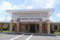
- West Nassau High (9-12) (Mascot: Warriors) - Callahan
- Yulee High (9-12) (Mascot: Hornets) - Yulee
Middle-senior high schools
- Hilliard Middle-Senior High (6-12) (Mascot: Flashes) - Hilliard
Private schools
- Amelia Island Montessori ( Pre Kindergarten-8) - Fernandina Beach
- Faith Christian Academy (Pre- Kindergarten-8) - Fernandina Beach
- Fernandina Beach Christian Academy ( Kindergarten-5th (2015) - Fernandina Beach
- Nassau Christian School ( Pre Kindergarten-12) - Yulee
- St. Michaels Academy (Pre Kindergarten-8) - Fernandina Beach
Higher education
Florida State College at Jacksonville, a state college in the Florida College System, has a campus in Nassau County near Yulee called the Betty Cook Center. It is accredited by the Southern Association of Colleges and Schools to award associates degrees and bachelor's degrees.
Libraries
The Nassau Coounty Public Library System mission statement includes the following goals: That it will provide a safe and comfortable physical space for use by county residents and visitors That it will provide high speed access to "the digital world" so that everyone can use the growing number of resources and services available through the internet That it will provide for children from birth to age 5 programs and services designed to ensure that they enter school ready to read, write and listen That it will provide library materials in a variety of formats to enhance patrons' leisure time, and assistance to find what those patrons want, and the help they need to make appropriate choices among the options available to them That it will provide the resources they need to explore topics of personal interest so that they may continue to learn throughout their lives The Nassau County Public Library has 5 branches.
A major renovation of the Fernandina Beach branch was completed in 2015 and a grand opening of the branch was held in April, 2016. The newly renovated library, located at 25 North 4th Street, doubled its size to approximately 16,000 square feet. Per the Nassau County Public Library's long range plan for 2013-2017, this renovation brought that building, originally opened in 1976, up to current Nassau County code. A resolution between the City of Fernandina Beach and Nassau County was also passed that details the ownership of the Library facility and Library operations. The Fernandina Beach branch also houses over one thousand titles that belong to the Amelia Island Genealogical Society. The materials are available for public use at the library.
- Bryceville
- Callahan
- Fernandina Beach [10]
- Hilliard
- Yulee
Media
There are three newspapers in Nassau County. The largest, the Fernandina Beach News-Leader is owned by Community Newspapers Incorporated, a media company headed by Tom Wood and Dink NeSmith. The Nassau County Record is also owned by Community Newspapers Incorporated. Both of these periodicals are available by subscription or from newsstands. The Westside Journal, an independent newspaper, is published by Florida Sun Printing, and is available for free through the mail and usually features submitted copy.
Communities
City
Towns
Unincorporated communities
- Amelia City
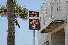
- American Beach
- Andrews
- Becker
- Boulogne
- Bryceville
- Chester
- Crandall
- Crawford
- Dahoma
- Dyal
- Evergreen
- Franklintown
- Glenwood
- Gross
- Hedges
- Hero
- Ingle
- Italia
- Keene
- Kent
- Kings Ferry
- Lessie
- Mattox
- Nassau Village-Ratliff
- Nassauville
- O'Neil
- Verdie
- Yulee Heights
- Yulee
Notable residents
- Derrick Henry, College Football player for the University of Alabama
- Howie Kendrick, Major League Baseball player for the Anaheim Angels'
- Frank Murphy, former National Football League player for the Chicago Bears and Tampa Bay Buccaneers
- Daniel Thomas, National Football League player for the Miami Dolphins
Historic places
- Historic Nassau County Courthouse, 416 Centre Street
- Hoyt House, 804 Atlantic Avenue,
- United States Post Office, Custom House, and Courthouse (Fernandina, Florida, 1912), NE corner Centre and 4th streets
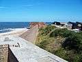
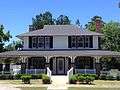
Gallery


References
- 1 2 "State & County QuickFacts". United States Census Bureau. Retrieved February 14, 2014.
- ↑ "Find a County". National Association of Counties. Retrieved 2011-06-07.
- ↑ "US Gazetteer files: 2010, 2000, and 1990". United States Census Bureau. 2011-02-12. Retrieved 2011-04-23.
- ↑ "County Totals Dataset: Population, Population Change and Estimated Components of Population Change: April 1, 2010 to July 1, 2015". Retrieved July 2, 2016.
- ↑ "U.S. Decennial Census". United States Census Bureau. Retrieved June 16, 2014.
- ↑ "Historical Census Browser". University of Virginia Library. Retrieved June 16, 2014.
- ↑ "Population of Counties by Decennial Census: 1900 to 1990". United States Census Bureau. Retrieved June 16, 2014.
- ↑ "Census 2000 PHC-T-4. Ranking Tables for Counties: 1990 and 2000" (PDF). United States Census Bureau. Retrieved June 16, 2014.
- ↑ "American FactFinder". United States Census Bureau. Retrieved 2011-05-14.
- ↑ "Fernandina Beach Library Update". Rotary Club of Fernandina Beach. Retrieved 2016-04-29.
Further reading
- Jan H. Johannes, Yesterday's Reflections, (1976, 1984)
- Jan H. Johannes, Yesterday's Reflections II, (2000) ISBN 0-9677419-0-4
- Jan H. Johannes, Tidewater Amelia: Historic homes & buildings of Amelia Island, Cumberland Island, St. Marys, Fort George Island, (2002) ISBN 0-9677419-2-0
External links
| Wikimedia Commons has media related to Nassau County, Florida. |
Economy
- Amelia Island Plantation
- Federal Aviation Administration Air Route Traffic Control Center ZJX
- Rayonier
- The Ritz Carlton
Local media
Cultural
Government links/Constitutional offices
- Nassau County Government official website for County Government
- Nassau County Clerk of Courts
- Nassau County Board of County Commissioners
- Nassau County Supervisor of Elections
- Nassau County Property Appraiser
- Nassau County Sheriff's Office
- Nassau County Public Library
- Nassau County Tax Collector
Special districts
- Nassau County School District
- St. Johns River Water Management District
- Nassau County Economic Development Board
- Nassau County Soil and Water Conservation District
Judicial branch
- Public Defender, 4th Judicial Circuit of Florida serving Duval, Clay, and Nassau counties
- Office of the State Attorney, 4th Judicial Circuit of Florida
- Circuit and County Court, 4th Judicial Circuit of Florida
 |
Camden County, Georgia | | ||
| Charlton County, Georgia | |
Atlantic Ocean | ||
| ||||
| | ||||
| Baker County | Duval County |
Municipalities and communities of Nassau County, Florida, United States | ||
|---|---|---|
| City | | |
| Towns | ||
| CDPs | ||
| Unincorporated communities |
| |
| Central city | 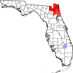 | |
|---|---|---|
| Municipalities over 10,000 population (in 2000) | ||
| Municipalities 1,000-10,000 population (in 2000) |
| |
| Counties | ||
Coordinates: 30°37′N 81°46′W / 30.61°N 81.77°W