| [3] |
Name on the Register[4] |
Image |
Date listed[5] |
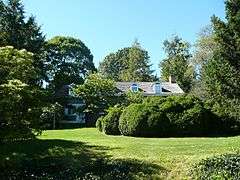
Location |
City or town |
Description |
|---|
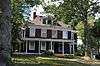
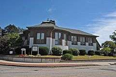
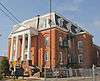
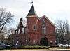
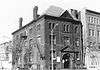
| 1 |
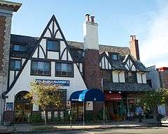
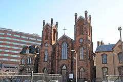
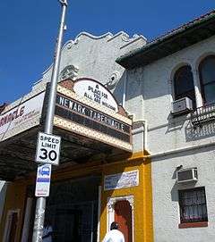
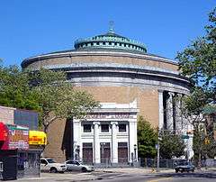
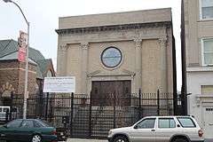
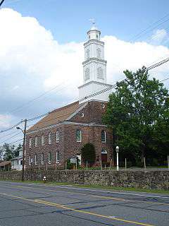
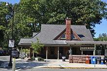
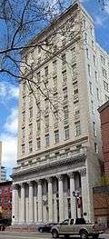
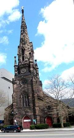
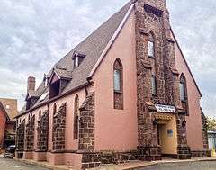
Ahavas Sholom |
|
000000002000-12-13-0000December 13, 2000
(#00001530) |
145 Broadway
40°45′19″N 74°10′12″W / 40.755278°N 74.17°W / 40.755278; -74.17 (Ahavas Sholom) |
Newark |
Now site of Jewish Museum of New Jersey
|
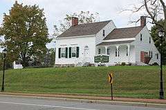
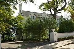
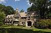
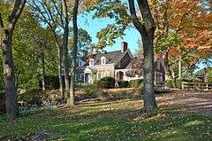
| 2 |
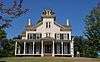
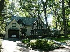
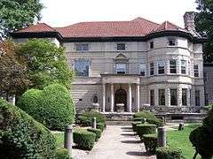
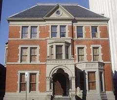
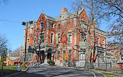
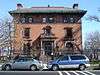
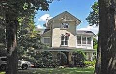
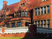
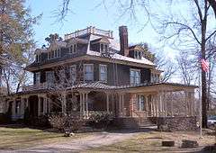
Ambrose-Ward Mansion |
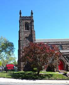
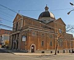
|
000000001982-09-20-0000September 20, 1982
(#82003272) |
132 S. Harrison St.
40°45′51″N 74°13′20″W / 40.764167°N 74.222222°W / 40.764167; -74.222222 (Ambrose-Ward Mansion) |
East Orange |
|
| 3 |
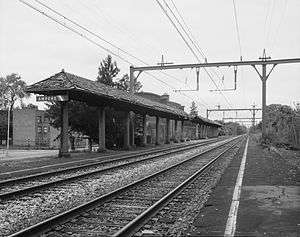
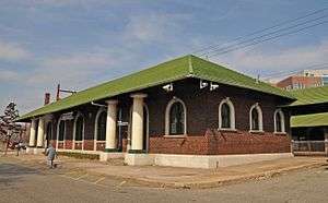
Ampere Station |
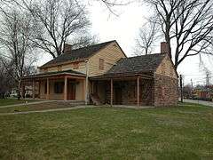
|
000000001984-06-22-0000June 22, 1984
(#84002628) |
Ampere Plaza and Whitney Pl.
40°45′55″N 74°11′40″W / 40.765278°N 74.194444°W / 40.765278; -74.194444 (Ampere Station) |
East Orange |
The station was closed in 1991 and demolished shortly after. Part of the Operating Passenger Railroad Stations Thematic Resource (TR).
|
| 4 |
The Anchorage |
|
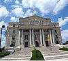
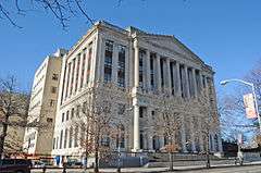
000000001988-07-01-0000July 1, 1988
(#86003061) |
155 Wildwood Ave.
40°50′13″N 74°12′15″W / 40.836944°N 74.204167°W / 40.836944; -74.204167 (The Anchorage) |
Montclair |
part of the Montclair Multiple Resource Area (MRA)
|
| 5 |
Anderson Park |
|
000000002009-12-11-0000December 11, 2009
(#09001073) |
SE corner of Bellevue and North Mountain Ave.
40°50′30″N 74°12′38″W / 40.841578°N 74.210464°W / 40.841578; -74.210464 (Anderson Park) |
Montclair |
First park in first county parks system in country.
|
| 6 |
John Ballantine House |
|
000000001973-10-02-0000October 2, 1973
(#73001093) |
43 Washington St.
40°50′00″N 74°10′16″W / 40.833333°N 74.171111°W / 40.833333; -74.171111 (John Ballantine House) |
Newark |
Now part of Newark Museum
|
| 7 |
Joseph Bardsley House |
|
000000001988-07-01-0000July 1, 1988
(#86003059) |
345 Park St.
40°50′11″N 74°12′09″W / 40.836389°N 74.2025°W / 40.836389; -74.2025 (Joseph Bardsley House) |
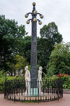
Montclair |
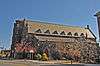
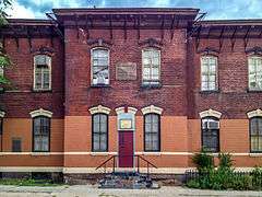
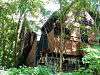
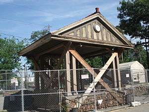
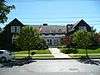
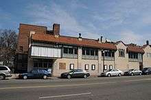
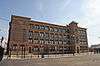
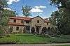
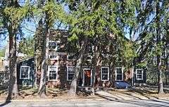
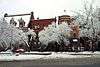
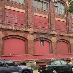
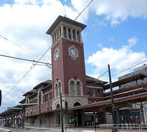
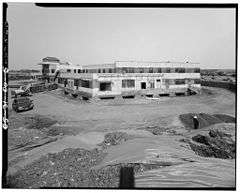
part of the Montclair MRA
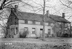
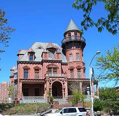
|
| 8 |
Belleville Avenue Congregational Church |
|
000000001986-08-13-0000August 13, 1986
(#86001505) |
151 Broadway
40°45′19″N 74°10′12″W / 40.755278°N 74.17°W / 40.755278; -74.17 (Belleville Avenue Congregational Church) |
Newark |
|
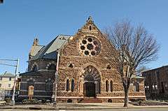
| 9 |
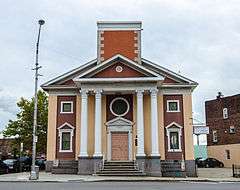
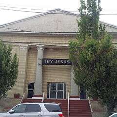
Bethany Baptist Church (Newark, New Jersey) |
|
000000001989-05-10-0000May 10, 1989
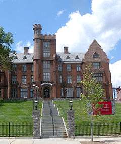
(#88000466) |
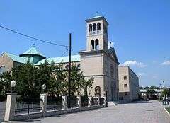
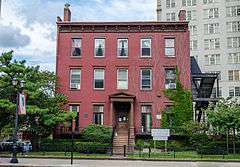
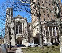
117 W. Market St.
40°44′25″N 74°11′01″W / 40.740278°N 74.183611°W / 40.740278; -74.183611 (Bethany Baptist Church (Newark, New Jersey)) |
Newark |
Photo shows the replacement church. The original has been demolished
|
| 10 |
Bloomfield Green Historic District |
|
000000001978-04-20-0000April 20, 1978
(#78001757) |
Bounded by Belleville Ave., Montgomery, Spruce, State, Liberty, and Franklin Sts.
40°47′48″N 74°11′44″W / 40.796667°N 74.195556°W / 40.796667; -74.195556 (Bloomfield Green Historic District) |
Bloomfield |
|
| 11 |
Bloomfield Station |
|
000000001984-06-22-0000June 22, 1984
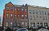
(#84002631) |
Washington St. and Glenwood Ave.
40°47′33″N 74°12′03″W / 40.7925°N 74.200833°W / 40.7925; -74.200833 (Bloomfield Station) |
Bloomfield |
part of the Operating Passenger Railroad Stations TR
|
| 12 |
Bradner`s Pharmacy |
|
000000001988-07-01-0000July 1, 1988
(#86003010) |
33 Watchung Plaza
40°49′48″N 74°12′21″W / 40.83°N 74.205833°W / 40.83; -74.205833 (Bradner`s Pharmacy) |
Montclair |
part of the Montclair MRA
|
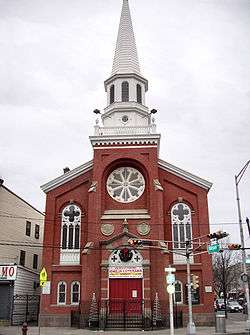
| 13 |
Branch Brook Park |
|
000000001981-01-12-0000January 12, 1981
(#81000392) |
Roughly bounded by Belleville Park, Washington and Clifton Aves., 6th and Orange Sts.
40°46′05″N 74°10′32″W / 40.768056°N 74.175556°W / 40.768056; -74.175556 (Branch Brook Park) |
Newark and Belleville |
|
| 14 |
Brick Church Station |
|
000000001984-06-22-0000June 22, 1984
(#84002636) |
Brick Church Plaza
40°45′56″N 74°13′10″W / 40.765556°N 74.219444°W / 40.765556; -74.219444 (Brick Church Station) |
East Orange |
part of the Operating Passenger Railroad Stations TR
|
| 15 |
Caldwell Presbyterian Church Manse |
|
000000001977-11-16-0000November 16, 1977
(#77000861) |
207 Bloomfield Ave.
40°50′15″N 74°16′22″W / 40.8375°N 74.272778°W / 40.8375; -74.272778 (Caldwell Presbyterian Church Manse) |
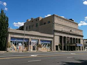
Caldwell |
|
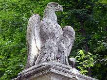
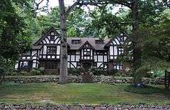
| 16 |
Canfield-Morgan House |
|
000000001995-11-07-0000November 7, 1995
(#95001265) |
899-903 Pompton Ave. (NJ 23)
40°51′48″N 74°13′51″W / 40.863333°N 74.230833°W / 40.863333; -74.230833 (Canfield-Morgan House) |
Cedar Grove |
|
| 17 |
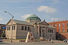
Carnegie Library |
|
000000001988-07-01-0000July 1, 1988
(#86003074) |
Church St. at Valley Rd.
40°48′55″N 74°13′15″W / 40.815278°N 74.220833°W / 40.815278; -74.220833 (Carnegie Library) |
Montclair |
part of the Montclair MRA
|
| 18 |
Casa Deldra |
|
000000001988-07-01-0000July 1, 1988
(#86003062) |
35 Afterglow Way
40°49′18″N 74°13′42″W / 40.821667°N 74.228333°W / 40.821667; -74.228333 (Casa Deldra) |
Montclair |
part of the Montclair MRA
|
| 19 |
Catedral Evangelica Reformada |
|
000000001972-10-26-0000October 26, 1972
(#72000773) |
27 Lincoln Park and Halsey St.
40°43′38″N 74°10′43″W / 40.727222°N 74.178611°W / 40.727222; -74.178611 (Catedral Evangelica Reformada) |
Newark |
|
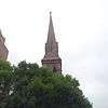
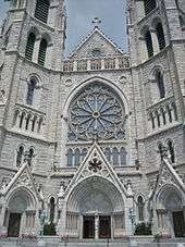
| 20 |
Cathedral of the Sacred Heart |
|
000000001976-12-22-0000December 22, 1976
(#76001151) |
89 Ridge St.
40°45′18″N 74°10′43″W / 40.755°N 74.178611°W / 40.755; -74.178611 (Cathedral of the Sacred Heart) |
Newark |
|
| 21 |
Central Avenue Commercial Historic District |
|
000000001983-08-26-0000August 26, 1983
(#83001600) |
560-654 Central Ave.
40°45′42″N 74°13′29″W / 40.761667°N 74.224722°W / 40.761667; -74.224722 (Central Avenue Commercial Historic District) |
East Orange |
|
| 22 |
Central Presbyterian Church |
|
000000001986-11-14-0000November 14, 1986
(#86003051) |
46 Park St.
40°49′04″N 74°13′04″W / 40.817778°N 74.217778°W / 40.817778; -74.217778 (Central Presbyterian Church) |
Montclair |
part of the Montclair MRA
|
| 23 |
J. M. Chapman House |
|
000000001988-07-01-0000July 1, 1988
(#86002975) |
10 Rockledge
40°49′22″N 74°13′38″W / 40.822778°N 74.227222°W / 40.822778; -74.227222 (J. M. Chapman House) |
Montclair |
part of the Montclair MRA
|
| 24 |
Church Street School |
|
000000001995-08-25-0000August 25, 1995
(#95001042) |
65 Church St., Nutley Township
40°49′07″N 74°09′49″W / 40.818747°N 74.163583°W / 40.818747; -74.163583 (Church Street School) |
Nutley |
|
| 25 |
William Clark House |
|
000000001977-11-10-0000November 10, 1977
(#77000863) |
346 Mount Prospect Ave.
40°45′50″N 74°10′20″W / 40.763889°N 74.172222°W / 40.763889; -74.172222 (William Clark House) |
Newark |
|
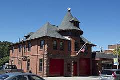
| 26 |
Cliffside Hose Company No. 4 |
|
000000001988-07-01-0000July 1, 1988
(#86003077) |
588 Valley Rd.
40°50′24″N 74°12′34″W / 40.84°N 74.209444°W / 40.84; -74.209444 (Cliffside Hose Company No. 4) |
Montclair |
part of the Montclair MRA
|
| 27 |
Community Hospital |
|
000000002004-03-22-0000March 22, 2004
(#04000224) |
130 W. Kinney St.
40°43′57″N 74°10′57″W / 40.7325°N 74.1825°W / 40.7325; -74.1825 (Community Hospital) |
Newark |
|
| 28 |
Congregational Church |
|
000000001988-07-01-0000July 1, 1988
(#86003050) |
42 S. Fullerton Ave.
40°48′45″N 74°13′11″W / 40.8125°N 74.219722°W / 40.8125; -74.219722 (Congregational Church) |
Montclair |
part of the Montclair MRA
|
| 29 |
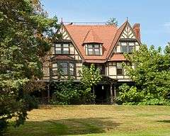
Israel Crane House |
|
000000001973-03-14-0000March 14, 1973
(#73001091) |
110 Orange Road
40°48′41″N 74°13′26″W / 40.811389°N 74.223889°W / 40.811389; -74.223889 (Israel Crane House) |
Montclair |
|
| 30 |
Day Street Public School |
|
000000002012-08-28-0000August 28, 2012
(#12000568) |
29 N. Day St.
40°46′23″N 74°13′44″W / 40.773124°N 74.228978°W / 40.773124; -74.228978 (Day Street Public School) |
Orange |
|
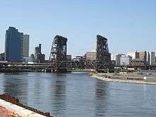
| 31 |
Dock Bridge |
|
000000001980-10-03-0000October 3, 1980
(#80002484) |
Spans Passaic River
40°44′09″N 74°09′43″W / 40.735833°N 74.161944°W / 40.735833; -74.161944 (Dock Bridge) |
Newark |
|
| 32 |
East Orange Station |
|
000000001984-06-22-0000June 22, 1984
(#84002638) |
65 City Hall Plaza
40°45′40″N 74°12′40″W / 40.761111°N 74.211111°W / 40.761111; -74.211111 (East Orange Station) |
East Orange |
part of the Operating Passenger Railroad Stations TR
|
| 33 |
Eastward |
|
000000001988-07-01-0000July 1, 1988
(#86002980) |
50 Lloyd Rd.
40°49′07″N 74°13′45″W / 40.818611°N 74.229167°W / 40.818611; -74.229167 (Eastward) |
Montclair |
part of the Montclair MRA
|
| 34 |
Edison National Historic Site |
|
000000001966-10-15-0000October 15, 1966
(#66000052) |
Main St. between Alden and Lakeside Sts.
40°47′13″N 74°14′16″W / 40.78694°N 74.23778°W / 40.78694; -74.23778 (Edison National Historic Site) |
West Orange |
|
| 35 |
Edison Storage Battery Company Building |
|
000000001996-02-28-0000February 28, 1996
(#96000055) |
177 Main St.
40°46′57″N 74°14′07″W / 40.7825°N 74.235278°W / 40.7825; -74.235278 (Edison Storage Battery Company Building) |
West Orange |
|
| 36 |
Egbert Farm |
|
000000001988-07-01-0000July 1, 1988
(#86002996) |
128 N. Mountain Ave.
40°49′39″N 74°13′08″W / 40.8275°N 74.218889°W / 40.8275; -74.218889 (Egbert Farm) |
Montclair |
part of the Montclair MRA
|
| 37 |
Eighteenth Avenue School |
|
000000002015-04-14-0000April 14, 2015
(#15000151) |
229-243 18th Ave.
40°43′45″N 74°11′31″W / 40.7292°N 74.1919°W / 40.7292; -74.1919 (Eighteenth Avenue School) |
Newark |
|
| 38 |
Enclosure Historic District |
|
000000001974-12-31-0000December 31, 1974
(#74001160) |
Enclosure and Calico Lane
40°49′11″N 74°09′16″W / 40.819722°N 74.154444°W / 40.819722; -74.154444 (Enclosure Historic District) |
Nutley |
|
| 39 |
Essex Club |
|
000000001991-02-22-0000February 22, 1991
(#91000110) |
52 Park Place
40°44′20″N 74°10′07″W / 40.7389°N 74.1687°W / 40.7389; -74.1687 (Essex Club) |
Newark |
|
| 40 |
Essex County Courthouse |
|
000000001975-06-26-0000June 26, 1975
(#75001135) |
470 High St.
40°44′13″N 74°10′45″W / 40.736944°N 74.179167°W / 40.736944; -74.179167 (Essex County Courthouse) |
Newark |
|
| 41 |
Essex County Jail |
|
000000001991-09-03-0000September 3, 1991
(#91001366) |
21 Wilsey St.
40°44′40″N 74°10′58″W / 40.744444°N 74.182778°W / 40.744444; -74.182778 (Essex County Jail) |
Newark |
|
| 42 |
Essex County Park Commission Administration Building |
|
000000001977-11-11-0000November 11, 1977
(#77000864) |
115 Clifton Ave.
40°45′12″N 74°10′41″W / 40.753333°N 74.178056°W / 40.753333; -74.178056 (Essex County Park Commission Administration Building) |
Newark |
|
| 43 |
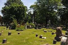
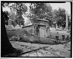
Evergreen Cemetery |
|
000000001991-07-09-0000July 9, 1991
(#91000882) |
1137 N. Broad St.
40°41′32″N 74°12′39″W / 40.692222°N 74.210833°W / 40.692222; -74.210833 (Evergreen Cemetery) |
Newark |
|
| 44 |
Fairfield Dutch Reformed Church |
|
000000001975-10-07-0000October 7, 1975
(#75001134) |
Fairfield Rd.
40°53′04″N 74°16′57″W / 40.884444°N 74.2825°W / 40.884444; -74.2825 (Fairfield Dutch Reformed Church) |
Fairfield |
|
| 45 |
Feigenspan Mansion |
|
000000001977-10-05-0000October 5, 1977
(#77000865) |
710 High St.
40°43′41″N 74°10′58″W / 40.728056°N 74.182778°W / 40.728056; -74.182778 (Feigenspan Mansion) |
Newark |
|
| 46 |
Henry Fenn House |
|
000000001988-07-01-0000July 1, 1988
(#86002988) |
208 N. Mountain Ave.
40°49′59″N 74°13′02″W / 40.833056°N 74.217222°W / 40.833056; -74.217222 (Henry Fenn House) |
Montclair |
part of the Montclair MRA
|
| 47 |
First Baptist Peddie Memorial Church |
|
000000001972-10-30-0000October 30, 1972
(#72000774) |
Broad and Fulton Sts.
40°44′29″N 74°10′09″W / 40.741389°N 74.169167°W / 40.741389; -74.169167 (First Baptist Peddie Memorial Church) |
Newark |
|
| 48 |
First Methodist Episcopal Church |
|
000000001988-07-01-0000July 1, 1988
(#86003048) |
24 N. Fullerton Ave.
40°48′55″N 74°13′06″W / 40.815278°N 74.218333°W / 40.815278; -74.218333 (First Methodist Episcopal Church) |
Montclair |
part of the Montclair MRA
|
| 49 |
First National State Bank Building |
|
000000001977-08-10-0000August 10, 1977
(#77000866) |
810 Broad St.
40°44′04″N 74°10′22″W / 40.734444°N 74.172778°W / 40.734444; -74.172778 (First National State Bank Building) |
Newark |
|
| 50 |
Forest Hill Historic District |
|
000000001990-08-03-0000August 3, 1990
(#90001193) |
Roughly bounded by Verona Ave., Mt. Prospect Ave., 2nd Ave., and Branch Brook Park
40°46′22″N 74°10′14″W / 40.772778°N 74.170556°W / 40.772778; -74.170556 (Forest Hill Historic District) |
Newark |
|
| 51 |
Four Corners Historic District |
|
000000002000-09-08-0000September 8, 2000
(#00001061) |
Roughly bounded by Raymond Blvd., Mulberry St., Hill St. and Washington St.
40°44′06″N 74°10′26″W / 40.735°N 74.173889°W / 40.735; -74.173889 (Four Corners Historic District) |
Newark |
|
| 52 |
Free Public Library, Upper Montclair Branch |
|
000000001988-07-01-0000July 1, 1988
(#86003076) |
185 Bellevue Ave.
40°50′29″N 74°12′19″W / 40.841389°N 74.205278°W / 40.841389; -74.205278 (Free Public Library, Upper Montclair Branch) |
Montclair |
part of the Montclair MRA
|
| 53 |
Glen Ridge Historic District |
|
000000001982-08-09-0000August 9, 1982
(#82004784) |
Roughly bounded by Bay St., Essex and Midland Aves., Adams Pl., Spencer Rd., and Franklin Pl.
• Boundary increase (listed 000000001988-11-14-0000November 14, 1988, refnum 88002155): North side roughly along Ridgewood and Forest Ave. from Bay to Gray St., south side along Hawthorne, Carteret, and Midland Ave.
• Boundary increase (listed 000000002013-07-09-0000July 9, 2013, refnum 13000480): Ridgewood, Sommer, Hawthorne, Victor, Forest, Oakwood, Watchung, Prescott & Sunset Aves., Brooklawn & Stonehouse Rds.
40°47′52″N 74°12′19″W / 40.797778°N 74.205278°W / 40.797778; -74.205278 (Glen Ridge Historic District) |
Glen Ridge |
|
| 54 |
Glencoe |
|
000000001991-10-01-0000October 1, 1991
(#91001481) |
698 Martin Luther King Blvd.
40°43′42″N 74°10′56″W / 40.728333°N 74.182222°W / 40.728333; -74.182222 (Glencoe) |
Newark |
|
| 55 |
Frank Goodwillie House |
|
000000001988-07-01-0000July 1, 1988
(#86003058) |
17 Wayside Pl.
40°48′16″N 74°13′51″W / 40.804444°N 74.230833°W / 40.804444; -74.230833 (Frank Goodwillie House) |
Montclair |
part of the Montclair MRA
|
| 56 |
Grace Church |
|
000000001972-11-02-0000November 2, 1972
(#72000776) |
Broad and Walnut Sts.
40°43′50″N 74°10′28″W / 40.730556°N 74.174444°W / 40.730556; -74.174444 (Grace Church) |
Newark |
|
| 57 |
Griffith Building |
|
000000001984-05-24-0000May 24, 1984
(#84002641) |
605-607 Broad St.
40°44′26″N 74°10′14″W / 40.740556°N 74.170556°W / 40.740556; -74.170556 (Griffith Building) |
Newark |
|
| 58 |
Hahne and Company |
|
000000001994-08-30-0000August 30, 1994
(#94001005) |
609 Broad St.
40°44′25″N 74°10′14″W / 40.740278°N 74.170556°W / 40.740278; -74.170556 (Hahne and Company) |
Newark |
|
| 59 |
Samuel Orton Harrison House |
|
000000001980-06-30-0000June 30, 1980
(#80002488) |
153 Orton Rd.
40°49′50″N 74°18′15″W / 40.830556°N 74.304167°W / 40.830556; -74.304167 (Samuel Orton Harrison House) |
West Caldwell |
|
| 60 |
Haskell`s Bloomfield Villa |
|
000000001988-07-01-0000July 1, 1988
(#86003002) |
84 Llewellyn Rd.
40°48′16″N 74°13′35″W / 40.804444°N 74.226389°W / 40.804444; -74.226389 (Haskell`s Bloomfield Villa) |
Montclair |
part of the Montclair MRA
|
| 61 |
Home Office Building |
|
000000001982-06-17-0000June 17, 1982
(#82003273) |
8-12 Park Pl.
40°44′25″N 74°10′07″W / 40.740278°N 74.168611°W / 40.740278; -74.168611 (Home Office Building) |
Newark |
|
| 62 |
House at 147 Park Street |
|
000000001988-07-01-0000July 1, 1988
(#86003064) |
147 Park St.
40°49′23″N 74°12′40″W / 40.823056°N 74.211111°W / 40.823056; -74.211111 (House at 147 Park Street) |
Montclair |
part of the Montclair MRA
|
| 63 |
House at 18 Brunswick Road |
|
000000001988-07-01-0000July 1, 1988
(#86003035) |
18 Brunswick Rd.
40°49′33″N 74°12′51″W / 40.825833°N 74.214167°W / 40.825833; -74.214167 (House at 18 Brunswick Road) |
Montclair |
part of the Montclair MRA
|
| 64 |
House at 21 Stonebridge Road |
|
000000001988-07-01-0000July 1, 1988
(#86003073) |
21 Stonebridge Rd.
40°48′04″N 74°13′41″W / 40.801111°N 74.228056°W / 40.801111; -74.228056 (House at 21 Stonebridge Road) |
Montclair |
part of the Montclair MRA
|
| 65 |
House at 52 Wayside Place |
|
000000001988-07-01-0000July 1, 1988
(#86003041) |
52 Wayside Pl.
40°48′05″N 74°13′52″W / 40.801389°N 74.231111°W / 40.801389; -74.231111 (House at 52 Wayside Place) |
Montclair |
part of the Montclair MRA
|
| 66 |
House at 53 Lloyd Road |
|
000000001988-07-01-0000July 1, 1988
(#86002973) |
53 Lloyd Rd.
40°49′03″N 74°13′45″W / 40.8175°N 74.229167°W / 40.8175; -74.229167 (House at 53 Lloyd Road) |
Montclair |
part of the Montclair MRA
|
| 67 |
House at 67 Warren Place |
|
000000001988-07-01-0000July 1, 1988
(#86003004) |
67 Warren Pl.
40°48′20″N 74°13′36″W / 40.805556°N 74.226667°W / 40.805556; -74.226667 (House at 67 Warren Place) |
Montclair |
part of the Montclair MRA
|
| 68 |
House at 68 Eagle Rock Way |
|
000000001988-07-01-0000July 1, 1988
(#86003009) |
68 Eagle Rock Way
40°50′28″N 74°12′33″W / 40.841111°N 74.209167°W / 40.841111; -74.209167 (House at 68 Eagle Rock Way) |
Montclair |
part of the Montclair MRA
|
| 69 |
House at 7 South Mountain Terrace |
|
000000001986-11-15-0000November 15, 1986
(#86003235) |
7 S. Mountain Terr.
40°48′37″N 74°13′51″W / 40.810278°N 74.230833°W / 40.810278; -74.230833 (House at 7 South Mountain Terrace) |
Montclair |
part of the Montclair MRA
|
| 70 |
House at 80 Lloyd Road |
|
000000001988-07-01-0000July 1, 1988
(#86003003) |
80 Lloyd Rd.
40°48′57″N 74°13′50″W / 40.815833°N 74.230556°W / 40.815833; -74.230556 (House at 80 Lloyd Road) |
Montclair |
part of the Montclair MRA
|
| 71 |
House at 97 Warren Place |
|
000000001988-07-01-0000July 1, 1988
(#86003070) |
97 Warren Pl.
40°48′39″N 74°13′44″W / 40.810833°N 74.228889°W / 40.810833; -74.228889 (House at 97 Warren Place) |
Montclair |
part of the Montclair MRA
|
| 72 |
House of Prayer Episcopal Church and Rectory |
|
000000001972-10-30-0000October 30, 1972
(#72000777) |
Broad and State Sts.
40°44′53″N 74°10′17″W / 40.748056°N 74.171389°W / 40.748056; -74.171389 (House of Prayer Episcopal Church and Rectory) |
Newark |
|
| 73 |
The House that Lives |
|
000000001988-07-01-0000July 1, 1988
(#86002976) |
83 Watchung Ave.
40°49′52″N 74°12′34″W / 40.831111°N 74.209444°W / 40.831111; -74.209444 (The House that Lives) |
Montclair |
part of the Montclair MRA
|
| 74 |
Indian and the Puritan |
|
000000001994-10-28-0000October 28, 1994
(#94001256) |
Opposite 5 Washington St.
40°44′38″N 74°10′13″W / 40.743889°N 74.170278°W / 40.743889; -74.170278 (Indian and the Puritan) |
Newark |
part of the Public Sculpture in Newark Multiple Property Submission (MPS)
|
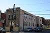
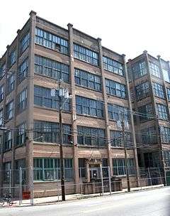
| 75 |
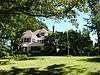
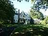
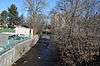
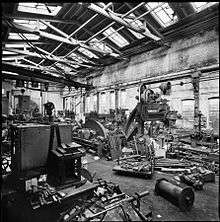
Interstate Hosiery Mills, Inc. Mill Building |
|
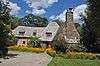
000000002009-12-30-0000December 30, 2009
(#09001176) |
110 N. Fulton St.
40°47′16″N 74°12′27″W / 40.787803°N 74.207631°W / 40.787803; -74.207631 (Interstate Hosiery Mills, Inc. Mill Building) |
Bloomfield |
|
| 76 |
Jacobus House |
|
000000001975-04-01-0000April 1, 1975
(#75001133) |
178 Grove Ave.
40°51′03″N 74°14′06″W / 40.850833°N 74.235°W / 40.850833; -74.235 (Jacobus House) |
Cedar Grove |
|
| 77 |
James Street Commons Historic District |
|
000000001978-01-09-0000January 9, 1978
(#78001758) |
Roughly bounded by Halsey, Warren, Boyden, Bleeker, Orange, and Broad Sts.
40°44′36″N 74°10′25″W / 40.743333°N 74.173611°W / 40.743333; -74.173611 (James Street Commons Historic District) |
Newark |
|
| 78 |
James Street Commons Historic District Addendum |
|
000000001983-09-22-0000September 22, 1983
(#83001601) |
18 Washington Pl.
40°44′30″N 74°10′16″W / 40.741667°N 74.171111°W / 40.741667; -74.171111 (James Street Commons Historic District Addendum) |
Newark |
|
| 79 |
Eugene V. Kelly Carriage House |
|
000000001975-11-10-0000November 10, 1975
(#75001136) |
S. Orange Ave., Seton Hall University campus
40°44′40″N 74°14′38″W / 40.744444°N 74.243889°W / 40.744444; -74.243889 (Eugene V. Kelly Carriage House) |
South Orange |
Historic building from 1887, with 5 acres, now on Seton Hall University campus
|
| 80 |
Kingsland Manor |
|
000000001978-03-24-0000March 24, 1978
(#78001762) |
3 Kingsland St.
40°49′35″N 74°08′35″W / 40.826389°N 74.143056°W / 40.826389; -74.143056 (Kingsland Manor) |
Nutley |
|
| 81 |
Krueger Mansion |
|
000000001972-11-09-0000November 9, 1972
(#72000778) |
601 High St.
40°43′57″N 74°10′54″W / 40.7325°N 74.181667°W / 40.7325; -74.181667 (Krueger Mansion) |
Newark |
|
| 82 |
Lincoln Park Historic District |
|
000000001984-01-05-0000January 5, 1984
(#84002646) |
Lincoln Park, Clinton Ave., and Spruce and Broad Sts.
40°43′35″N 74°10′46″W / 40.726389°N 74.179444°W / 40.726389; -74.179444 (Lincoln Park Historic District) |
Newark |
|
| 83 |
Llewellyn Park Historic District |
|
000000001986-02-28-0000February 28, 1986
(#86000423) |
Roughly bounded by Eagle Rock Ave., Main St., Pleasant Ave., and NJ 280
40°47′37″N 74°14′25″W / 40.793611°N 74.240278°W / 40.793611; -74.240278 (Llewellyn Park Historic District) |
West Orange |
|
| 84 |
Maplewood Memorial Park |
|
000000002015-08-03-0000August 3, 2015
(#15000489) |
Bounded by Oakland & Dunnell Rds., Valley & Baker Sts.
40°43′51″N 74°16′23″W / 40.73079°N 74.27297°W / 40.73079; -74.27297 (Maplewood Memorial Park) |
Maplewood |
|
| 85 |
Maplewood Municipal Building |
|
000000002014-10-01-0000October 1, 2014
(#14000810) |
574 Valley St.
40°43′48″N 74°16′18″W / 40.7301°N 74.2716°W / 40.7301; -74.2716 (Maplewood Municipal Building) |
Maplewood |
|
| 86 |
Marlboro Park Historic District |
|
000000001988-07-22-0000July 22, 1988
(#86002967) |
Roughly along Fairfield St., Waterbury Rd., Montclair Ave., and Watchung Ave. between N. Fullerton and Grove Sts.
40°49′46″N 74°12′09″W / 40.829444°N 74.2025°W / 40.829444; -74.2025 (Marlboro Park Historic District) |
Montclair |
part of the Montclair MRA
|
| 87 |
Marsellis House |
|
000000001988-07-01-0000July 1, 1988
(#86003031) |
190 Cooper Ave.
40°50′19″N 74°12′21″W / 40.838611°N 74.205833°W / 40.838611; -74.205833 (Marsellis House) |
Montclair |
part of the Montclair MRA
|
| 88 |
Military Park Commons Historic District |
|
000000002004-06-18-0000June 18, 2004
(#04000649) |
Roughly bounded by Washington Pl., McCarter Hwy, E. Park St. and Raymond Blvd.
40°44′19″N 74°10′09″W / 40.738631°N 74.169286°W / 40.738631; -74.169286 (Military Park Commons Historic District) |
Newark |
|
| 89 |
Miller Street Historic District |
|
000000001988-07-01-0000July 1, 1988
(#86002971) |
Miller and Fulton Sts. between Elmwood Ave., Elm, and New Sts.
40°48′26″N 74°12′53″W / 40.807222°N 74.214722°W / 40.807222; -74.214722 (Miller Street Historic District) |
Montclair |
part of the Montclair MRA
|
| 90 |
George A. Miller House |
|
000000001988-07-01-0000July 1, 1988
(#86002979) |
275 Claremont Ave.
40°49′13″N 74°13′11″W / 40.820278°N 74.219722°W / 40.820278; -74.219722 (George A. Miller House) |
Montclair |
part of the Montclair MRA
|
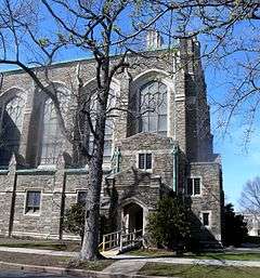
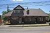
| 91 |
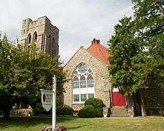
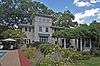
Montclair Art Museum |
|
000000001986-11-14-0000November 14, 1986
(#86002984) |
3 S. Mountain Ave.
40°49′07″N 74°13′27″W / 40.818611°N 74.224167°W / 40.818611; -74.224167 (Montclair Art Museum) |
Montclair |
part of the Montclair MRA
|
| 92 |
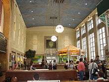
Montclair Railroad Station |
|
000000001973-01-08-0000January 8, 1973
(#73001092) |
Lackawanna Plaza
40°48′41″N 74°12′48″W / 40.811389°N 74.213333°W / 40.811389; -74.213333 (Montclair Railroad Station) |
Montclair |
|
| 93 |
Montrose Park Historic District |
|
000000001997-08-29-0000August 29, 1997
(#97000978) |
Roughly bounded by S. Orange, Sanford, and Heywood Aves., and Holland Rd.
40°44′57″N 74°14′52″W / 40.749167°N 74.247778°W / 40.749167; -74.247778 (Montrose Park Historic District) |
South Orange |
|
| 94 |
Morris Canal |
|
000000001974-10-01-0000October 1, 1974
(#74002228) |
Irregular line beginning at Phillipsburg and ending at Jersey City
40°41′08″N 75°09′49″W / 40.685556°N 75.163611°W / 40.685556; -75.163611 (Morris Canal) |
Not Applicable |
|
| 95 |
Mount Pleasant Cemetery |
|
000000001988-10-28-0000October 28, 1988
(#87000836) |
375 Broadway
40°45′50″N 74°09′51″W / 40.763889°N 74.164167°W / 40.763889; -74.164167 (Mount Pleasant Cemetery) |
Newark |
|
| 96 |
Mountain Avenue Station |
|
000000001984-06-22-0000June 22, 1984
(#84002654) |
451 Upper Mountain Ave.
40°50′57″N 74°12′21″W / 40.849167°N 74.205833°W / 40.849167; -74.205833 (Mountain Avenue Station) |
Upper Montclair |
part of the Operating Passenger Railroad Stations TR
|
| 97 |
Mountain District |
|
000000001988-07-22-0000July 22, 1988
(#86002970) |
Roughly bounded by Highland, Bradford, Upper Mountain, and Claremont Aves.
40°49′52″N 74°13′10″W / 40.831111°N 74.219444°W / 40.831111; -74.219444 (Mountain District) |
Montclair |
part of the Montclair MRA
|
| 98 |
Mountain Station |
|
000000001984-09-29-0000September 29, 1984
(#84002656) |
449 Vose Ave.
40°45′17″N 74°15′13″W / 40.754722°N 74.253611°W / 40.754722; -74.253611 (Mountain Station) |
South Orange |
part of the Operating Passenger Railroad Stations TR
|
| 99 |
Mulford House |
|
000000001988-07-01-0000July 1, 1988
(#86003038) |
207 Union St.
40°48′42″N 74°13′50″W / 40.811667°N 74.230556°W / 40.811667; -74.230556 (Mulford House) |
Montclair |
part of the Montclair MRA
|
| 100 |
Murphy Varnish Works |
|
000000001979-03-09-0000March 9, 1979
(#79001484) |
McWhorter, Vesey, and Chestnut Sts.
40°43′28″N 74°10′14″W / 40.724444°N 74.170556°W / 40.724444; -74.170556 (Murphy Varnish Works) |
Newark |
|
| 101 |
Mutual Benefit Life Insurance Company |
|
000000001983-11-17-0000November 17, 1983
(#83004031) |
300 Broadway and 2nd St.
40°45′40″N 74°10′10″W / 40.761111°N 74.169444°W / 40.761111; -74.169444 (Mutual Benefit Life Insurance Company) |
Newark |
|
| 102 |
New Jersey Bell Headquarters Building |
|
000000002005-09-21-0000September 21, 2005
(#05001054) |
540 Broad St.
40°44′42″N 74°10′08″W / 40.745°N 74.168889°W / 40.745; -74.168889 (New Jersey Bell Headquarters Building) |
Newark |
|
| 103 |
New Point Baptist Church |
|
000000001972-11-02-0000November 2, 1972
(#72000779) |
17 E. Kinney St.
40°43′41″N 74°10′32″W / 40.728056°N 74.175556°W / 40.728056; -74.175556 (New Point Baptist Church) |
Newark |
|
| 104 |
Newark Broad Street Station |
|
000000001984-06-22-0000June 22, 1984
(#84002662) |
Broad and University Sts.
40°44′50″N 74°10′20″W / 40.747222°N 74.172222°W / 40.747222; -74.172222 (Newark Broad Street Station) |
Newark |
part of the Operating Passenger Railroad Stations TR
|
| 105 |
Newark City Hall |
|
000000001978-02-17-0000February 17, 1978
(#78001759) |
920 Broad St.
40°43′54″N 74°10′27″W / 40.731667°N 74.174167°W / 40.731667; -74.174167 (Newark City Hall) |
Newark |
|
| 106 |
Newark Female Charitable Society |
|
000000001979-09-12-0000September 12, 1979
(#79001485) |
305 Halsey St., 41-43 Hill St.
40°43′56″N 74°10′36″W / 40.732222°N 74.176667°W / 40.732222; -74.176667 (Newark Female Charitable Society) |
Newark |
|
| 107 |
Newark Metropolitan Airport Buildings |
|
000000001980-12-12-0000December 12, 1980
(#80002485) |
U.S. 22
40°42′23″N 74°09′45″W / 40.706389°N 74.1625°W / 40.706389; -74.1625 (Newark Metropolitan Airport Buildings) |
Newark |
|
| 108 |
Newark Orphan Asylum |
|
000000001973-06-19-0000June 19, 1973
(#73001094) |
High and Bleeker Sts., Newark College of Engineering
40°44′36″N 74°15′37″W / 40.743333°N 74.260278°W / 40.743333; -74.260278 (Newark Orphan Asylum) |
Newark |
|
| 109 |
North Broad Street Historic District |
|
000000001996-07-23-0000July 23, 1996
(#96000813) |
136-148 Broad St.
40°45′27″N 74°10′08″W / 40.7575°N 74.168889°W / 40.7575; -74.168889 (North Broad Street Historic District) |
Newark |
|
| 110 |
North Reformed Church |
|
000000001972-10-05-0000October 5, 1972
(#72000780) |
510 Broad St.
40°44′39″N 74°10′10″W / 40.744167°N 74.169444°W / 40.744167; -74.169444 (North Reformed Church) |
Newark |
|
| 111 |
Oakes Estate |
|
000000001981-08-06-0000August 6, 1981
(#81000390) |
240 Belleville Ave.
40°47′56″N 74°11′27″W / 40.798889°N 74.190833°W / 40.798889; -74.190833 (Oakes Estate) |
Bloomfield |
|
| 112 |
Old First Presbyterian Church |
|
000000001972-11-02-0000November 2, 1972
(#72000781) |
820 Broad St.
40°44′03″N 74°10′22″W / 40.734167°N 74.172778°W / 40.734167; -74.172778 (Old First Presbyterian Church) |
Newark |
|
| 113 |
Orange Free Public Library |
|
000000001981-09-28-0000September 28, 1981
(#81000393) |
348 Main St.
40°46′21″N 74°13′56″W / 40.7725°N 74.232222°W / 40.7725; -74.232222 (Orange Free Public Library) |
Orange |
|
| 114 |
Orange Memorial Hospital Historic District |
|
000000002015-11-17-0000November 17, 2015
(#15000797) |
180 S. Essex Ave.
40°46′05″N 74°14′02″W / 40.768157°N 74.233936°W / 40.768157; -74.233936 (Orange Memorial Hospital Historic District) |
Orange |
|
| 114 |
Orange Station |
|
000000001984-06-22-0000June 22, 1984
(#84002665) |
73 Lincoln Ave.
40°46′18″N 74°14′02″W / 40.771667°N 74.233889°W / 40.771667; -74.233889 (Orange Station) |
Orange |
part of the Operating Passenger Railroad Stations TR
|
| 115 |
Pan American C.M.A. Church |
|
000000001972-07-31-0000July 31, 1972
(#72000782) |
76 Prospect St.
40°43′48″N 74°09′47″W / 40.73°N 74.163056°W / 40.73; -74.163056 (Pan American C.M.A. Church) |
Newark |
|
| 116 |
Passaic Machine Works-Watts, Campbell & Company |
|
000000001986-08-13-0000August 13, 1986
(#86001503) |
1270 McCarter Hwy.
40°45′02″N 74°10′04″W / 40.750556°N 74.167778°W / 40.750556; -74.167778 (Passaic Machine Works-Watts, Campbell & Company) |
Newark |
|
| 117 |
Pennsylvania Station |
|
000000001978-12-20-0000December 20, 1978
(#78001760) |
Raymond Plaza West
40°44′03″N 74°09′53″W / 40.734167°N 74.164722°W / 40.734167; -74.164722 (Pennsylvania Station) |
Newark |
|
| 118 |
Pine Street Historic District |
|
000000002000-03-16-0000March 16, 2000
(#00000175) |
Roughly bounded by Glenridge Ave., the NJ TRANSIT Boonton Line, Pine and Baldwin Sts.
40°48′35″N 74°12′28″W / 40.809722°N 74.207778°W / 40.809722; -74.207778 (Pine Street Historic District) |
Montclair |
|
| 119 |
Post Office Building, Upper Montclair |
|
000000001988-07-01-0000July 1, 1988
(#86003012) |
242-244 Bellevue Ave.
40°50′28″N 74°12′33″W / 40.841111°N 74.209167°W / 40.841111; -74.209167 (Post Office Building, Upper Montclair) |
Montclair |
part of the Montclair MRA
|
| 120 |
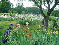
Presby Memorial Iris Gardens Horticultural Center |
|
000000001980-09-17-0000September 17, 1980
(#80002483) |
474 Upper Mountain Ave.
40°51′05″N 74°12′23″W / 40.851389°N 74.206389°W / 40.851389; -74.206389 (Presby Memorial Iris Gardens Horticultural Center) |
Montclair |
|
| 121 |
Protestant Foster Home |
|
000000001986-02-13-0000February 13, 1986
(#86000211) |
272-284 Broadway
40°45′37″N 74°10′11″W / 40.760278°N 74.169722°W / 40.760278; -74.169722 (Protestant Foster Home) |
Newark |
|
| 122 |
Queen of Angels Church |
|
000000001972-10-26-0000October 26, 1972
(#72000783) |
Belmont Ave. at Morton St.
40°43′00″N 74°11′22″W / 40.716667°N 74.189444°W / 40.716667; -74.189444 (Queen of Angels Church) |
Newark |
|
| 123 |
M. F. Reading House |
|
000000001988-07-01-0000July 1, 1988
(#86003006) |
87 Midland Ave.
40°49′10″N 74°13′01″W / 40.819444°N 74.216944°W / 40.819444; -74.216944 (M. F. Reading House) |
Montclair |
part of the Montclair MRA
|
| 124 |
Red Gables |
|
000000001988-07-01-0000July 1, 1988
(#86002992) |
99 S. Fullerton Ave.
40°48′29″N 74°13′08″W / 40.808056°N 74.218889°W / 40.808056; -74.218889 (Red Gables) |
Montclair |
part of the Montclair MRA
|
| 125 |
Reformed Dutch Church of Second River |
|
000000001978-12-21-0000December 21, 1978
(#78001756) |
171 Main St.
40°47′12″N 74°08′58″W / 40.786667°N 74.149444°W / 40.786667; -74.149444 (Reformed Dutch Church of Second River) |
Belleville |
|
| 126 |
Riverbank Park |
|
000000001998-04-16-0000April 16, 1998
(#98000351) |
Roughly bounded by Van Buren, Market, and Somme Sts., and Passaic R.
40°43′55″N 74°09′09″W / 40.731944°N 74.1525°W / 40.731944; -74.1525 (Riverbank Park) |
Newark |
|
| 127 |
Route 1 Extension |
|
000000002005-08-12-0000August 12, 2005
(#05000880) |
US 1 and 9 milepoint: 51.25-54.55, NJ 139 milepoint 0-1.45
40°44′09″N 74°05′30″W / 40.73583°N 74.09167°W / 40.73583; -74.09167 (Route 1 Extension) |
Newark |
Includes Pulaski Skyway. Also listed in Hudson County section.
|
| 128 |
Salaam Temple |
|
000000001977-10-05-0000October 5, 1977
(#77000867) |
1020 Broad St.
40°43′40″N 74°10′35″W / 40.727778°N 74.176389°W / 40.727778; -74.176389 (Salaam Temple) |
Newark |
Later became Newark Symphony Hall
|
| 129 |
Charles S. Shultz House |
|
000000001979-07-22-0000July 22, 1979
(#79001482) |
30 N. Mountain Ave.
40°49′17″N 74°13′24″W / 40.821389°N 74.223333°W / 40.821389; -74.223333 (Charles S. Shultz House) |
Montclair |
|
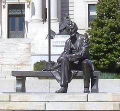
| 130 |
Seated Lincoln |
|
000000001995-03-30-0000March 30, 1995
(#95000303) |
Junction of Springfield and Market Sts., Essex County Courthouse Plaza
40°44′13″N 74°10′40″W / 40.736944°N 74.177778°W / 40.736944; -74.177778 (Seated Lincoln) |
Newark |
part of the Public Sculpture in Newark MPS
|
| 131 |
Second Reformed Dutch Church |
|
000000001979-03-07-0000March 7, 1979
(#79001486) |
178-184 Edison Pl.
40°43′57″N 74°09′51″W / 40.7325°N 74.164167°W / 40.7325; -74.164167 (Second Reformed Dutch Church) |
Newark |
|
| 132 |
Short Hills Park Historic District |
|
000000001980-09-18-0000September 18, 1980
(#80002482) |
Off NJ 24
40°43′53″N 74°19′38″W / 40.731389°N 74.327222°W / 40.731389; -74.327222 (Short Hills Park Historic District) |
Millburn |
|
| 133 |
S. C. Smith House |
|
000000001988-07-01-0000July 1, 1988
(#86002978) |
40 Northview Ave.
40°50′23″N 74°12′25″W / 40.839722°N 74.206944°W / 40.839722; -74.206944 (S. C. Smith House) |
Montclair |
part of the Montclair MRA
|
| 134 |
South Orange Fire Department |
|
000000001998-03-19-0000March 19, 1998
(#98000255) |
Junction of First and Sloan Sts.
40°44′43″N 74°15′39″W / 40.745278°N 74.260833°W / 40.745278; -74.260833 (South Orange Fire Department) |
South Orange Village |
|
| 135 |
South Orange Station |
|
000000001984-06-22-0000June 22, 1984
(#84002669) |
19 Sloan St.
40°44′45″N 74°15′39″W / 40.745833°N 74.260833°W / 40.745833; -74.260833 (South Orange Station) |
South Orange |
part of the Operating Passenger Railroad Stations TR
|
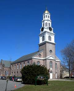
| 136 |
South Orange Village Hall |
|
000000001976-05-28-0000May 28, 1976
(#76001152) |
S. Orange Ave. and Scotland Rd.
40°44′46″N 74°15′30″W / 40.746111°N 74.258333°W / 40.746111; -74.258333 (South Orange Village Hall) |
South Orange |
|
| 137 |
South Park Calvary United Presbyterian Church |
|
000000001972-12-05-0000December 5, 1972
(#72000784) |
1035 Broad St.
40°43′34″N 74°10′31″W / 40.726111°N 74.175278°W / 40.726111; -74.175278 (South Park Calvary United Presbyterian Church) |
Newark |
|
| 138 |
St. Barnabas' Episcopal Church |
|
000000001972-10-18-0000October 18, 1972
(#72000785) |
W. Market St. and Sussex and Roseville Aves.
40°45′04″N 74°11′38″W / 40.751111°N 74.193889°W / 40.751111; -74.193889 (St. Barnabas' Episcopal Church) |
Newark |
|
| 139 |
St. Casimir's Roman Catholic Church |
|
000000001997-07-09-0000July 9, 1997
(#97000773) |
164 Nichols St.
40°43′24″N 74°09′32″W / 40.723333°N 74.158889°W / 40.723333; -74.158889 (St. Casimir's Roman Catholic Church) |
Newark |
|
| 140 |
St. Columba's Church |
|
000000001972-10-30-0000October 30, 1972
(#72000786) |
Pennsylvania Ave. and Brunswick St.
40°43′28″N 74°10′49″W / 40.724444°N 74.180278°W / 40.724444; -74.180278 (St. Columba's Church) |
Newark |
|
| 141 |
St. James' A. M. E. Church |
|
000000001972-10-18-0000October 18, 1972
(#72000787) |
High and Court Sts.
40°43′57″N 74°10′52″W / 40.7325°N 74.181111°W / 40.7325; -74.181111 (St. James' A. M. E. Church) |
Newark |
|
| 142 |
St. John's Church |
|
000000001972-10-30-0000October 30, 1972
(#72000789) |
22-26 Mulberry St.
40°44′17″N 74°09′58″W / 40.738056°N 74.166111°W / 40.738056; -74.166111 (St. John's Church) |
Newark |
|
| 143 |
St. Joseph's Roman Catholic Church Rectory and School |
|
000000001980-12-08-0000December 8, 1980
(#80002486) |
W. Market St.
40°44′35″N 74°11′11″W / 40.743056°N 74.186389°W / 40.743056; -74.186389 (St. Joseph's Roman Catholic Church Rectory and School) |
Newark |
|
| 144 |
St. Lucy's Church |
|
000000001998-12-31-0000December 31, 1998
(#98001570) |
19-26 Ruggiero Plaza
40°45′01″N 74°10′36″W / 40.750278°N 74.176667°W / 40.750278; -74.176667 (St. Lucy's Church) |
Newark |
|
| 145 |
St. Luke's Church |
|
000000001988-07-01-0000July 1, 1988
(#86003045) |
69 S. Fullerton Ave.
40°48′36″N 74°13′06″W / 40.81°N 74.218333°W / 40.81; -74.218333 (St. Luke's Church) |
Montclair |
part of the Montclair MRA
|
| 146 |
St. Mark's Episcopal Church |
|
000000001977-09-22-0000September 22, 1977
(#77000868) |
13 Main St.
40°46′37″N 74°14′21″W / 40.776944°N 74.239167°W / 40.776944; -74.239167 (St. Mark's Episcopal Church) |
West Orange |
|
| 147 |
St. Mary's Abbey Church |
|
000000001972-11-03-0000November 3, 1972
(#72000790) |
High and William Sts.
40°44′09″N 74°17′13″W / 40.735833°N 74.286944°W / 40.735833; -74.286944 (St. Mary's Abbey Church) |
Newark |
|
| 148 |
St. Patrick's Pro Cathedral |
|
000000001972-11-03-0000November 3, 1972
(#72000791) |
Washington St. and Central Ave.
40°44′31″N 74°10′21″W / 40.741944°N 74.1725°W / 40.741944; -74.1725 (St. Patrick's Pro Cathedral) |
Newark |
|
| 149 |
St. Rocco's Roman Catholic Church |
|
000000001980-09-29-0000September 29, 1980
(#80002487) |
212-216 Hunterdon St.
40°44′15″N 74°11′35″W / 40.7375°N 74.193056°W / 40.7375; -74.193056 (St. Rocco's Roman Catholic Church) |
Newark |
|
| 150 |
St. Stephan's Church |
|
000000001972-10-05-0000October 5, 1972
(#72000792) |
Ferry St. and Wilson Ave.
40°43′40″N 74°09′20″W / 40.727778°N 74.155556°W / 40.727778; -74.155556 (St. Stephan's Church) |
Newark |
|
| 151 |
Stanley Theater |
|
000000001986-08-28-0000August 28, 1986
(#86001957) |
985 S. Orange Ave.
40°44′48″N 74°13′46″W / 40.746667°N 74.229444°W / 40.746667; -74.229444 (Stanley Theater) |
Newark |
|
| 152 |
State Street Public School |
|
000000001990-08-03-0000August 3, 1990
(#90001201) |
15 State St.
40°44′56″N 74°10′18″W / 40.748889°N 74.171667°W / 40.748889; -74.171667 (State Street Public School) |
Newark |
|
| 153 |
Stone Eagles |
|
000000001988-07-01-0000July 1, 1988
(#86003005) |
60 Undercliff Rd.
40°48′27″N 74°14′02″W / 40.8075°N 74.233889°W / 40.8075; -74.233889 (Stone Eagles) |
Montclair |
part of the Montclair MRA
|
| 154 |
Stone House by the Stone House Brook |
|
000000001991-11-22-0000November 22, 1991
(#87001333) |
219 S. Orange Ave.
40°44′42″N 74°15′13″W / 40.745°N 74.253611°W / 40.745; -74.253611 (Stone House by the Stone House Brook) |
South Orange |
|
| 155 |
Sydenham House |
|
000000001970-07-29-0000July 29, 1970
(#70000384) |
Old Road to Bloomfield, at Heller Pkwy.
40°46′36″N 74°10′21″W / 40.776667°N 74.1725°W / 40.776667; -74.1725 (Sydenham House) |
Newark |
|
| 156 |
Symington House |
|
000000001979-03-02-0000March 2, 1979
(#79001487) |
2 Park Place
40°44′26″N 74°10′07″W / 40.740556°N 74.168611°W / 40.740556; -74.168611 (Symington House) |
Newark |
|
| 157 |
Temple B'Nai Abraham |
|
000000002007-04-26-0000April 26, 2007
(#07000358) |
621 Clinton Ave.
40°43′23″N 74°12′25″W / 40.723056°N 74.206944°W / 40.723056; -74.206944 (Temple B'Nai Abraham) |
Newark |
|
| 158 |
Trinity Cathedral |
|
000000001972-11-03-0000November 3, 1972
(#72000793) |
Broad and Rector Sts.
40°44′25″N 74°10′09″W / 40.740278°N 74.169167°W / 40.740278; -74.169167 (Trinity Cathedral) |
Newark |
|
| 159 |
Upper Montclair Station |
|
000000001984-06-22-0000June 22, 1984
(#84002673) |
275 Bellvue Ave.
40°50′31″N 74°12′35″W / 40.841944°N 74.209722°W / 40.841944; -74.209722 (Upper Montclair Station) |
Upper Montclair |
part of the Operating Passenger Railroad Stations TR
|
| 160 |
Van Ness House |
|
000000001977-07-29-0000July 29, 1977
(#77000862) |
236 Little Falls Rd.
40°52′59″N 74°15′35″W / 40.883056°N 74.259722°W / 40.883056; -74.259722 (Van Ness House) |
Fairfield |
|
| 161 |
Van Reyper-Bond House |
|
000000001979-01-22-0000January 22, 1979
(#79001483) |
848 Valley Rd.
40°51′23″N 74°12′00″W / 40.856389°N 74.2°W / 40.856389; -74.2 (Van Reyper-Bond House) |
Montclair |
|
| 162 |
Von Schmid House |
|
000000001988-07-01-0000July 1, 1988
(#86002974) |
580 Park St.
40°51′07″N 74°11′49″W / 40.851944°N 74.196944°W / 40.851944; -74.196944 (Von Schmid House) |
Montclair |
part of the Montclair MRA
|
| 163 |
Vreeland Homestead |
|
000000001994-10-14-0000October 14, 1994
(#94001217) |
216 Chesnut St.
40°49′09″N 74°10′12″W / 40.819167°N 74.17°W / 40.819167; -74.17 (Vreeland Homestead) |
Nutley |
|
| 164 |
Ward-Force House and Condit Family Cook House |
|
000000001981-12-29-0000December 29, 1981
(#81000391) |
366 S. Livingston Ave.
40°46′54″N 74°19′00″W / 40.781667°N 74.316667°W / 40.781667; -74.316667 (Ward-Force House and Condit Family Cook House) |
Livingston |
|
| 165 |
Wars of America |
|
000000001994-10-28-0000October 28, 1994
(#94001257) |
Military Park, 614-706 Broad St.
40°44′20″N 74°10′11″W / 40.7388°N 74.1697°W / 40.7388; -74.1697 (Wars of America) |
Newark |
part of the Public Sculpture in Newark MPS
|
| 166 |
Watchung Avenue Station |
|
000000001984-06-22-0000June 22, 1984
(#84002674) |
Park St.
40°49′46″N 74°12′25″W / 40.829444°N 74.206944°W / 40.829444; -74.206944 (Watchung Avenue Station) |
Montclair |
part of the Operating Passenger Railroad Stations TR
|
| 167 |
Weequahic Park Historic District |
|
000000002003-02-12-0000February 12, 2003
(#03000013) |
Roughly bounded by Meeker Ave., Dayton St., the Union County border and Maple Ave.
40°42′06″N 74°12′19″W / 40.701667°N 74.205278°W / 40.701667; -74.205278 (Weequahic Park Historic District) |
Newark |
|
| 168 |
Wickcliffe Presbyterian Church |
|
000000001978-05-22-0000May 22, 1978
(#78001761) |
111 13th Ave.
40°44′19″N 74°11′05″W / 40.738611°N 74.184722°W / 40.738611; -74.184722 (Wickcliffe Presbyterian Church) |
Newark |
|
| 169 |
Allyn Wight House |
|
000000001988-07-01-0000July 1, 1988
(#86003007) |
75 Gates Ave.
40°48′25″N 74°13′08″W / 40.806944°N 74.218889°W / 40.806944; -74.218889 (Allyn Wight House) |
Montclair |
part of the Montclair MRA
|
| 170 |
Williams-Harrison House |
|
000000001979-03-13-0000March 13, 1979
(#79001488) |
126 Eagle Rock Ave.
40°49′14″N 74°17′24″W / 40.820556°N 74.29°W / 40.820556; -74.29 (Williams-Harrison House) |
Roseland |
|
| 171 |
Woman's Club of Upper Montclair |
|
000000002012-09-04-0000September 4, 2012
(#12000594) |
200 Cooper Avenue
40°50′21″N 74°12′24″W / 40.839171°N 74.206595°W / 40.839171; -74.206595 (Woman's Club of Upper Montclair) |
Montclair |
part of the Clubhouses of New Jersey Women's Clubs MPS |
.jpg)


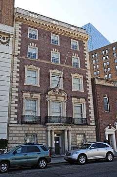


%2C_N._Fulton_St.%2C_Bloomfield%2C_New_Jersey.JPG)

.jpg)


%2C_Montclair%2C_Essex_County%2C_NJ_HABS_NJ%2C7-MONC%2C4-1.tif.jpg)