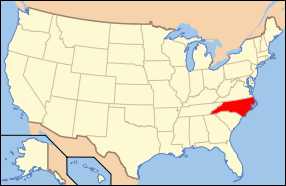
National Register of Historic Places listings in Wayne County, North Carolina
This list includes properties and districts listed on the National Register of Historic Places in Wayne County, North Carolina. Click the "Map of all coordinates" link to the right to view a Google map of all properties and districts with latitude and longitude coordinates in the table below.[1]
Current listings
- This National Park Service list is complete through NPS recent listings posted December 2, 2016.[2]
| [3] |
Name on the Register[4] |
Image |
Date listed[5] |
Location |
City or town |
Description |
|---|
| 1 |
Charles B. Aycock Birthplace |
Upload image |
000000001970-02-26-0000February 26, 1970
(#70000482) |
6 miles from jct. of SR 1542 and U.S. 117
35°31′11″N 77°58′30″W / 35.519722°N 77.975°W / 35.519722; -77.975 (Charles B. Aycock Birthplace) |
Fremont |
|
| 2 |
Barnes-Hooks Farm |
Upload image |
000000001995-09-01-0000September 1, 1995
(#95001072) |
414 Stuckey Rd.
35°34′15″N 77°59′05″W / 35.570833°N 77.984722°W / 35.570833; -77.984722 (Barnes-Hooks Farm) |
Fremont |
|
| 3 |
Borden Manufacturing Company |
Upload image |
000000002005-02-02-0000February 2, 2005
(#04001583) |
800 and 801 N. William St.
35°23′41″N 77°59′19″W / 35.394722°N 77.988611°W / 35.394722; -77.988611 (Borden Manufacturing Company) |
Goldsboro |
|
| 4 |
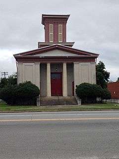
Eureka United Methodist Church |
Upload image |
000000001982-08-26-0000August 26, 1982
(#82003520) |
Church St.
35°32′40″N 77°52′47″W / 35.544444°N 77.879722°W / 35.544444; -77.879722 (Eureka United Methodist Church) |
Eureka |
|
| 5 |
First Presbyterian Church |
|
000000001979-05-29-0000May 29, 1979
(#79003340) |
111 W. Ash St.
35°23′10″N 77°59′50″W / 35.386111°N 77.997222°W / 35.386111; -77.997222 (First Presbyterian Church) |
Goldsboro |
|
| 6 |
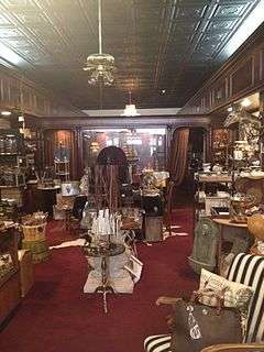
L. D. Giddens and Son Jewelry Store |
|
000000001979-03-19-0000March 19, 1979
(#79001763) |
135 S. Center St.
35°22′56″N 77°59′52″W / 35.382325°N 77.997733°W / 35.382325; -77.997733 (L. D. Giddens and Son Jewelry Store) |
Goldsboro |
|
| 7 |
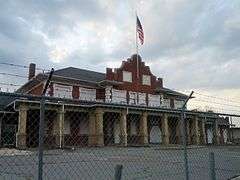
Goldsboro Union Station |
|
000000001977-04-13-0000April 13, 1977
(#77001015) |
101 North Carolina St.
35°23′05″N 78°00′15″W / 35.384722°N 78.004167°W / 35.384722; -78.004167 (Goldsboro Union Station) |
Goldsboro |
|
| 8 |
Harry Fitzhugh Lee House |
Upload image |
000000001984-03-01-0000March 1, 1984
(#84002542) |
310 W. Walnut St.
35°23′03″N 78°00′11″W / 35.384167°N 78.003056°W / 35.384167; -78.003056 (Harry Fitzhugh Lee House) |
Goldsboro |
|
| 9 |
Mount Olive High School |
Upload image |
000000001998-10-22-0000October 22, 1998
(#98001266) |
100 Wooten St.
35°12′01″N 78°04′23″W / 35.200278°N 78.073056°W / 35.200278; -78.073056 (Mount Olive High School) |
Mount Olive |
|
| 10 |
Mount Olive Historic District |
Upload image |
000000001999-05-27-0000May 27, 1999
(#99000639) |
Roughly bounded by Park Ave., Wooten, Nelson, and Johnson Sts.
35°11′42″N 78°04′09″W / 35.195°N 78.069167°W / 35.195; -78.069167 (Mount Olive Historic District) |
Mount Olive |
|
| 11 |
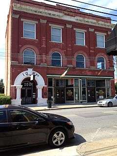
Odd Fellows Lodge |
|
000000001978-08-03-0000August 3, 1978
(#78001984) |
111-115 N. John St.
35°23′00″N 77°59′43″W / 35.383261°N 77.995386°W / 35.383261; -77.995386 (Odd Fellows Lodge) |
Goldsboro |
|
| 12 |
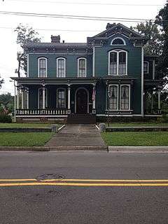
Perry-Cherry House |
Upload image |
000000001986-03-13-0000March 13, 1986
(#86000392) |
308 W. Main St.
35°11′50″N 78°04′14″W / 35.197222°N 78.070556°W / 35.197222; -78.070556 (Perry-Cherry House) |
Mount Olive |
|
| 13 |
Southerland-Burnette House |
Upload image |
000000001988-02-08-0000February 8, 1988
(#88000057) |
201 N. Chesnut St.
35°11′51″N 78°04′04″W / 35.1975°N 78.067778°W / 35.1975; -78.067778 (Southerland-Burnette House) |
Mount Olive |
|
| 14 |
U.S. Post Office, Former |
Upload image |
000000001995-06-02-0000June 2, 1995
(#95000670) |
124 W. James St.
35°11′50″N 78°04′01″W / 35.197222°N 78.066944°W / 35.197222; -78.066944 (U.S. Post Office, Former) |
Mount Olive |
|
| 15 |
Vernon |
|
000000001974-10-09-0000October 9, 1974
(#74001387) |
Address Restricted
|
Mount Olive |
Demolished[6]
|
| 16 |
Solomon and Henry Weil Houses |
|
000000001976-12-22-0000December 22, 1976
(#76001350) |
204 and 200 W. Chestnut St.
35°22′56″N 78°00′00″W / 35.382169°N 78.000067°W / 35.382169; -78.000067 (Solomon and Henry Weil Houses) |
Goldsboro |
|
| 17 |
Dred and Ellen Yelverton House |
Upload image |
000000002009-08-27-0000August 27, 2009
(#09000662) |
1979 NC 222 E.
35°33′36″N 78°00′28″W / 35.559897°N 78.0078°W / 35.559897; -78.0078 (Dred and Ellen Yelverton House) |
Fremont |
|
See also
References
- ↑ The latitude and longitude information provided in this table was derived originally from the National Register Information System, which has been found to be fairly accurate for about 99% of listings. For about 1% of NRIS original coordinates, experience has shown that one or both coordinates are typos or otherwise extremely far off; some corrections may have been made. A more subtle problem causes many locations to be off by up to 150 yards, depending on location in the country: most NRIS coordinates were derived from tracing out latitude and longitudes off of USGS topographical quadrant maps created under the North American Datum of 1927, which differs from the current, highly accurate WGS84 GPS system used by most on-line maps. Chicago is about right, but NRIS longitudes in Washington are higher by about 4.5 seconds, and are lower by about 2.0 seconds in Maine. Latitudes differ by about 1.0 second in Florida. Some locations in this table may have been corrected to current GPS standards.
- ↑ "National Register of Historic Places: Weekly List Actions". National Park Service, United States Department of the Interior. Retrieved on December 2, 2016.
- ↑ Numbers represent an ordering by significant words. Various colorings, defined here, differentiate National Historic Landmarks and historic districts from other NRHP buildings, structures, sites or objects.
- ↑ National Park Service (2008-04-24). "National Register Information System". National Register of Historic Places. National Park Service.
- ↑ The eight-digit number below each date is the number assigned to each location in the National Register Information System database, which can be viewed by clicking the number.
- ↑ "North Carolina Listings in the National Register of Historic Places by County". North Carolina State Historic Preservation Office. 22 October 2008. Retrieved 6 July 2009.
|
|---|
|
| Topics | | |
|---|
|
Lists
by county | |
|---|
|
| Other lists | |
|---|
|
|---|
|
| Topics | |
|---|
|
| Lists by states | |
|---|
|
| Lists by insular areas | |
|---|
|
| Lists by associated states | |
|---|
|
| Other areas | |
|---|
|
-
 Portal Portal
-
 WikiProject WikiProject
|