Newton Falls, Ohio
| Newton Falls, Ohio | |
|---|---|
| Village | |
 | |
| Motto: "Working toward a better tomorrow!" | |
 Location of Newton Falls, Ohio | |
 Location of Newton Falls in Trumbull County | |
| Coordinates: 41°11′20″N 80°58′11″W / 41.18889°N 80.96972°WCoordinates: 41°11′20″N 80°58′11″W / 41.18889°N 80.96972°W | |
| Country | United States |
| State | Ohio |
| County | Trumbull |
| Government | |
| • Mayor | Lyle A. Waddell |
| Area[1] | |
| • Total | 2.39 sq mi (6.19 km2) |
| • Land | 2.31 sq mi (5.98 km2) |
| • Water | 0.08 sq mi (0.21 km2) |
| Elevation[2] | 932 ft (284 m) |
| Population (2010)[3] | |
| • Total | 4,795 |
| • Estimate (2012[4]) | 4,739 |
| • Density | 2,075.8/sq mi (801.5/km2) |
| Time zone | Eastern (EST) (UTC-5) |
| • Summer (DST) | EDT (UTC-4) |
| ZIP code | 44444 |
| Area code(s) | 330 |
| FIPS code | 39-55650[5] |
| GNIS feature ID | 1065149[2] |
| Website | http://ci.newtonfalls.oh.us/ |
Newton Falls is a village located within Newton Township in Trumbull County, Ohio, United States. The population was 4,795 at the 2010 census. It is part of the Youngstown-Warren-Boardman, OH-PA Metropolitan Statistical Area.
The village is known for its ZIP code, which is 44444, and for its covered bridge, which is the second oldest in the state of Ohio.
The village earned its name from the two sets of falls within the village, each on different branches of the Mahoning River.
History
Newton Falls was likely named for the first school teacher, Newton, and the falls south of the Covered Bridge. It grew in part from factors such as the river and its falls, steel manufacturing, and the proximity of the nearby Ravenna Training and Logistics Site.[6]
On May 31, 1985, an F5 tornado struck the city as part of The 1985 United States-Canadian tornado outbreak, a deadly series of tornadoes that swept through Ohio, Pennsylvania, New York, and Ontario, Canada. The tornado to hit Newton Falls was the only F5 to hit Ohio that day. The tornado damaged most of the downtown area destroying dozens of homes, damaging the Senior and Junior High Schools (destroying the gymnasium and rendering the Junior High unusable), and devastating many businesses. Remarkably, no deaths were attributed to the tornado. There were between 70 and 80 injuries in the entire town.[7][8] They discovered that just in Newton Falls alone, 400 families were homeless and the entire central business district had been destroyed.[7] They indicated that warning sirens were the main reason the death toll, which was zero, wasn't that high. "If it hadn't been for the (warning) sirens, the death toll" that was zero "might have been higher," stated Ohio National Guard Major Calvin Taylor.[7] There was even television footage of one of the freight trains being taken from its tracks.[9]
On July 6, 2012, the city was shaken by a shooting rampage in the East River Gardens apartment complex. Robert Brazzon murdered four people, including a fifteen year-old boy, before taking his own life in a city cemetery. He believed his girlfriend was stealing his illegal drugs; he was addicted to opiate pain medication and heroin for years due to his failing health. He had a decades-long criminal history, an obsession with firearms, and was a loner with few friends. Despite being caught earlier with homemade bombs and thousands of illegally-obtained pills in his house, he was never jailed for these offenses, instead taking a plea deal that have him probation. [10]
Attractions
Covered Bridge
Newton Falls is home to an early 19th-century covered bridge, which was constructed over the Mahoning River in 1831. A walkway was added to the side of the bridge in 1921–1922. In 1985 the bridge was repaired after being damaged by the Niles/Wheatland tornado.[11] In December 2007 the bridge was reopened after a two-year restoration funded by government grants. In July 2009 a delivery truck damaged the bridge and rendered it out of service until repairs could be made. It reopened in 2010.[12]The Newton Falls bridge is considered the second oldest existing covered bridge in Ohio, the oldest covered bridge in use on its original site, the only covered bridge in the state with a covered crosswalk, and the last surviving covered bridge in Trumbull County. Built on the Town Lattice truss plan, the bridge is 123 feet long and twenty-four feet wide. It has a clear span of 101 1/2 feet and a sixteen foot-wide roadway.[13]
Fourth of July Festivities
The village last celebrated Dicker Days in 1987. It holds the largest Fourth of July Festivities in the county, which have been annual since 1946. The normally sleepy little town brings in up to 40,000 spectators to view the Parade and Fireworks, as well as a week-long carnival with entertainment provided by the Newton Falls Fourth of July Festivities Committee which is made up entirely of volunteers. The committee raises money for the fireworks through a Car Show, Bike Show, and 10,000 Dollar Raffle, in addition to donations.
Arts in the Park
This festival celebrates all forms of the Fine & Professional Arts and is organized by Christine Spletzer-Newman. It is very deliberately a collection of arts to do rather than arts to view. Festival goers paint legal graffiti on train cars, roll wheelchairs through paint and onto canvas, participate in the creation of a fairytale, and more. This summer event is held in the beautiful waterfall centered park known as Veteran's Park. Admission and most events are free.
Geography
Newton Falls is located at 41°11′20″N 80°58′11″W / 41.18889°N 80.96972°W.[14]
According to the United States Census Bureau, the city has a total area of 2.39 square miles (6.19 km2), of which 2.31 square miles (5.98 km2) is land and 0.08 square miles (0.21 km2) is water.[1]
The Mahoning River flows through Newton Falls.
Demographics
| Historical population | |||
|---|---|---|---|
| Census | Pop. | %± | |
| 1880 | 575 | — | |
| 1890 | 698 | 21.4% | |
| 1900 | 732 | 4.9% | |
| 1910 | 757 | 3.4% | |
| 1920 | 1,100 | 45.3% | |
| 1930 | 3,458 | 214.4% | |
| 1940 | 3,120 | −9.8% | |
| 1950 | 4,451 | 42.7% | |
| 1960 | 5,038 | 13.2% | |
| 1970 | 5,378 | 6.7% | |
| 1980 | 4,960 | −7.8% | |
| 1990 | 4,866 | −1.9% | |
| 2000 | 5,002 | 2.8% | |
| 2010 | 4,795 | −4.1% | |
| Est. 2015 | 4,654 | [15] | −2.9% |
As of the census[5] of 2000, there were 5,002 people, 2,171 households, and 1,346 families residing in the city. The population density was 2,193.1 people per square mile (847.1/km²). There were 2,376 housing units at an average density of 1,041.7 per square mile (402.4/km²). The racial makeup of the city was 98.10% White, 0.38% African American, 0.42% Native American, 0.06% Asian, 0.04% Pacific Islander, 0.24% from other races, and 0.76% from two or more races. Hispanic or Latino of any race were 0.64% of the population.
There were 2,171 households out of which 28.9% had children under the age of 18 living with them, 46.1% were married couples living together, 12.1% had a female householder with no husband present, and 38.0% were non-families. 33.3% of all households were made up of individuals and 14.9% had someone living alone who was 65 years of age or older. The average household size was 2.30 and the average family size was 2.95.
In the village the population was spread out with 24.8% under the age of 18, 8.0% from 18 to 24, 29.1% from 25 to 44, 22.2% from 45 to 64, and 15.9% who were 65 years of age or older. The median age was 37 years. For every 100 females there were 89.2 males. For every 100 females age 18 and over, there were 85.7 males.
The median income for a household in the village was $32,827, and the median income for a family was $41,250. Males had a median income of $34,067 versus $21,992 for females. The per capita income for the village was $16,039. About 8.1% of families and 10.5% of the population were below the poverty line, including 18.8% of those under age 18 and 4.5% of those age 65 or over.
2010 census
As of the census[3] of 2010, there were 4,795 people, 2,064 households, and 1,236 families residing in the village. The population density was 2,075.8 inhabitants per square mile (801.5/km2). There were 2,395 housing units at an average density of 1,036.8 per square mile (400.3/km2). The racial makeup of the village was 97.6% White, 0.8% African American, 0.1% Native American, 0.1% Asian, 0.2% from other races, and 1.2% from two or more races. Hispanic or Latino of any race were 1.1% of the population.
There were 2,064 households of which 29.3% had children under the age of 18 living with them, 41.9% were married couples living together, 13.9% had a female householder with no husband present, 4.1% had a male householder with no wife present, and 40.1% were non-families. 34.8% of all households were made up of individuals and 15.2% had someone living alone who was 65 years of age or older. The average household size was 2.30 and the average family size was 2.98.
The median age in the village was 40 years. 23.4% of residents were under the age of 18; 7.8% were between the ages of 18 and 24; 25.3% were from 25 to 44; 26.4% were from 45 to 64; and 17.1% were 65 years of age or older. The gender makeup of the village was 47.5% male and 52.5% female.
Government
Township
The township is governed by a three-member Board of Trustees. Each is elected for a four-year term. The Trustees meet the fourth Monday of each month at the Township Administration Building
- Trustee: Pete Augusta
- Trustee: Gregory Dubos
- Trustee: Robert Page
Village
The village government consists of five elected city councilmen (each representing different wards), an elected mayor (who serves on the council and votes in the event of a tie), and a village manager.
- Village Manager: Jack Haney
- Mayor: Lyle A. Waddell
- Councilman, Ward 1: Richard Zamecnik
- Councilwoman, Ward 2: Nancy Hoffman
- Councilman, Ward 3: Richard Monteville
- Councilman, Ward 4: Jim Luonuansuu
- Councilwoman, At-Large: Mary-Ann Johnson
Education
Newton Falls is served by the Newton Falls Exempted Village Schools district. The district operates 3 traditional schools:
- Newton Falls High School
- Newton Falls Middle School
- Newton Falls Elementary
Media
Newspapers
- The Bridge
- The Newton Falls Herald (defunct)
- The Review
- The Weekly Villager
Transportation
Major highways
Other highways
Notable people
- Clara Louise Bell, painter[17]
- Earnie Shavers, heavyweight boxing contender
- Patricia Cooksey, horse jockey
- Edward H. Ives, Wisconsin State Senator
- Jack Kucek, major league baseball player
- Jessica Lea Mayfield, singer and songwriter
- Karl Hoerig, U.S. Air Force Major and slain combat veteran
References
- 1 2 "US Gazetteer files 2010". United States Census Bureau. Retrieved January 6, 2013.
- 1 2 "US Board on Geographic Names". United States Geological Survey. October 25, 2007. Retrieved January 31, 2008.
- 1 2 "American FactFinder". United States Census Bureau. Retrieved January 6, 2013.
- ↑ "Population Estimates". United States Census Bureau. Retrieved June 17, 2013.
- 1 2 "American FactFinder". United States Census Bureau. Retrieved January 31, 2008.
- ↑ "Newton Falls & Newton Township, Ohio History". Newton Falls Public Library. Retrieved November 9, 2009.
- 1 2 3 Green, Larry (June 2, 1985). "Tornadoes Death Toll Rises to 90 Thousands in Ohio, Pennsylvania Left Homeless in Storms: [Home Edition]". Los Angeles Times. Retrieved October 5, 2012.
- ↑ "Tornado Photos and Video". Retrieved January 31, 2007.
- ↑ Unknown (June 1, 1985). "Pennsylvania, Ohio and Canada Twisters Kill 45 Hundreds Injured, Devastation is Widespread as Single Storm System Spawns Many Tornadoes:[Home Edition]". Los Angeles Times. Retrieved October 5, 2012.
- ↑ http://wkbn.com/2013/07/01/newton-falls-mass-murderer-killed-family-over-drug-theft/
- ↑ "Covered Bridge". Newton Falls Public Library. Retrieved November 9, 2009.
- ↑ Runyan, Ed (October 22, 2009). "Covered bridge to stay closed for $57K repairs". The Vindicator. Retrieved November 9, 2009.
- ↑ ""
- ↑ "US Gazetteer files: 2010, 2000, and 1990". United States Census Bureau. February 12, 2011. Retrieved April 23, 2011.
- ↑ "Annual Estimates of the Resident Population for Incorporated Places: April 1, 2010 to July 1, 2015". Retrieved July 2, 2016.
- ↑ "Census of Population and Housing". Census.gov. Retrieved June 4, 2015.
- ↑ "Clara Louise Bell". Smithsonian American Art Museum. Smithsonian Institution. Retrieved 17 December 2015.
External links
Municipalities and communities of Trumbull County, Ohio, United States | ||
|---|---|---|
| Cities | 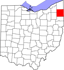 | |
| Villages | ||
| Townships | ||
| CDPs |
| |
| Unincorporated communities | ||
| Footnotes | ‡This populated place also has portions in an adjacent county or counties | |