Nikiforovsky District
| Nikiforovsky District Никифоровский район (Russian) | |
|---|---|
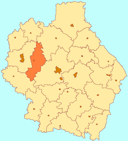 Location of Nikiforovsky District in Tambov Oblast | |
| Coordinates: 52°53′04″N 40°47′22″E / 52.88444°N 40.78944°ECoordinates: 52°53′04″N 40°47′22″E / 52.88444°N 40.78944°E | |
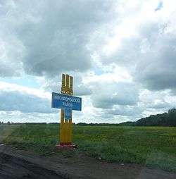 Entrance to Nikiforovsky District | |
.png) | |
|
| |
| Location | |
| Country | Russia |
| Federal subject | Tambov Oblast[1] |
| Administrative structure (as of April 2012) | |
| Administrative center | work settlement of Dmitriyevka[1] |
| Administrative divisions:[1] | |
| Settlement councils | 1 |
| Selsoviets | 5 |
| Inhabited localities:[1] | |
| Urban-type settlements[2] | 1 |
| Rural localities | 56 |
| Municipal structure (as of April 2012) | |
| Municipally incorporated as | Nikiforovsky Municipal District[3] |
| Municipal divisions:[3] | |
| Urban settlements | 1 |
| Rural settlements | 5 |
| Statistics | |
| Area | 1,191.4 km2 (460.0 sq mi)[4] |
| Population (2010 Census) | 20,066 inhabitants[5] |
| • Urban | 42.0% |
| • Rural | 58.0% |
| Density | 16.84/km2 (43.6/sq mi)[6] |
| Time zone | MSK (UTC+03:00)[7] |
| Official website | |
| Nikiforovsky District on WikiCommons | |
Nikiforovsky District (Russian: Ники́форовский райо́н) is an administrative[1] and municipal[3] district (raion), one of the twenty-three in Tambov Oblast, Russia. It is located in the west and northwest of the oblast. The area of the district is 1,191.4 square kilometers (460.0 sq mi).[4] Its administrative center is the urban locality (a work settlement) of Dmitriyevka.[1] Population: 20,066 (2010 Census);[5] 22,970 (2002 Census);[8] 26,181 (1989 Census).[9] The population of the administrative center accounts for 42.0% of the district's total population.[5]
Geography
Nikiforovsky District is in the north-central region of Tambov Oblast, about 40 km west of the city of Tambov, and 15 km east of Michurinsk. The Bolshoy Voronezh River runs from north-to-south through the district. The river is a tributary of the Voronezh River, and part of the Don River basin. The terrain is flat with draws and ravines, with steppe and forest-steppe vegetation.[10] The black soil of the district supports agriculture, and there are deposits of limestone and other minerals in the area.
The district is elongated in shape, measuring about 110 km north-south and 25 km west-east. The administrative center of the district is the city of Demitriyevka. The Lipetsk-Tambov highway runs across the middle of the district, as does the Moscow-Volgograd (E119) highway. Subdivisions of the district include one urban and 5 rural settlements.[10] In the east-center of the district is the Ozero Yaroslavlskoye, a large reservoir.
As of January, 2016, the three largest towns are Demitrievka (pop. 7,751), Ekaterinin (pop. 2,749), and Saburo-Pokrovskoye (pop. 2,748).[11] To the north, the area is bordered by Sosnovsky District, in the east by Tambovsky District, in the south by Petrovsky District, and in the west by Michurinsky District.
Climate
Average January temperature in Demitrievka is −10 °C (14 °F), and average July temperature is 20 °C (68 °F). Annual precipitation is 546 millimeters (21.5 in), and falls mostly in April through October.[12] The climate is Humid continental climate, cool summer, (Dfb). This climate is characterized by large swings in temperature, both diurnially and seasonally, with mild summers and cold, snowy winters.
History
As with much of the north Tambov region, significant settlement began in 1635, with the building of the Belgorod Line, and the expansion of the fort as Kozlov (now the town of Michurinsky, 20 km to the west) [13] The line of fortifications from Belgorod to Simbirsk ran through what is now the Nikiforovsky District, leaving many sites of archaeological and cultural significance.[14]
In 1869, the South East Railway laid tracks through the district, on which the Nikiforovko station was built.
During the Great Patriotic War, over 14,000 citizens of Nikiforovsky District were enlisted in the Red Army; 6,436 did not return.[14]
Economy
Employment in the district is focused on food processing, light industry, and agriculture.
Agriculture
Nikiforovsky is an agricultural district, with farm revenues split about 65% crops and 35% livestock. The most important grains are wheat, barley and sunflower.[15] Approximately 70,336 hectares (60%) of the total area of the district is in cultivation for crops. In 2014, the top seven crops by area were:
| Crop | Cultivated Area (ha) | % of Culitvated Area |
|---|---|---|
| Winter wheat | 18,143 | 28 |
| Summer Barley | 15,150 | 23 |
| Sunflower grain | 13,548 | 21 |
| Spring wheat | 6,006 | 9 |
| Soybeans | 4,591 | 7 |
| Sugar beet (factory) | 3,772 | 6 |
| Peas | 2,756 | 4 |
Transportation
The Michurinsk-Tambov line of the South Easter Railway crosses Nikiforovsky District through the town of Demitrievka, with the main station 'Nikiforovka', and other stations about every 20 km. Detailed route map of South East Railway (in Russian) A E119 highway, from the north to Tambov, runs west-east across the middle of the district.
Culture
The Catherine Arboretum and experimental plant institute displays 230 species of trees and shrubs; it was founded in the 19th century by a local landlord, AA Ushakov.
References
- 1 2 3 4 5 6 Law #72-Z
- ↑ The count of urban-type settlements may include the work settlements, the resort settlements, the suburban (dacha) settlements, as well as urban-type settlements proper.
- 1 2 3 Law #232-Z
- 1 2 "Descriptive Statistics - Nikiforovsky" (in Russian). Federal State Statistics Service, Russian Federation. Retrieved July 17, 2016.
- 1 2 3 Russian Federal State Statistics Service (2011). "Всероссийская перепись населения 2010 года. Том 1" [2010 All-Russian Population Census, vol. 1]. Всероссийская перепись населения 2010 года (2010 All-Russia Population Census) (in Russian). Federal State Statistics Service. Retrieved June 29, 2012.
- ↑ The value of density was calculated automatically by dividing the 2010 Census population by the area specified in the infobox. Please note that this value is only approximate as the area specified in the infobox does not necessarily correspond to the area of the entity proper or is reported for the same year as the population.
- ↑ Правительство Российской Федерации. Федеральный закон №107-ФЗ от 3 июня 2011 г. «Об исчислении времени», в ред. Федерального закона №271-ФЗ от 03 июля 2016 г. «О внесении изменений в Федеральный закон "Об исчислении времени"». Вступил в силу по истечении шестидесяти дней после дня официального опубликования (6 августа 2011 г.). Опубликован: "Российская газета", №120, 6 июня 2011 г. (Government of the Russian Federation. Federal Law #107-FZ of June 31, 2011 On Calculating Time, as amended by the Federal Law #271-FZ of July 03, 2016 On Amending Federal Law "On Calculating Time". Effective as of after sixty days following the day of the official publication.).
- ↑ Russian Federal State Statistics Service (May 21, 2004). "Численность населения России, субъектов Российской Федерации в составе федеральных округов, районов, городских поселений, сельских населённых пунктов – районных центров и сельских населённых пунктов с населением 3 тысячи и более человек" [Population of Russia, Its Federal Districts, Federal Subjects, Districts, Urban Localities, Rural Localities—Administrative Centers, and Rural Localities with Population of Over 3,000] (XLS). Всероссийская перепись населения 2002 года [All-Russia Population Census of 2002] (in Russian). Retrieved August 9, 2014.
- ↑ Demoscope Weekly (1989). "Всесоюзная перепись населения 1989 г. Численность наличного населения союзных и автономных республик, автономных областей и округов, краёв, областей, районов, городских поселений и сёл-райцентров" [All Union Population Census of 1989: Present Population of Union and Autonomous Republics, Autonomous Oblasts and Okrugs, Krais, Oblasts, Districts, Urban Settlements, and Villages Serving as District Administrative Centers]. Всесоюзная перепись населения 1989 года [All-Union Population Census of 1989] (in Russian). Институт демографии Национального исследовательского университета: Высшая школа экономики [Institute of Demography at the National Research University: Higher School of Economics]. Retrieved August 9, 2014.
- 1 2 "About the region". Nikiforovsky District (Official website). Nikiforovsky District. Retrieved July 10, 2016.
- ↑ "Population of Municipalities in Tambov Region, January 1, 2016" (PDF) (in Russian). TERRITORIAL AUTHORITY OF THE FEDERAL SERVICE STATE STATISTICS for Tambov Region. Retrieved July 16, 2016.
- ↑ "Climate: Demetrievka". Climate-Data.org. Climate-Date.org. Retrieved 17 July 2016.
- ↑ Davies, Brian (2004). State power and community in early modern Russia : the case of Kozlov, 1635-1649. Palgrave Macmillan. p. 72. Retrieved 17 July 2016.
- 1 2 "Nikiforovsky District - History". Nikiforovsky District (Official Website). Nikiforovsky District. Retrieved 17 July 2016.
- ↑ "Descriptive Statistics - Nikiforovsky District (Scroll down for agricultural statistics" (in Russian). Federal State Statistics Service, Russian Federation. Retrieved July 16, 2016.
Sources
- Тамбовская областная Дума. Закон №72-З от 21 июня 1996 г. «Об административно-территориальном устройстве Тамбовской области», в ред. Закона №544-З от 11 июня 2015 г. «О внесении изменений в статью 7 Закона Тамбовской области "Об административно-территориальном устройстве Тамбовской области"». Опубликован: "Тамбовская жизнь", №131, 1996 г. (Tambov Oblast Duma. Law #72-Z of June 21, 1996 On the Administrative-Territorial Structure of Tambov Oblast, as amended by the Law #544-Z of June 11, 2015 On Amending Article 7 of the Law of Tambov Oblast "On the Administrative-Territorial Structure of Tambov Oblast". ).
- Тамбовская областная Дума. Закон №232-З от 17 сентября 2004 г. «Об установлении границ и определении места нахождения представительных органов муниципальных образований в Тамбовской области», в ред. Закона №606-З от 7 декабря 2015 г. «О внесении изменений в Закон Тамбовской области "Об установлении границ и определении места нахождения представительных органов муниципальных образований в Тамбовской области"». Вступил в силу со дня официального опубликования. Опубликован: "Тамбовская жизнь", №185 (23125). (Tambov Oblast Duma. Law #232-Z of September 17, 2004 On Establishing the Borders and Determining the Location of the Representative Organs of the Municipal Formations of Tambov Oblast, as amended by the Law #606-Z of December 7, 2015 On Amending the Law of Tambov Oblast "On Establishing the Borders and Determining the Location of the Representative Organs of the Municipal Formations of Tambov Oblast". Effective as of the official publication date.).
External links
- Nikiforovsky Official map of the district
- Nikiforovsky District on OpenStreetMap.org
- Nikiforovsky District on GoogleMaps
| Cities and towns | |||
|---|---|---|---|
| Districts | |||