Panagarh
| Panagarh পানাগড় | |
|---|---|
| Town | |
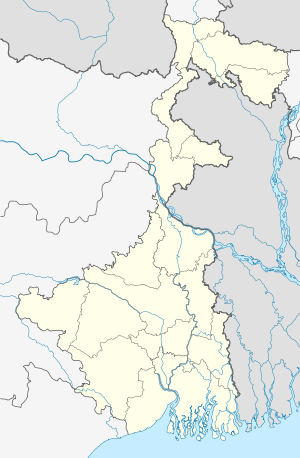 Panagarh  Panagarh Location in West Bengal, India | |
| Coordinates: 23°27′N 87°26′E / 23.45°N 87.43°ECoordinates: 23°27′N 87°26′E / 23.45°N 87.43°E | |
| Country |
|
| State | West Bengal |
| District | Bardhaman |
| Elevation | 58 m (190 ft) |
| Languages | |
| • Official | Bengali, English |
| Time zone | IST (UTC+5:30) |
| Vehicle registration | WB |
| Lok Sabha constituency | Bardhaman-Durgapur |
| Vidhan Sabha constituency | Galsi |
| Website |
bardhaman |
Panagarh is the easternmost suburb of Durgapur, located in Kanksa police station of Durgapur subdivision in Bardhaman District of West Bengal. Both the Indian Army and the Indian Air Force have their establishment here. An airport is also located here which is extensively used by Indian Air Force.
Geography
Panagarh is located at 23°27′N 87°26′E / 23.45°N 87.43°E.[1] It has an average elevation of 58 m (190 ft). The Asansol-Durgapur region is composed of undulating laterite soil. This area lies between two rivers – the Damodar and the Ajay. They flow almost parallel to each other in the region – the average distance between the two rivers is around 30 km. For ages the area was heavily forested and infested with plunderers and marauders. The discovery of coal led to industrialisation of the area and most of the forests have been cleared.[2] Vehicle Depot Panagarh and Ammunition Depot Panagarh are army largest military suppliers in the country.
Transport
It is connected by both roads and railways with Kolkata, the state's capital, located approximately 150 km in south east direction.
NH 2/Grand Trunk Road passes through Panagarh. The Panagarh–Morgram Highway links it to NH 34.
Randiha is a nearby picnic spot. Kasba another rich cultural village 13 km away from Panagarh
Other settlements
Panagarh has a large military army base of Eastern command.Its vehicle depot and ammunition depot is largest military supplier in the country. Air Force Station Arjan Singh of IAF's Eastern Air Command is located here. [3]
Education
Panagarh has five primary schools, Rama Krishna Ashrama Vidyapitha, The kendriya vidyalaya, secondary school (Panagarh Railway Colony School) and two higher secondary schools (Panagarh Bazar Hindi High School and Kanksha High School).[4]
Professional Education in Durgapur :-
Panagarh has 2 engineering colleges viz. Aryabhatta Institute Of Engineering and Management ( Popularly known as Aryabhatta engineering college, Durgapur or AIEMD [5]) & Techno India, Durgapur. Other nearby engineering colleges are Durgapur Institute Of Advanced Technology & Management, at Rajbandh. & Kanad Institute Of Engineering & Management at Mankar . The engineering colleges are affiliated to West Bengal University Of Technology, Kolkata.
It is also having Kendriya Vidyalaya Higher Secondary school. There is Manisha International School[6] near Rajbandh, under Rahul Foundation.
Health care
Although situated in suburbs, Panagarh has some fine doctors and hospitals/Nursing Homes. Noticeable among them are Rama Nursing Centre, situated at Saradapally, Railpar; proprietor Dr. K.G. Mondal. There are numerous government healthcare campaigns held here including vaccination camps. The Lion's Club Eye Hospital is there for eye treatments. Besides, emergency and Trauma care has been re established with the foundation of Gouri Devi Hospital and Research Institute,[7] Rajbandh.
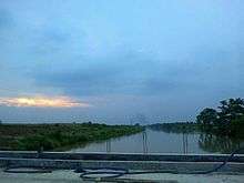
Panagarh Bypass
Panagarh bypass is recently the much talked about topic in Panagarh and throughout West Bengal and India. for detail maps and information please log on to http://panagarh.com/bypass.html
External links
http://panagarh.com/ is the website for detail information about Panagarh.
References
- ↑ Falling Rain Genomics, Inc – Panagarh. Fallingrain.com. Retrieved on 2012-03-23.
- ↑ Chattopadhyay, Akkori, Bardhaman Jelar Itihas O Lok Sanskriti (History and Folk lore of Bardhaman District.), (Bengali), Vol I, pp 14–15, Radical Impression. ISBN 81-85459-36-3
- ↑ http://panagarh.com/Military.html
- ↑ All India Education Survey 2003. National Informatics Centre (Burdwan District Unit), Department of Information Technology, Ministry of Communications and Information Technology, India. bardhaman.gov.in,
- ↑ Welcome to AIEMD: HOME. Aiemd.org. Retrieved on 2012-03-23.
- ↑ http://mis.rahul.ac.in/
- ↑ http://gdhri.rahul.ac.in/
| Cities, municipal and census towns |
| ||||||||||||||||||||||
|---|---|---|---|---|---|---|---|---|---|---|---|---|---|---|---|---|---|---|---|---|---|---|---|
| Locations other than cities and towns | |||||||||||||||||||||||
| Related topics |
| ||||||||||||||||||||||