Katwa
| Katwa | |
|---|---|
| Town | |
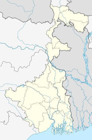 Katwa Location in West Bengal, India | |
| Coordinates: 23°39′N 88°08′E / 23.65°N 88.13°ECoordinates: 23°39′N 88°08′E / 23.65°N 88.13°E | |
| Country |
|
| State | West Bengal |
| District | Bardhaman |
| Government | |
| • Body | Katwa Municipality |
| • Chairman | Amar Ram |
| • MP | Sunil Mondal |
| • MLA | Rabindra Nath Chatterjee |
| Area | |
| • Total | 8.53 km2 (3.29 sq mi) |
| Elevation | 21 m (69 ft) |
| Languages | |
| • Official | Bengali, English |
| Time zone | IST (UTC+5:30) |
| PIN | 713130 |
| Telephone code | 91 3453 |
| Lok Sabha constituency | Bardhaman Purba |
| Vidhan Sabha constituency | Katwa |
| Website |
bardhaman |
Katwa (Bengali: কাটোয়া) is a town and the headquarters of Katwa subdivision in Bardhaman district of Indian state of West Bengal.
Geography

Katwa is located at 23°39′N 88°08′E / 23.65°N 88.13°E. It has an average elevation of 21 m (69 ft). It is situated between the Ajay River and the Bhagirathi River and so bounded by water to the east, west and north.
Gram panchayats under Katwa I Panchayat Samiti are: Koshigram, Goai, Srikhanda, Khajurdihi, Sudpur, Karajgram, Alampur, Gidhagram and Saragram.[1]
Gram panchayats under Katwa II Panchayat Samiti are: Karui, Palsona, Jagadannadapur, Gazipur, Agradwip, Sribati[2] and Singhee.[1]
Demographics
As of 2001 India census,[3] Katwa had a population of 71,573, 51% male and 49% female. The average literacy rate is 74%, higher than the national average: male literacy is 78%, and female literacy is 69%. 10% of the population is under 6 years of age.
Katwa has a total area of 8.53 km² with a population density of 8,391/km².[4] A steady flow of refugees from East Pakistan increased the population of the area in the fifties.[5]
History
The small town has a historical background of five hundred years. The earliest name of Katwa was Indranee Pargana. Later the name was changed to 'Kantak Nagari' and became the fort area of the Murshid Quli Khan, Nawab of Bengal. Katwa was invaded by the Bargis (break-away Maratha gropus several times. This was the place where Sri Sri Chaitanya Mahaprabhu got "Deeksha" from Sri Ishwarpuri. Since then, this small township has been a sacred place for the Vaishnavites.
Railway
Katwa railway station is a railway junction on Broad Gauge 1,676 mm (5 ft 6 in) railway line from Calcutta to New Jalpaiguri railway station. The Katwa-Burdwan narrow gauge railway line is being converted to broad gauge under project Unigauge. The 26 km Burdwan-Balgona section has been converted to broad gauge in 2013 and EMU train started on the section in February 2014.Rest(Balgona to Katwa) work is going on and projected to complete within December 2017.[6]
See also
References
- 1 2 "List of Pradhan of Gram Panchayats, District: Bardhaman" (PDF). Government of West Bengal. Retrieved 2009-08-29.
- ↑ Sribati
- ↑ "Census of India 2001: Data from the 2001 Census, including cities, villages and towns (Provisional)". Census Commission of India. Archived from the original on 2004-06-16. Retrieved 2008-11-01.
- ↑ Population data on urban units of Bardhaman
- ↑ Chattopadhyay, Akkori, Bardhaman Jelar Itihas O Lok Sanskriti (History and folklore of Bardhaman District.), (Bengali), Vol I, p57, Radical Impression. ISBN 81-85459-36-3
- ↑ http://epaper.timesofindia.com/Repository/getimage.dll?path=TOIKM/2014/02/09/19/Img/Ad0191102.png
| Cities, municipal and census towns |
| ||||||||||||||||||||||
|---|---|---|---|---|---|---|---|---|---|---|---|---|---|---|---|---|---|---|---|---|---|---|---|
| Locations other than cities and towns | |||||||||||||||||||||||
| Related topics |
| ||||||||||||||||||||||