Paneče
| Paneče | |
|---|---|
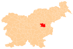
 Paneče Location in Slovenia | |
| Coordinates: 46°5′27.81″N 15°16′56.29″E / 46.0910583°N 15.2823028°ECoordinates: 46°5′27.81″N 15°16′56.29″E / 46.0910583°N 15.2823028°E | |
| Country |
|
| Traditional region | Styria |
| Statistical region | Savinja |
| Municipality | Laško |
| Area | |
| • Total | 6.43 km2 (2.48 sq mi) |
| Elevation | 469.3 m (1,539.7 ft) |
| Population (2002) | |
| • Total | 114 |
| [1] | |
Paneče (pronounced [paˈneːtʃɛ]) is a settlement in the Municipality of Laško in eastern Slovenia. It lies in the hills east of Rimske Toplice. Traditionally part of the Styria region, the area is now included with the rest of the municipality in the Savinja Statistical Region.[2]
References
External links
This article is issued from Wikipedia - version of the 2/1/2016. The text is available under the Creative Commons Attribution/Share Alike but additional terms may apply for the media files.