Pep, Texas
| Pep, Texas | |
|---|---|
| Unincorporated community | |
|
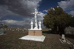
Saint Phillips Cemetery in Pep | |
 Pep  Pep | |
| Coordinates: 33°48′58″N 102°33′30″W / 33.81611°N 102.55833°WCoordinates: 33°48′58″N 102°33′30″W / 33.81611°N 102.55833°W[1] | |
| Country |
|
| State |
|
| County | Hockley |
| Physiographic region | Llano Estacado |
| Founded | 1936 |
| Elevation[1] | 3,701 ft (1,128 m) |
| Population (2000) | |
| • Total | 35 |
| Time zone | Central (CST) (UTC-6) |
| • Summer (DST) | CDT (UTC-5) |
| ZIP code | 79353 |
| Area code | 806 |
| Website | Handbook of Texas |
Pep is an unincorporated community in northwestern Hockley County, Texas, United States, situated along Farm to Market Road 303. It is located on the high plains of the Llano Estacado just to the west of the historic Yellow House Ranch. Although it is unincorporated, Pep has a post office, with the ZIP code of 79353.[2]
Education
Public education in the community of Pep is provided by the Whiteface Consolidated Independent School District. The Pep Independent School District consolidated with neighboring Whiteface in August 1978.[3]
See also
References
- 1 2 "Pep". Geographic Names Information System. United States Geological Survey.
- ↑ Zip Code Lookup
- ↑ About WCISD – Whiteface Consolidated Independent School District. Retrieved September 19, 2009.
4. http://lubbockonline.com/local-news/2014-11-27/pep-natives-return-home-cook-serve-thanksgiving-meal
External links
- U.S. Geological Survey Geographic Names Information System: Pep, Texas
- Pep, Texas from the Handbook of Texas Online
- Photos of West Texas and Eastern New Mexico
Municipalities and communities of Hockley County, Texas, United States | ||
|---|---|---|
| Cities | 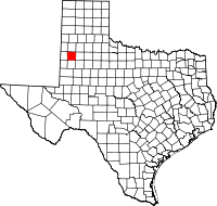 | |
| Towns | ||
| Unincorporated communities | ||
This article is issued from Wikipedia - version of the 11/10/2016. The text is available under the Creative Commons Attribution/Share Alike but additional terms may apply for the media files.