Perry County, Pennsylvania
| Perry County, Pennsylvania | |
|---|---|
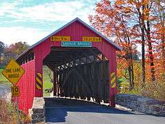 Saville Covered Bridge in Saville Township | |
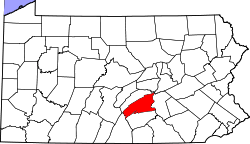 Location in the U.S. state of Pennsylvania | |
 Pennsylvania's location in the U.S. | |
| Founded | March 22, 1820 |
| Named for | Oliver Hazard Perry |
| Seat | New Bloomfield |
| Largest borough | Marysville |
| Area | |
| • Total | 556 sq mi (1,440 km2) |
| • Land | 551 sq mi (1,427 km2) |
| • Water | 4.1 sq mi (11 km2), 0.7% |
| Population (est.) | |
| • (2015) | 45,685 |
| • Density | 83/sq mi (32/km²) |
| Congressional districts | 10th, 11th |
| Time zone | Eastern: UTC-5/-4 |
| Website |
www |
Perry County is a county located in the U.S. state of Pennsylvania. As of the 2010 census, the population was 45,969.[1] The county seat is New Bloomfield.[2] The county was created on March 22, 1820, and was named after Oliver Hazard Perry, a hero of the War of 1812 who had recently died.[3] It was originally part of Cumberland County and was created in part because residents did not want to travel over the mountain to Carlisle (the county seat of Cumberland County).
Perry County is included in the Harrisburg-Carlisle, PA Metropolitan Statistical Area.
In 2010, the center of population of Pennsylvania was located in the eastern end of Perry County.[4] Green Park, an incorporated village located in northeastern Tyrone Township, serves as Perry County’s midpoint between the Conococheague Mountain in the west and the Susquehanna River to the east.[5]
Geography
According to the U.S. Census Bureau, the county has a total area of 556 square miles (1,440 km2), of which 551 square miles (1,430 km2) is land and 4.1 square miles (11 km2) (0.7%) is water.[6]
Adjacent counties
- Juniata County (north)
- Northumberland County (northeast)
- Dauphin County (east)
- Cumberland County (south)
- Franklin County (southwest)
Major Highways
Demographics
| Historical population | |||
|---|---|---|---|
| Census | Pop. | %± | |
| 1820 | 11,342 | — | |
| 1830 | 14,261 | 25.7% | |
| 1840 | 17,096 | 19.9% | |
| 1850 | 20,088 | 17.5% | |
| 1860 | 22,793 | 13.5% | |
| 1870 | 25,447 | 11.6% | |
| 1880 | 27,522 | 8.2% | |
| 1890 | 26,276 | −4.5% | |
| 1900 | 26,263 | 0.0% | |
| 1910 | 24,136 | −8.1% | |
| 1920 | 22,875 | −5.2% | |
| 1930 | 21,744 | −4.9% | |
| 1940 | 23,213 | 6.8% | |
| 1950 | 24,782 | 6.8% | |
| 1960 | 26,582 | 7.3% | |
| 1970 | 28,615 | 7.6% | |
| 1980 | 35,718 | 24.8% | |
| 1990 | 41,172 | 15.3% | |
| 2000 | 43,609 | 5.9% | |
| 2010 | 45,969 | 5.4% | |
| Est. 2015 | 45,685 | [7] | −0.6% |
| U.S. Decennial Census[8] 1790-1960[9] 1900-1990[10] 1990-2000[11] 2010-2013[1] | |||
As of the census[12] of 2000, there were 43,602 people, 16,695 households, and 12,320 families residing in the county. The population density was 79 people per square mile (30/km²). There were 18,941 housing units at an average density of 34 per square mile (13/km²). The racial makeup of the county was 98.54% White, 0.43% Black or African American, 0.12% Native American, 0.15% Asian, 0.01% Pacific Islander, 0.21% from other races, and 0.54% from two or more races. 0.69% of the population were Hispanic or Latino of any race. 45.8% were of German, 16.4% American, 7.8% Irish and 5.0% English ancestry according to Census 2000. 96.8% spoke English and 1.2% Spanish as their first language.
There were 16,695 households out of which 33.2% had children under the age of 18 living with them, 61.6% were married couples living together, 7.8% had a female householder with no husband present, and 26.20% were non-families. 21.7% of all households were made up of individuals and 9.30% had someone living alone who was 65 years of age or older. The average household size was 2.58 and the average family size was 3.01. There is also a high population of Amish.
In Perry County, the population was spread out with 25.5% under the age of 18, 7.4% from 18 to 24, 29.8% from 25 to 44, 25.1% from 45 to 64, and 12.3% who were 65 years of age or older. The median age was 38 years. For every 100 females there were 98.4 males. For every 100 females age 18 and over, there were 96.9 males.
Perry County's live birth rate was 609 births in 1990. The County's live birth rate in 2000 had declined sharply to 511 births, while in 2011 it was 555 babies.[13] Over the past 50 years (1960 to 2010), rural Pennsylvania saw a steady decline in both the number and proportion of residents under 18 years old. In 1960, 1.06 million rural residents, or 35 percent of the rural population, were children.
Metropolitan Statistical Area
The United States Office of Management and Budget[14] has designated Perry County as the Harrisburg-Carlisle, PA Metropolitan Statistical Area (MSA). As of the 2010 U.S. Census[15] the metropolitan area ranked 6th most populous in the State of Pennsylvania and the 96th most populous in the United States with a population of 549,475. Perry County is also a part of the larger Harrisburg-York-Lebanon, PA Combined Statistical Area (CSA), which combines the populations of Perry County as well as Adams, Cumberland, Dauphin, Lebanon and York Counties in Pennsylvania. The Combined Statistical Area ranked 5th in the State of Pennsylvania and 43rd most populous in the United States with a population of 1,219,422.
Government
County Commissioners
- Brenda Benner, Chair (R)
- Stephen C. Naylor, Vice Chair
- Paul Rudy, Secretary (R)
Emergency Services
Perry County 911, located in the basement of the Perry County Courthouse, is the county's public-safety answering point (PSAP).
Politics
Perry County is one of the most Republican counties in Pennsylvania. In 2004, George W. Bush received 13,919 votes (72%) to 5,423 votes (28%) for John Kerry. The county has voted for the Republican in every presidential election since 1964. In 2006, Lynn Swann received 9,998 votes (69%) to 4,477 votes (31%) for Ed Rendell, making it Swann's strongest county in his defeat. Rick Santorum also received more than 60% of the Perry County vote in his defeat.
Education
Public School Districts
- Greenwood School District
- While physically located in Perry County, the district also serves some residents of Juniata County.
- Newport School District
- Susquenita School District
- While physically located in Perry County, the district also serves some residents of Dauphin County.
- West Perry School District
- Fannett-Metal School District
- While physically located in Franklin County, the district also serves some residents of Perry County.
Intermediate unit
The Capital Area Intermediate Unit 15 is a state approved education agency that offers: Perry County school districts, charter schools, private schools, and home school students, a variety of services including: a completely developed K-12 curriculum that is mapped and aligned with the Pennsylvania Academic Standards (available online), shared services, a joint purchasing program and a wide variety of special education and special needs services.
Private schools
As reported on EdNA (ED Names and Addresses) by the Pennsylvania Department of Education
- Blue Goose Children's Learning Center, Inc - Newport
- Carson Long Military Institute
- Clarks Run Parochial School - Blain
- Community Christian Academy - Newport
- Farm Lane School - Ickesburg
- Fowlers Hollow School - Blain
- Heritage Christian School - West Perry
- Honeysuckle Ridge School - Elliotsburg
- Kuddly Bear Child Care Center Inc. - Duncannon
- Loysville Youth Development Center - Loysville
- Manassa School - Blain
- Messiah Day Care Center - Elliottsburg
- Mountain View Parochial School - Ickesburg
- Perry View Parochial School - Landisburg
- Raccoon Valley Amish School - Millerstown
- Shermans View School - Loysville
- Stony Point School - Loysville
- Sunset Valley School - Millerstown
Trade schools
- Central Pennsylvania Diesel Institute - Liverpool
Public Libraries
- New Bloomfield Public Library
- Community Library of Western Perry County
- Marysville-Rye Public Library
- Newport Public Library
Media
Newspapers
The county is home to four weekly newspapers, three published by Advance Publications of Perry and Juniata Counties, Inc. associated with The Patriot-News of Harrisburg: Duncannon Record, The News-Sun and Perry County Times and the separate Perry County Weekly published by The Sentinel in Carlisle, Cumberland County, by Lee Enterprises of Davenport, Iowa .[17]
Communities
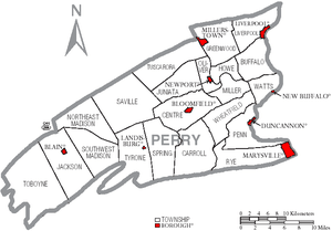
Under Pennsylvania law, there are four types of incorporated municipalities: cities, boroughs, townships, and, in at most two cases, towns. The following boroughs and townships are located in Perry County:
Boroughs
- Blain
- Duncannon
- Landisburg
- Liverpool
- Marysville
- Millerstown
- New Bloomfield (county seat)
- New Buffalo
- Newport
Townships
Unincorporated area
- Cove
- Green Park
- Ickesburg
- Loysville
- Perdix
- New Germantown
- Shermans Dale
Population ranking
The population ranking of the following table is based on the 2010 census of Perry County.[18]
† county seat
| Rank | City/Town/etc. | Municipal type | Population (2010 Census)
|
|---|---|---|---|
| 1 | Marysville | Borough | 2,534 |
| 2 | Newport | Borough | 1,574 |
| 3 | Duncannon | Borough | 1,522 |
| 4 | † New Bloomfield | Borough | 1,247 |
| 5 | Liverpool | Borough | 955 |
| 6 | Millerstown | Borough | 673 |
| 7 | Blain | Borough | 263 |
| 8 | Landisburg | Borough | 218 |
| 9 | New Buffalo | Borough | 129 |
Marcellus shale impact fee
Act 13 of 2012,[19] which levied a Marcellus Shale Impact Fee, was signed into law by Governor Tom Corbett on February 14, 2012.[20][21] In 2014, Perry County received an impact fee disbursement of $43,677.42. The top county recipient was Washington County which received $6,512,570.65 in 2014.[22] In 2014, there were no marcellus shale wells in Perry County.[23][24]
- 2013 - no shale wells, impact fee revenues to Perry County - $43,793.65[25]
See also
References
- 1 2 "State & County QuickFacts". United States Census Bureau. Retrieved November 20, 2013.
- ↑ "Find a County". National Association of Counties. Retrieved 2011-06-07.
- ↑ Early History of Perry County
- ↑ "Centers of Population by State: 2010". United States Census Bureau. Retrieved April 22, 2014.
- ↑ Hain, H. H. "History of Perry County, Pennsylvania". Hain-Moore Company, Publishers. Retrieved 14 October 2011.
- ↑ "2010 Census Gazetteer Files". United States Census Bureau. August 22, 2012. Retrieved March 10, 2015.
- ↑ "County Totals Dataset: Population, Population Change and Estimated Components of Population Change: April 1, 2010 to July 1, 2015". Retrieved July 2, 2016.
- ↑ "U.S. Decennial Census". United States Census Bureau. Retrieved March 10, 2015.
- ↑ "Historical Census Browser". University of Virginia Library. Retrieved March 10, 2015.
- ↑ Forstall, Richard L., ed. (March 24, 1995). "Population of Counties by Decennial Census: 1900 to 1990". United States Census Bureau. Retrieved March 10, 2015.
- ↑ "Census 2000 PHC-T-4. Ranking Tables for Counties: 1990 and 2000" (PDF). United States Census Bureau. April 2, 2001. Retrieved March 10, 2015.
- ↑ "American FactFinder". United States Census Bureau. Retrieved 2008-01-31.
- ↑ Pennsylvania Department of Health, Birth Age County Reports 1990 and 2011, 2011
- ↑ http://www.whitehouse.gov/omb
- ↑ http://www.census.gov/2010census/
- ↑ Perry County Technology Resource Sharing
- ↑ Perry County Times and
- ↑ http://www.census.gov/2010census/
- ↑ Pennsylvania House of Representatives (February 8, 2012). "HB1950 of Session 2011 OIL AND GAS (58 PA.C.S.) - OMNIBUS AMENDMENTS".
- ↑ Pennsylvania General Assembly, Act 13 of 2012, February 14, 2012.
- ↑ Pennsylvania Utility Commission (2012). "Act 13 (Impact Fee)".
- ↑ Pennsylvania Utility Commission (2015). "Disbursements and Impact Fees 2014".
- ↑ Pennsylvania Utility Commission (2015). "County Well Count Breakdown for 2014".
- ↑ Nick Malawskey (April 3, 2014). "Drilling Across Pennsylvania". Pennlive.com.
- ↑ Pennsylvania Utility Commission (2013). "Perry County Total distribution for year 2013".
External links
- Perry County (official website)
Municipalities and communities of Perry County, Pennsylvania, United States | ||
|---|---|---|
| Boroughs | | |
| Townships | ||
| Unincorporated communities |
| |
Coordinates: 40°24′N 77°16′W / 40.40°N 77.27°W