Piegan Glacier
| Piegan Glacier | |
|---|---|
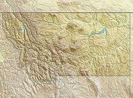 Piegan Glacier Location in Montana | |
| Type | Mountain glacier |
| Location | Glacier National Park, Glacier County, Montana, U.S. |
| Coordinates | 48°42′29″N 113°41′02″W / 48.70806°N 113.68389°WCoordinates: 48°42′29″N 113°41′02″W / 48.70806°N 113.68389°W[1] |
| Area | Approximately 62 acres (0.25 km2) in 2005[2] |
| Terminus | Barren rock |
| Status | Retreating |
Piegan Glacier is in Glacier National Park in the U.S. state of Montana. The glacier is situated in a cirque on the southeast slope of Piegan Mountain and just below the summit at an elevation between 8,800 and 8,200 ft (2,700 and 2,500 m) above sea level.[3] The glacier covered an area of approximately 62 acres (0.25 km2) in 2005, a 10 percent reduction in its surface area since 1966.[2] Comparing images of the glacier taken in 1930 with those from 1998, indicates that the glacier experienced relatively little change during that period.[4]
See also
References
- ↑ "Piegan Glacier". Geographic Names Information System. United States Geological Survey. Retrieved 2012-09-23.
- 1 2 "Retreat of Glaciers in Glacier National Park" (pdf). United States Geological Survey. 2010. Retrieved 2012-09-23.
- ↑ Logan Pass, MT (Map). TopoQwest (United States Geological Survey Maps). Retrieved 2012-09-23.
- ↑ "Piegan Glacier". Repeat Photography Project. United States Geological Survey. Retrieved 2012-09-23.
This article is issued from Wikipedia - version of the 12/24/2015. The text is available under the Creative Commons Attribution/Share Alike but additional terms may apply for the media files.