Thunderbird Glacier
| Thunderbird Glacier | |
|---|---|
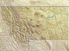 Thunderbird Glacier Location in Montana | |
| Type | Mountain glacier |
| Location | Glacier National Park, Glacier County, Montana, U.S. |
| Coordinates | 48°56′03″N 114°02′23″W / 48.93417°N 114.03972°WCoordinates: 48°56′03″N 114°02′23″W / 48.93417°N 114.03972°W[1] |
| Area |
Approximately 58 acres (0.23 km2)[2] in total including numerous ice patches |
| Terminus | Talus |
| Status | Retreating |
Thunderbird Glacier is in Glacier National Park in the U.S. state of Montana. The glacier is situated on the east side Continental Divide below Thunderbird Mountain at an average elevation of 8,000 feet (2,400 m) above sea level.[3] As of 2005, Thunderbird Glacier consisted of numerous ice patches covering a total of 58 acres (0.23 km2), which is over 33 percent smaller than it was in 1966.[2]
References
- ↑ "Thunderbird Glacier". Geographic Names Information System. United States Geological Survey. Retrieved 2012-07-30.
- 1 2 "Retreat of Glaciers in Glacier National Park" (pdf). United States Geological Survey. 2010. Retrieved 2012-07-30.
- ↑ Mount Carter, MT (Map). TopoQwest (United States Geological Survey Maps). Retrieved 2012-07-30.
See also
This article is issued from Wikipedia - version of the 12/24/2015. The text is available under the Creative Commons Attribution/Share Alike but additional terms may apply for the media files.