Pine Level, Montgomery County, Alabama
| Pine Level, Alabama | |
|---|---|
| Unincorporated community | |
 Pine Level, Alabama  Pine Level, Alabama | |
| Coordinates: 32°04′05″N 86°03′35″W / 32.06806°N 86.05972°WCoordinates: 32°04′05″N 86°03′35″W / 32.06806°N 86.05972°W | |
| Country | United States |
| State | Alabama |
| County | Montgomery |
| Elevation | 489 ft (149 m) |
| Population (2007) | |
| • Total | 1,782 |
| Time zone | Central (CST) (UTC-6) |
| • Summer (DST) | CDT (UTC-5) |
| ZIP code | 36069 |
| Area code(s) | 334 |
| GNIS feature ID | 152926[1] |
Pine Level, also known as Pine Tucky, is an unincorporated community in Montgomery County, Alabama, United States. Pine Level is located along U.S. Route 231 and Alabama State Route 53, 25 miles (40 km) southeast of Montgomery.
History
Pine Level was originally known as Pine Tucky, most likely due to its location on poor sandy soil covered with pine trees. The community later began to be called Pine Level.[2] A post office first opened under the name Pine Level in 1839.[3]
Notable person
- Rosa Parks, African-American Civil Rights activist, lived in Pine Level as a child
References
- ↑ "Pine Level". Geographic Names Information System. United States Geological Survey.
- ↑ Foscue, Virginia (1989). Place Names in Alabama. Tuscaloosa: The University of Alabama Press. p. 111. ISBN 0-8173-0410-X.
- ↑ "Montgomery County". Jim Forte Postal History. Retrieved 18 January 2015.
Municipalities and communities of Montgomery County, Alabama, United States | ||
|---|---|---|
| Cities | 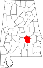 | |
| Towns | ||
| Unincorporated communities | ||
| Footnotes | ‡This populated place also has portions in an adjacent county or counties | |
This article is issued from Wikipedia - version of the 7/31/2016. The text is available under the Creative Commons Attribution/Share Alike but additional terms may apply for the media files.