Pipriac
| Pipriac Presperieg | ||
|---|---|---|
|
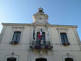
The town hall of Pipriac | ||
| ||
 Pipriac | ||
|
Location within Brittany region  Pipriac | ||
| Coordinates: 47°48′36″N 1°56′47″W / 47.8100°N 1.9464°WCoordinates: 47°48′36″N 1°56′47″W / 47.8100°N 1.9464°W | ||
| Country | France | |
| Region | Brittany | |
| Department | Ille-et-Vilaine | |
| Arrondissement | Redon | |
| Canton | Pipriac | |
| Intercommunality | Canton of Pipriac | |
| Government | ||
| • Mayor (2014–2020) | Marcel Bouvier | |
| Area1 | 48.65 km2 (18.78 sq mi) | |
| Population (2008)2 | 3,457 | |
| • Density | 71/km2 (180/sq mi) | |
| Time zone | CET (UTC+1) | |
| • Summer (DST) | CEST (UTC+2) | |
| INSEE/Postal code | 35219 / 35550 | |
| Elevation | 14–98 m (46–322 ft) | |
|
1 French Land Register data, which excludes lakes, ponds, glaciers > 1 km² (0.386 sq mi or 247 acres) and river estuaries. 2 Population without double counting: residents of multiple communes (e.g., students and military personnel) only counted once. | ||

Pipriac (Breton: Presperieg, Gallo: Pisperiac) is a commune in the Ille-et-Vilaine department in Brittany in northwestern France.
It lies 35 km (22 mi) southwest of Rennes.
Population
Inhabitants of Pipriac are called Pipriatains in French.
| Historical population | ||
|---|---|---|
| Year | Pop. | ±% |
| 1962 | 2,804 | — |
| 1968 | 2,848 | +1.6% |
| 1975 | 2,669 | −6.3% |
| 1982 | 2,669 | +0.0% |
| 1990 | 2,772 | +3.9% |
| 1999 | 2,912 | +5.1% |
| 2008 | 3,457 | +18.7% |
International relations
Pipriac is twinned with the village of Whitland in Carmarthenshire, Wales.
See also
References
External links
| Wikimedia Commons has media related to Pipriac. |
- Pipriac Info Website (French)
- Cultural Heritage (French)
This article is issued from Wikipedia - version of the 9/10/2016. The text is available under the Creative Commons Attribution/Share Alike but additional terms may apply for the media files.